
| Oliver's Cornwall |
|
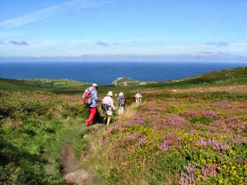
Great Estates, Hills, Slate and Clay Country |
|
|
|
|
|
 |
RIVERS
and their valleys - and a canal
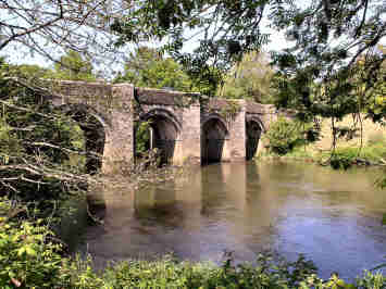
One odd thing about Cornwall is that there is no major river. Not that you would get that impression on a circuit of the coast where several estuaries have the appearance of serious rivers, most particularly those of the Tamar, Fowey, Fal, Helford, Hayle and Camel. But what you are looking at are mostly rias or drowned valleys. Thanks to the narrowness of the Cornish peninsula, no river rises more than 40 miles from the sea. Our particular favourites are the Fowey for its moorland source, its falls at Draynes Bridge and its lovely estuary; and the Camel for its superb dune-lined estuary and its surfing beach at Polzeath. |
 |
WEST
PENWITH - Mostly on the high moorland
Cornwall's tiny far west sub-peninsula - the land beyond St. Ives and Penzance - is a mere 15 miles long from Lelant to Land's End, and just 9 miles wide from Pendeen Watch to Lamorna. Yet within this area is some of Cornwall's most spectacular scenery. The central high moorland can be difficult to access, thanks to few roads and to heavy scrub and bracken growth on the un-grazed land. But views can be tremendous; our favourites are those from Castle an Dinas on Trenowin Downs, Trencrom Hill on St. Michaels Way and Chapel Carn Brea near Land's End. |
|
MISCELLANEOUS
INLAND
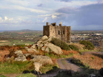
This miscellaneous section covers a wide variety of landscape and interest and again is largely concerned with walks in the countryside. There are great estates - Godolphin, Lanhydrock, Mount Edgcumbe and Penrose; some major and striking hills - Carn Brea, Carn Marth and Kit Hill; a walk around St. Clether seeking a holy well and Cornish crosses; a literary walk in Daphne du Maurier country. There are also items on two very different industrial landscapes - clay country north of St. Austell and slate country in North Cornwall. And more! |
|
|
|
|
|
|
|
|
|
|
|
|
|
|
|
|
|
|
|
Introduction to the Countryside Pages
 |
One sees and hears
so much about the Cornish coast, its soaring cliffs, its sandy beaches,
its sheltered harbours and the wonderful Coast Path, that it is easy to
miss the fact that there is lots of glorious scenery and some superb walking
inland too. Thank goodness that's the case because there are times
- at school summer vacation and bank holiday weekends especially - when
the roads to the coast just get too congested, as does the coast path in
places. At these times we tend to head for the moors or the mining
trails or clay trails and get well away from the crowds. I have divided
the Inland section into three. Miscellaneous
includes clay country around St. Austell and some of the great estates;
these walks tend to be easy. Rivers
flow to both south and north coasts and, although there are no river trails,
I include walks in their valleys, again easy walking. West
Penwith covers mostly the high moorland to the west of St. Ives
and Penzance. I have separate pages for Inland
Trails and for
Bodmin Moor.
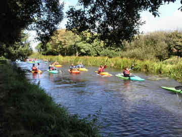
Bodmin Moor speaks for itself, high open moorland that rises at its highest to almost 1400 feet; in places the walking tends to be rocky, steep and difficult but the views are often of both coasts. Since few paths are waymarked on the moor, it is wise to carry both a large scale map and a compass. The Inland Trails pages include the Tinners Way, the Zennor Churchway, Saints Way, St. Michael's Way, the Camel Trail, Clay Trails, the Land's End Trail, Mark Camp's enterprising Copper Trail and the Mining Trails. The Mining Trails reflect my own interest in industrial archaeology; since these trails all follow former horse-drawn tramways that served the tin and copper mines, walking (and sometimes cycling) is easy. |
|
|
A 'logan' stone is dish-shaped and will rock under pressure |
Online Mapping
- Cornwall Council's Mapping Website
 |
The recently introduced
'Right to Roam' legislation - long agitated for by the Ramblers Association,
and initially opposed by many landowners - has resulted in vast areas of
land all over England, Scotland, Wales and Cornwall being opened up to
the general public. Essentially these rights are for walkers only
- suits me. I used to find the Countryside Agency's Open Access website
an immense help in my Cornwall moorland walking, not just on Bodmin Moor
but also in West Penwith. Unfortunately the site, now Natural England,
has been messed around with and although the maximum scale is acceptable,
maps are too small and navigation is quite awkward. As a result,
it is no longer worth, as a walker, using it in its current CRoW Access
form.
Fortunately, Cornwall Council has an excellent mapping web site, which I find better for Cornwall than the Open Access site ever was. It is easy to use, shows Open Access land, rights of way, path numbers should you wish to report problems, and is zoomable up to large scale. A word of warning on Open Access land. I soon discovered that this may not be quite as straightforward as that. I have encountered barbed wire fences, locked gates and even one gate on Bodmin Moor, leading to access land, that has a 'no walkers' sign on it. And, in West Penwith, where moorland is lower, I have found impenetrable furze and bramble. So don't expect it to be easy. |
|
|
Mapping Website shows Open Access, footpaths, cycleways |
|
|
|
|
|
|
|
|
|
|
|
|
|
|
|
|
|
|
|