 |
 |
 |
|
|
|
|
|
|
|
|
Text and images should align. To view this page at its best, adjust your zoom so that the page uses full screen width
| This page is for those who like to walk on the coast but prefer round walks to linear ones. This is the format: descriptions, Oliver's Diary, detailed route directions, GPS data and information about parking, refreshments, interest etc. As at November 2015 a total of 46 walks are included here, listed in a counter-clockwise direction, starting at Northcott Mouth, and finishing at Kingsand. From time to time I hope to add other walks, probably in a random order. Click here for the full index to the walks. Click here for Cornwall's excellent Mapping Website |
CORNWALL REVIEWS
INDEX and SITE CONTENTS
|
|
|
|
|
|
|
|
|
|
|
|
|
|
|
|
|
|
|
| 01 Northcott Mouth, Stowe, Coombe, Duckpool | 02 Boscastle, St. Juliot, Beeny Cliff | 03 Polzeath, Rumps, Pentire Point |
| 04 Padstow, Stepper Point & Trevone Bay | 05 Holywell Bay, Ellenglaze, West Pentire | 06 Holywell Bay, Penhale Sands |
| 07 Chapel Porth, Beacon, Trevaunance | 08 Portreath, Tehidy Park, North Cliffs | 09 Zennor, River Cove, Treveal |
| 10 Pendeen Watch, Chûn Castle, Morvah | 11 Pendeen Watch, Botallack, Boscaswell | 12 Sennen Cove, Chapel Carn Brea |
| 13 Porthcurno, Gwennap Head, Porthgwarra | 14 Porthcurno, Penberth Cove, Treen | 15 Lamorna Antiquities Walk |
| 16 Loe Bar, The Loe and the Penrose Estate | 17 Mullion Cove and Predannack Wollas | 18 Kynance Cove & Predannack Wollas |
| 19 Landewednack, Cadgwith, Poltesco, St. Ruan | 20 Coverack, Porthoustock, St. Keverne | 21 P'r'oustock, Porthallow, St. Keverne |
| 22 Helford, St. Anthony, Manaccan, Frenchman's | 23 The Roseland: Place & St. Antony Head | 24 The Roseland: Percuil & Portscatho |
| 25 Carne Beach, Portloe, Veryan | 26 Porthluney Cove, Dodman, Penare | 27 Penare, Gorran Haven, Treveague |
| 28 Pentewan, Heligan, Mevagissey | 29 Polkerris, Gribbin Head, Readymoney | 30 Fowey, Pont, Lantic Bay, Polruan |
| 31 Kingsand, Rame Head, Forder, Cawsand | 32 Kingsand, Maker, Mt. Edgcumbe Park | And some more Coastal Round Walks |
Round Walk 01
Northcott
Mouth, Stowe Barton, Coombe and Duckpool - 6¾ miles
Easy
farmland to a lost great house; woodland to a delightful village;
Strenuous at first on scenic coast, then easier
 |
A walk of three contrasting sections, much interest along the way. To Stowe Barton is over open farmland on a bridleway with few waymarks. You climb gradually to 400 feet, the ascent scarcely noticeable. One route difference from the OS map; at 1.77 miles, a bridleway right was the old route but the NT’s new route brings you out opposite Stowe Barton. The second part is mostly wooded. After Stowe Barton and charming Driftwood Cottage, a kissing gate (pick up a Stowe leaflet) leads through a field to Stowe Wood. Path then track stay in Stowe and Lee Woods to Coombe; care is needed as there are many turns on cross tracks but few waymarks. The woodland is lovely, native broadleaf of oak, ash, birch, beech and hazel with a few rhodos. Coombe is photogenic and worth lingering over. Coombe to Duckpool is on tarmac but with little traffic. The final section to Northcott Mouth uses the Coast Path and is fairly strenuous with steep ascents and two major flights of steps. However, going is mostly grassy so easier than you expect. It might be possible at low tide to use the beach between Duckpool and Northcott Mouth, rocky at first then sandy. From the cliffs, views are good. You look back to Steeple Point and GCHQ and forward round a shallow curve to Tintagel Island. |
|
|
Oliver's Diary - Route Directions - Statistics, Interest and Info |
Round Walk 01 - Oliver's Diary
| Jane and I first walked this route in 2003. We used a walk booklet called Circular Coast Walks Cornwall by Chris Adams. This particular booklet is not the easiest for route following. Sketch maps really are sketchy and the route directions are somewhat skimpy. So, if you do use it, be sure to take the appropriate OS Explorer with you. The walk was a revelation as, at that time, we had never heard of either Stowe Barton or Coombe, the inland highlights of the walk. I soon walked it again, this time with my sister Mary, and later included both Stowe Barton and Coombe on inland walks. This particular walk was done on a gloriously warm and sunny day in June 2010 and proved even more enjoyable than I had remembered. It also proved slightly easier as, when I first walked it, I remember scrambling up very steeply from Duckpool with no clear path; now there is a clear route up. Much of the walk is on National Trust property, on the Stowe Estate. Coombe hamlet, once part of the same estate, is now owned by the admirable Landmark Trust and is kept in immaculate order. This time, the cottages by the ford had just been re-thatched and were looking very smart. Do make a point of seeing all the hamlet, including the mill and the unusual porches and unexpectedly elegant Georgian windows of Hawkers Cottages, named for Parson Hawker. |  |
| Description - Route Directions - Statistics, Interest and Info |
|
Round Walk 01 - Route Directions
| Route with detailed GPS Data, grid refs, heights & distances --- Click here for easily printable PDF page |
| Route without GPS Data but occasional distance information --- Click here for easily printable PDF page |
Round Walk 01 - Statistics, Interest and Useful Information
| Statistics
Distance: 6.67 miles on the GPS. Ascent: 1260 feet in all, of which 775 feet in 2.20 miles on the Coast Path. Highest Point: 400 feet shortly before Stowe Barton. 315 feet above Warren Little Beach on the Coast Path. Biggest Climb: 400 easy feet out of Northcott Mouth. 280 feet up from Duckpool. 160 feet up from Warren Gutter. Steps: Up, flight of 63 up from Warren Gutter. Down, 105 down to Northcott Mouth. Stiles: Just 2 wooden stiles. Gates: 7 regular gates and 6 kissing gates. Footing: Good paths and tracks - some tarmac - all the way to Duckpool. Mostly grass along the Coast Path. Difficulty: Overall moderate; easy to Duckpool, fairly strenuous on to Northcott Mouth. |
| Interest
Stowe Barton: John Grenville, Earl of Bath, built a grand new home in 1679, his daughter demolished it in 1739. Rev. Sabine Baring-Gould (Rock of Ages) wrote "within the memory of one man, grass grew and was mown in the meadow where sprang up Stowe House, and grew and was mown where Stowe had been." Contents of Stowe were dispersed when the house was demolished and décor of one room ended up in Prideaux Place in Padstow, as the Grenville Room. The previous Tudor house probably stood opposite the present farmhouse. The farmhouse may be a conversion of part of Grenville’s stables, behind are handsome and massive farm buildings. The great house of 1679 stood on the left of the path beyond the present Driftwood Cottage; the raised platforms opposite were part of the extensive gardens. Stowe Wood and Lee Wood: All part of the National Trust’s thousand acre Stowe Barton estate, the two woods merge into one. They are a delight of native broadleaf woodland – oak, ash, beech, birch and hazel with a few invading rhododendron ponticum. As you approach Coombe, the stream below was a leat which fed Coombe Mill. Coombe: Once part of the Stowe estate, the hamlet of Coombe is now owned by the Landmark Trust, which specialises in restoring interesting historic buildings and letting them as up-market holiday rentals. The surrounding land is part of the Stowe estate. The hamlet consists of a tall watermill, the mill house, two semi-detatched cottages and a couple of converted barns. All, apart from the mill, are rentable. The mill is intact, including all its machinery and a large waterwheel, but a large colony of bats prevents its conversion at present. However, the Landmark Trust hopes to use the mill to provide Coombe’s electricity. The hamlet is divided by a small river with a shallow paved ford and a footbridge. Cottages are thatched and whitewashed, all are quite charming and easy to photograph. One pair of cottages is known as Hawker’s Cottages. For a while Rev. Stephen Hawker, rector of Morwenstow, lived in the left-hand one. Sandy Mouth: The National Trust owns much of the coastal strip along here and has made Sandy Mouth a popular destination by providing car park, café and toilets above the long sandy beach. At low tide you can walk for miles along the beach, almost all the way from Duckpool to Bude. |
| Useful Information
Parking: NT CP above Northcott Mouth beach at 20349/08440. Getting there: From A39 at Stratton, N of Bude, follow signs for Poughill, then sign for Northcott Mouth. Intermediate Parking: Duckpool, by the beach at 20225/11700. Refreshments: Seasonal tea garden, Northcott Mouth (poor). Seasonal NT café, Sandy Mouth. Toilets: Duckpool, by the Car Park. Sandy Mouth, by the car park. Map: OS Explorer 126 Clovelly and Hartland |
Round Walk 02
Boscastle,
Valency Valley, St. Juliot, Beeny Cliff, Boscastle - 6½ miles
Wooded river valley to Hardy
country; farmland to the coast.
On the coast path, strenuous with great views .
 |
Like Walk 01, this is also very much of three parts. The first follows the delightful valley of the River Valency through broadleaf woodland for one-and-a-half miles, much of the way to St. Juliot church with its Thomas Hardy associations. The last half mile is through pasture with pleasing views of the wooded valley below. Entry into the churchyard is unusual, up substantial granite steps and over a slate cattle stile, complete with coffin rests. This section climbs over 500 feet but the ascent is easy. The second section, 1¾ miles from St. Juliot to Beeny Cliff, after a short stretch of country lane, is also over farmland, mostly pasture but with one arable field. At the end of the lane, Hardy enthusiasts may like to make the short detour to see the Old Rectory. Crossing the fields, there is an odd mixture of stiles, originally of slate, several now hybridised with wood. This section is easy going, well waymarked and easy to follow. The final section, 2¾ miles on the Coast Path, is the most difficult, particularly the steep climb up from Pentargon. The descent down Beeny Cliff is awkward, too, steep with loose stones; however, you can avoid it by following the NT’s easier white-waymarked alternative. Views along the coast are superb, back to Steeple Point and beyond, forward to Tintagel Island. And, when you reach Penally Point, the view into Boscastle is a delight. |
|
|
Oliver's Diary - Route Directions - Statistics, Interest and Info |
Round Walk 02 - Oliver's Diary
| I originally walked this in early 2008, first solo, soon after to St. Juliot and back with Jane. I was on part of it in February 2009 when I walked Frank Squibb’s Coast-to-Coast Smugglers Way from Boscastle to Looe. I love the Valency Valley with its little river tumbling over rounded boulders and stacked shelves of slate. After leaving the river at Newmills, I love Rose Cottage; if you have room in the backpack, look out for plants for sale there. On this June 2010 walk, after visiting St. Juliot church I stopped at the Old Rectory, where Sally Searle, who provides classy Bed and Breakfast, was happy for me to wander round her garden and take photos. I found myself a little irritated with the stiles between there and Trebyla Farm. Three were once proper slate cattle stiles but the farmer, rather than repair them properly, has added wooden struts to make odd hybrids, not easy to get over. The Coast Path section reminded me of encroaching age. In 2004, first walking the Coast Path from Crackington Haven to Boscastle, I found this part only moderate. Six years on I must confess to finding it fairly strenuous, most particularly the steep climb up all those steps from Pentargon Shute. Back in Boscastle, a cup of coffee while siitting outside a café on the main street, watching the world go by, was more than welcome. | |
| Description - Route Directions - Statistics, Interest and Info |
|
Round Walk 02 - Route
Directions
| Route with detailed GPS Data, grid refs, heights & distances --- Click here for easily printable PDF page |
| Route without GPS Data but occasional distance information --- Click here for easily printable PDF page |
Round Walk 02 - Statistics,
Interest and Useful Information
| Statistics
Distance: 6.42 miles. Ascent: 1330 feet. Highest Point: 555 feet inland near St. Juliot Rectory. 485 feet approaching Fire Beacon Point on the Coast Path. Biggest Climb: Easy 500 feet to St. Juliot. Strenuous 180 feet from Pentargon. Steps: Up 233, includes 189 up from Pentargon. Down 168, including 67 down Beeny Cliff. Stiles: 20, of which 13 wooden, 4 slate, 3 hybrid. Gates: 4 regular, 7 kissing gates. Footing: Good as far as the Coast Path. Some grass on the Coast Path but a lot of loose slatey stone. Difficulty: Overall moderate; easy to Coast Path, some strenuous on Coast Path, especially at Pentargon. Map: Ordnance Survey Explorer 111 Bude, Boscastle and Tintagel. |
| Interest - Features on Boscastle
and Thomas Hardy
Boscastle: See feature below. River Valency: It is hard to believe that this stream could have caused such devastating floods as occurred in Boscastle in August 2004. It rises at Trevilla Down, on the edge of Bodmin Moor, and flows for a mere seven miles to the sea at Boscastle. But its valley, wooded for much of the way, is steep and surrounded by springs. The even smaller River Jordan, joining the Valency in Boscastle, provided the final impetus for the floods. The name Valency is probably a corruption of the old Cornish Melin Chy, meaning mill house. In medieval times there were many mills along the river. St. Juliot Church and Thomas Hardy: See feature below. Pentargon: The cove is narrow enough, and steep enough, almost to be a chasm (Zawn in Cornish). For the photographer, tt is worth spending a little time here to get photos of the narrow but impressive waterfall, Pentargon Shute. The best time to catch the waterfall is after heavy rain and with a strong westerly wind. Then the spray can be carried back inland 10 or 20 feet above the footbridge that you cross on the Coast Path. |
| Useful Information
Parking: Use the main Boscastle Car Park on Penally Hill at 10005/91271. Getting There: B3266 from A39 at Camelford. B3263 from A39 1½ miles south of Wainhouse Corner. Intermediate Parking: Room for a couple of cars by St. Juliot Church. Refreshments: Boscastle only, pubs, restaurants, cafés. Toilets: Boscastle, by the car park |
 |
When I started this web site I didn't like Boscastle very much. I was about ready to post a critical item when the dreadful flood of August 2004 happened. That was no time for criticism so I decided to leave it until repair and restoration were complete. I am glad I did because, before and after a walk up the Valency Valley in June 2008, I took time to explore the village. Now not only am I most impressed by the way Boscastle has recovered but I also find that I now like it. It may be very tourist oriented - Visitor Centre, National Trust shop, Witchcraft Museum, art and craft galleries, gift shops, restaurants, cafés - but it looks terrific. Scenically it is hard to beat thanks to its setting in a steep valley, the River Valency winding down to a small harbour (dry at low tide) with a few fishing boats, beyond it two high headlands, both on the coast path, and the sea. In the photo a lime kiln stands in front of the former 'pilchard palace'; this latter houses the TIC, a National Trust shop and café and a Witchcraft Museum. And don't miss walking up Old Road, a narrow no-entry street, to admire its charming cottages. I can't comment on eating places as I have only had coffee here, but for sociability the Wellington Hotel bar is probably top; other pubs are the Cobweb opposite the car park and the Napoleon at the top of the village. |
|
|
Thomas Hardy and St. Juliot |
Back
to Round Walk 02
Back
to Round Walks Index
Go
to Oliver's Cornwall Walking Pages
Go
to Home Page for full Site Contents
| Thomas Hardy:
Not all his works were set in his native Dorset. His ‘Wessex’ extended
to include Cornwall and that was the setting for ‘A Pair of Blue Eyes’.
In his earlier guise as architect, Hardy undertook plans for the restoration
of St. Juliot Church near Boscastle between 1870 and 1872. He stayed
at St. Juliot Rectory with the Giffords - and married the Rector’s sister
Emma who encouraged his writing. In ‘A Pair of Blue Eyes’, St. Juliot
appears as St. Agnes, West Endelstow. A house between church and
rectory is now called Endelstow. In his 'Poems of 1912-13', written
after Emma's death, the background is mostly St. Juliot. It is not
only church and old rectory that are associated with Hardy;
Beeny Cliff, where the walk joins the coast, was a favourite location of
the couple.
St. Juliot Church: Attractive from the outside with a handsome tower and vaulted south porch but inside disappoints. The only interest is the Hardy association: a memorial tablet to him and another, which he himself designed, to Emma; two of his drawings and one of her paintings; and a superb engraved glass window by Simon Whistler, depicting Hardy's journey to Cornwall, the church, Beeny Cliff and waterfalls on the Valency. There are three Cornish crosses in the churchyard and coffin rests on the stile up from the field. |
 |
| Boscastle |
|
Round Walk 03 - Polzeath,
The Rumps and Pentire Point - 5¼ miles
An easy walk with a great promontory
fort and glorious views of coast and Camel estuary
 |
A relatively short and easy walk which, even with a fair amount of interest and some sublime coastal scenery, need occupy no more than a morning or afternoon. Again, this is a walk of three parts: the first cross country to reach the coast at Pengirt Cove, the second along the rugged north coast to Pentire Point; the third heading back to Polzeath along Padstow Bay. The climb on the first cross-country part amounts to 300 feet but is easy all the way. The second north coast section is very much up and down but with no severe climbs except for the optional Rumps – the distance includes going up both Rumps. The scenery here, from Pengirt Cove to Pentire Point, will look great at any state of the tide. Views forward along the coast are good though restricted but are magnificent looking back over Port Isaac Bay to Tintagel Island, Cambeak, the dishes of GCHQ at Steeple Point, and on along the coast to Hartland Point in Devon and, on a clear day, to Lundy Island. The final section, back to Polzeath, looks at its best when the tide is out and acres of golden sand are exposed in Hayle Bay and the Camel Estuary. There is quite a lot of interest along the way: the National Trust’s Pentireglaze Farm, lead mines nearby, sheep gates in the massive Cornish hedges much of the way along the north coast, and the remarkable iron age promontory fort known as The Rumps. |
|
|
Oliver's Diary - Route Directions - Statistics, Interest, Info |
| This is probably my favourite short walk of all and one to which I like to introduce all visitors. It’s a great stand-by, too, as from home it doesn’t need a car, just the bus to and from Polzeath. Oddly, I had walked out to Pentire Point many times with Jane, and had walked from Port Isaac to Polzeath on several occasions, before it occurred to me to look for a round walk starting in Polzeath and taking in the Rumps and Pentire Point, two of my favourite viewpoints along the Cornish coast. If I start from Polzeath itself, I tend to do this walk exactly as described. If I start from New Polzeath, I tend to go for a slightly shorter route, starting on the coast path then taking the bridleway from Pentireglaze Haven to Pentireglaze Farm. I may also omit climbing the steeper eastern Rump and take the path circling it. When researching this walk in June 2010 I did the full route described and included both of the Rumps. Probably my favourite viewpoint of all, and one I favour taking a snack break at, is the bench by the Lawrence Binyon memorial plaque at about 92544/80599, at the top of the climb after the Rumps. For refreshments I tend to favour New Polzeath over expensive Polzeath, at least at weekends when Mr. Surfy operates a reasonably priced snack wagon at the north end of Atlantic Terrace. |  |
| Description - Route Directions - Statistics, Interest and Info |
|
| POLZEATH REFRESHMENTS: Looking for somewhere to get a coffee in winter in Polzeath, we happened upon Tubestation. Open Tuesday to Saturday throughout the year, it's in the former Methodist chapel. It's dog friendly, child friendly (complete with a small skateboard ramp), serves good soups and sandwiches and great coffee. The welcome is genuine, the place feels comfortable and the prices are very reasonable and, although Tubestation is the public face of a religious organisation, they don't make an issue of it. |
Round Walk 03 - Route
Directions
| Route with detailed GPS Data, grid refs, heights & distances --- Click here for easily printable PDF page |
| Route without GPS Data but occasional distance information --- Click here for easily printable PDF page |
Round Walk 03 - Possible Shortcuts
| 1. On the lane to Pentireglaze farm at 94375/79736
at 0.90 miles a gate on L leads to a Bridleway downhill directly to Pentireglaze
Haven.
2. Halfway between Com Head and The Rumps, at 93551/80545 at 1.90 miles, a path up L heads uphill through a gate, crosses a field and turns L on a track to Pentire Farm. At the end of the farmyard a path goes R down to Pentire Haven. 3. Halfway between Rumps and Pentire Point, at 93015/80726 at 2.98 miles, WM points L to a gate to Pentire Farm ½ mile. |
| Statistics
Distance: 5.20 miles. Ascent: 1200 feet in all. Highest Point: 285 feet halfway between Rumps and Pentire Point. Biggest Climb: Easy 195 feet out of Polzeath. 5 other climbs over 100 feet, biggest 150 feet. Steps: Up, 51. Down, 43. Stiles: None. Gates: 7 regular gates. Footing: Mostly very good but some loose small stone on the Coast Path. Difficulty: Fairly easy but with some moderate on Coast Path and steep climbs up the Rumps (optional). Map: OS 106 Newquay and Padstow |
| Interest - See Feature on The
Camel Estuary, Polzeath and Rock
The Camel Estuary, Polzeath and Rock: See feature below. Pentireglaze Lead Mines: The mines here, and at Polzeath and Trebetherick, produced lead ore for around four centuries. Despite their longevity, they were never very successful and production ceased in 1857. A storyboard here covers the coast from Polzeath to Port Quin and has information about the NT's Pentire Farm and clifftop grazing. Sheep Gates: Note, all way from Pengirt Cove to Pentire Haven, gaps in the thick Cornish hedges, about 3’ x 2’, which were once used to allow sheep to graze the cliff-top but keep cattle off cliffs. Look out for the massive one in the next walk, from Padstow, not long before descending to Trevone Bay. The Rumps: A major promontory fort (or cliff castle) defended by three ramparts across a narrow isthmus, isolating a relatively level area and the two hills of the Rumps themselves. The site was occupied in the late iron age, for about three centuries up to around 100 AD, evidence of round houses and pottery having been found. It may not have really been a fort at all but rather a defended trading post, with two usable coves below. From the west The Rumps have quite a reptilian look. The rump-like island is called The Mouls. Lawrence Binyon: poet, 1869-1943, is commemorated at 92544/80599. He wrote For the Fallen on these cliffs in 1914. |
| Useful Information
Parking: Polzeath Beach (beware on some tides) or CP behind Ann’s Cottage Surf Shop. Intermediate Parking: Lead Mines, Pentireglaze (free); New Polzeath, Atlantic Terrace or Mews (free) and pay CP up hill. Getting There: From Wadebridge, B3314 for 4 miles, L fork signed Polzeath, then R fork New Polzeath. Refreshments: Polzeath, Tubestation, cafés, restaurants. New Polzeath, Mr. Surfy's seasonal weekend snack wagon. Toilets: Polzeath, opposite S end of beach. New Polzeath, Atlantic Mews, one street behind beach. |
The Camel
Estuary, Polzeath and Rock
| If Newquay is Cornwall's down-market playground, the Camel Estuary is its up-market counterpart. This is where the rich gather; the permanent rich all year, the vacationing rich in season. In summer you might be in 'Kensington-on-Sea', an impression especially strong a few years ago when the royal princes would holiday here. Rock’s main activity is sailing and the estuary is often crowded with small boats. Windsurfers congregate at Daymer Bay - though not in summer as it's a family beach then - surfers at Polzeath. Social life centres around Rock sailing club, St. Enodoc Hotel and - for the drinkers - the Mariners and Rock Inn by the water. Golfers enjoy St. Enodoc Golf Club, one of Cornwall's best - and most expensive! During the day coast path walkers cross the water from Rock, by ferry to and from Padstow. In the evening foodies cross from Rock to Padstow for Rick Stein's famed Seafood Restaurant and other top spots. Polzeath’s raison d’être is surfing with hire shops and stalls, surf schools, and cafés priced for well-heeled surfers. At least there is a reasonably priced seasonal snack wagon, Mr. Surfy’s, on Atlantic Terrace in New Polzeath and the excellent Tubestation in Polzeath. The surfing is among the safest, best and busiest in Cornwall and I have counted 200 in the water on occasions. Spring tides go out for the best part of half-a-mile. Car parking is on the beach but beware high spring tide; you might return to find your car awash. |  |
| Description - Diary - Directions - Statistics, Interest and Info |
|
Round Walk 04 - Padstow,
Stepper Point, Trevone, Padstow - 7¾ - 8¼ miles
Long moderate climb along Camel
estuary;
fairly easy going on coast; over farmland back to
Padstow.
 |
This, like all the preceding walks, is a walk of three parts. The first, starting from Padstow, is along the delightful estuary of the River Camel, finishing at Stepper Point. This is easy going most of the way but culminates in a long, fairly steep, climb up to the Pepper Pot to the west of the point itself. For some of the way, views are obscured by high hedges but where there are views they are delightful, especially at lowish tide. The second part of the walk takes you along the coast to Trevone Bay. The going is fairly easy, much of it on grass, which is a relief after some of the more rocky parts of the coast. Views are somewhat restricted, only to Pentire Point to the east and to Trevose Head in the west. Nonetheless, the views over Harlyn Bay, once you get that far, are lovely. The third part is the inland section from Trevone Bay back to Padstow. It starts with a fairly stiff climb up the lane towards Crugmeer. You than have a choice: the more direct way by Porthmissen Farm and Trethillick or a longer route, mostly over fields, by Crugmeer. Both come into Padstow by the town’s great house, Prideaux Place and then follow the attractive Church Hill back down to the harbour. There is one great oddity about the first two parts of the route – the vast number of totally superfluous waymark posts, about twenty where three or four would suffice. |
|
|
Oliver's Diary - Route Directions - Statistics, Interest, Info |
| June 2012. Good news for those who like to stop for a snack in lovely surroundings. I learned about Rest-a-While last November but had my first chance to try it in June 2012. A couple of miles out of Padstow, towards Stepper Point, it is in the garden of 7 Coastguard Cottages at Hawker's Cove. Open (weather permitting) daily in summer, weekends in winter, it serves soup, sandwiches, cakes, cream teas and hot and cold drinks. Seating is on a terrace with glorious views over the Camel Estuary. On my June 2012 visit, I enjoyed a ham and cheese sandwich - superb home-baked ham - and a mug of good coffee. Clearly signed, reasonable prices, strongly recommended |
Round Walk 04 - Oliver's Diary
| Living, as Jane and I do, in Wadebridge, this is one of walks that we have done time and time again. All it needs is a short bus ride into Padstow and we are away. It is also another of those walks to which we like to introduce all our visitors. Of our two local, bus-friendly walks, I would opt for Walk 03, the Polzeath, Rumps and Pentire Point one, over this as coastal views are longer and more striking. I still, however, get a great deal of pleasure from this one. You could, of course, equally well start from Trevone Bay – parking is a little cheaper there than in Padstow – but, from our point of view, the bus doesn’t go to Trevone. If you do start at Trevone, I still suggest doing the walk in a counter-clockwise direction in order to enjoy the feeling of freedom that the coastal section gives at the end of the walk. I have still never managed to catch either of the two blow holes at their best. It needs careful calculation, and a deal of luck, as you really need earlyish morning, with the sun in the east high enough to be shining on entrances, and a tide high enough and strong enough to produce a cascade of water. At the start or end of the walk in Padstow, I like to stop off at the Crib Box café by the bus terminus for the best value bacon butty and coffee in town. In season, or on fine winter weekends, I can recommend Rest-a-While at Hawker's Cove for good value good food. |  |
| Description - Route Directions - Statistics, Interest and Info |
|
Round Walk 04 - Route Directions
| Route with detailed GPS Data, grid refs, heights & distances --- Click here for easily printable PDF page |
| Route without GPS Data but occasional distance information --- Click here for easily printable PDF page |
| Low tide variation: Soon after leaving Padstow, at Harbour Cove there is an awkward little inland bit. You can miss this by getting down to the dunes or beach soon after Gun Point. And, if the tide is fairly well out, you can continue on the beach right round to Hawker's Cove. |
Round Walk 04 - Statistics,
Interest and Useful Information
| Statistics
Distance: 7.78 miles (or 8.16 if using higher route from Trevone Bay to Padstow). Ascent: 1100 feet (or 1150 ). Highest Point: 250 feet at the Pepper Pot on Stepper Point. 240 feet between Trevone Bay and Tregirls Lane on the higher route from Trevone Bay to Padstow. Biggest Climb: 270 feet, in two stages, up to Stepper Point. 120 ft out of Padstow. 155 feet (or 200) out of Trevone Bay. Steps: Up, 19. Down, 32. Stiles: 13, of which 10 slate cattle stiles, 3 wooden stiles. (17 stiles if using higher route back to Padstow). Gates: 5 regular gates, 2 kissing gates. Footing: Mostly very good, quite a lot of grass, but some loose small stone on the Coast Path. Difficulty: Overall moderate but with two fairly steep climbs. Map: OS 106 Newquay and Padstow. |
| Interest - Features on Padstow and
Prideaux
Place
Padstow: See feature below. Prideaux Place: See feature below. Camel Estuary: The coastal views, on north coast section of this walk, may be a little disappointing as they are restricted to a relatively small area bounded by Pentire Point to the east and Trevose Head to the west. The views on the first part of the walk, along the Camel estuary, are magical. Best seen on a sunny day, at about mid-tide so that ample stretches of golden sand are revealed. The finest view is probably from the gate after Padstow’s war memorial, taking in Brea Hill, Daymer Bay, Trebetherick, Pentire Point, Newlands rock, and Stepper Point. And see feature in Round Walk 3. Holy Wells: According to the OS map, there are supposed to be two holy wells between Padstow and Stepper Point. St. George’s Well should be by St. George’s Cove. Although it is said once to have had a chapel, I can find no trace of it. Nor can I find St. John’s Well named on the waymark where you turn left up to the Pepper Pot. Hawker’s Cove: An attractive hamlet which owes its existence to a combination of the RNLI and the Coastguard. A converted boathouse dates from 1931 but the Padstow Lifeboat had been kept in the cove since 1855. There was a Coastguard Station here and one row of cottages housed the coastguards; 7 Coastguard Cottages has a tea garden. Stepper Point: The odd shape of the headland is due to it having been quarried away between 1918 and 1948. This must have been one of the most inaccessible quarries imaginable. After crushing, all the stone was taken away by sea from a small jetty. The tower (Pepper Pot), just west of the point, was constructed as a daymark to assist shipping. Blow Holes: These are formed by the collapse of the roofs of coastal caves, leaving a great bowl-shaped depression with a small entrance from the sea. At the right state of the tide, and with a heavy sea running, the sight and sound of the sea blasting through the entrance can be most impressive. There are two blow holes on this walk, Pepper Hole and Round Hole. Trevone Bay: A sheltered little sandy bay, popular with families and surfers. There are three car parks – by the beach, in a field above and on grass by the toilets and café. The café is seasonal, there is a surf shop, and a shop in village. |
| Useful Information
Parking: Padstow South Quay (arrive early). Also large car parks A389 and very S end of harbour (by bus terminus). Intermediate Parking: Trevone Bay, 2 above beach plus a large field. Getting There: From A39 S of Wadebridge, take A389 to Padstow. Refreshments: Padstow is full of cafés, restaurants, pubs. Hawker's Cove, Rest-a-While (see above, below description). Trevone, café above the beach (seasonal). Toilets: Padstow bus terminus car park, South Quay car park and on Coast Path opposite North Quay. Trevone. |
 |
To first-time visitors this will seem like unchanging Cornwall. But for those who remember Padstow from the 1940s, things have changed greatly. The railway has gone - it's now a cycle trail; most restaurants and shops concentrate on tourists; foodies have arrived, enticed by Rick Stein's famed seafood empire. Fishing boats do still land their catches (much of it is exported ) and many restaurants specialise in seafood. Views across the Camel estuary are to the village of Rock and a little ferry carries hikers and holiday makers. Cream teas are all you expect; we prefer to take ours in the lounge of the Metropole. Some of the Cornish pasties are good, too, especially at the Chough bakery close by the harbour and at Rick Stein’s patisserie. Wander around narrow, steep streets; walk up the hill behind the town to visit the 'great house', Prideaux Place. For all this, Padstow is no longer very likeable. In the season it heaves with people and cars; out of season it seems deserted, cafés and restaurants closed, many shops deserted. Thanks to second homers, housing is very expensive so less and less native Padstonians actually live there. It should be a lovely small harbour town but now it disappoints us. The Camel Trail starts here, offering cyclists an 18 mile trail to Wenford Bridge, by way of Wadebridge and Bodmin, on level hard surfaces. |
|
|
Prideaux Place |
| Home to the Prideauxs (now Prideaux-Brunes) since Edmund acquired the property at the Dissolution of the Monasteries, Prideaux Place looks from the outside like an ivy-clad minor Robert Adam castle. Inside it is a riot of totally unexpected Strawberry Hill Gothick with pendant plasterwork in brilliant white, only the Great Chamber and Grenville Room not conforming. In the former a superb 16th century plasterwork ceiling tells the story of Susannah and the Elders; the latter has an interior brought from lost Stowe House near Bude, demolished in the 18th century. Contents include Royal Worcester armorial porcelain, heraldic glass, painted panels by Verrio and Cornish artist Alec Cobbe. Our favourite rooms are the Morning and Drawing rooms, charming, comfortable, well lit and clearly in family use. Gardens are (2010) undergoing major restoration, supervised by Tom Petherick, one of the leading figures in the restoration of the 'Lost Gardens' of Heligan. This includes woodland walks and clearing and replanting large areas. A Formal Garden, lost for years, has been recreated in a simpler manner than the original. There are exhibitions in the stableyard, where you should walk through the dairy to see its gothic disguise. Near the deer park is a large well. It was excavated in 2007 and is believed to be St. Petroc’s original holy well. Long views east take in Roughtor and Brown Willy. There is a tea room and parking by the house. |  |
| Padstow |
|
Round Walk 05 - Holywell
Bay, Ellenglaze, West Pentire - 6¼ miles
Easy walk. Valley, farm
and Open Access land to the coast; glorious coastal views; 2 holy wells
 |
The first leg of three starts from Holywell Bay on a tarmac lane through Holywell Bay holiday park. Towards the end of the park a path heads off through woodland and along fields to the tiny hamlet of Ellenglaze. Here you follow a grassy track through fields, over a hill to cross the road into Trevornick holiday park. The second takes you alongside Holywell Bay golf course then across the NT’s Open Access land of The Kelseys and Cubert Common on the way to the village of West Pentire and the coast. The final section follows the Coast Path, almost entirely on National Trust land, including The Kelseys, back to Holywell Bay. Despite it being coast path, the walking here is easy, mostly on grass once past Porth Joke. Views along this section are lovely, at first back over Crantock Beach to Pentire Point East and on to Trevose Head, later forward over Holywell Bay, Gull Rocks and Penhale Point and on to Godrevy and the West Penwith hills. The final half mile is less straightforward than expected. Waymarks across the Holywell dunes tend to get buried by shifting sands. In November 2012 they were clearly visible; route in the box below. Should you get lost, from 76739/59579 follow steps on the right down to the beach, follow the beach to its southern end and ford a stream to reach the road and car park. |
|
|
Oliver's Diary - Route Directions - Statistics, Interest, Info |
| Holywell Dunes - November 2012: Waymark posts, yellow topped, have been replaced and are currently easy to spot. They lead you (correctly) SSW round the left side of the top of the highest small dune, after which there are less, but still visible, posts. You head eventually SSE down to a small wooden footbridge over a stream, at which point you can take the left track to the village, shops and toilets, or bear right of that to the back of St. Piran's Inn. |
| The short version of this walk, omitting Ellenglaze and Trevornick was one of the very first Coastal Round Walks I ever did. Jane and I found it in Jarrold Pathfinder Cornwall Walks and I was so taken with it that, having done it with Jane, I soon did it with each sister and with friend Craig from New York. Jarrold describes the walk starting in West Pentire and walking clockwise; I prefer it counter-clockwise from Holywell Bay, partly because I like Holywell, partly because, as a member, I like NT free parking. I have done it many times since but this time I decided to make more of a walk of it by adding the obvious extension, something I had done before with my sister Frances. I prefer it for the extra bit of distance, the woodland walk to Ellenglaze and the chance to visit the holy well on the golf course. When I did the extended walk with Frances, we were challenged by the owner of Lewannick who wanted us to believe that there was no footpath through his property. Having researched it carefully, and spotted a waymark that you don’t see unless you are approaching from Cubert, I can assure you that there definitely is a right of way. This is a walk that I never tire of. I find its variety a delight, its coastal views superb and its minor degree of difficulty entirely suitable for 70 year old legs and joints. |  |
| Update September 2011 in the box below |
|
| Update September 2011: I walked this again with my sister Mary on a blustery September day (the tail end of Tropical Storm Katia) and, though the route remains the same, I have several information updates. The owner of Lewannick Farm, presumably a second homer and I can't think who else could have done it, has now removed the waymark post where the path through Lewannick comes to the path to the Kelseys. Be in no doubt that this is a right of way: the path through Lewannick Farm is Parish Path 302/5/6 and it joins 302/8/4 to the Kelseys. The route through the dunes to Holywell has been newly waymarked. It is as I describe but is now easier to follow. Beware of the shop in Holywell. It has a sign outside, claiming to serve Cornish Coffee, a proper coffee. What it served to us inside was instant Nescafé - and the proprietor was a rude Londoner, not a good advert for Cornwall. |
Round Walk 05 - Route Directions
| Route with detailed GPS Data, grid refs, heights & distances --- Click here for easily printable PDF page |
| Route without GPS Data but occasional distance information --- Click here for easily printable PDF page |
Round Walk 05 - Statistics,
Shorter Options, Interest, Useful Information
| Statistics
Distance: 6.25 miles. Shorter options 5.50, 5.00 or 4.25. Ascent: 800 feet, of which 400 feet to West Pentire, 400 feet on the Coast Path. Highest Point: 200 feet between Ellenglaze and Trevornick. 175 feet near Kelsey Head. Biggest Climb: Easy 185 feet out of Ellenglaze. Easy 135 feet up to Kelsey Head. Steps: None worth mentioning. Stiles: None. Gates: 5 regular wooden gates. 6 kissing gates. Footing: Mostly very good on good paths and tracks. Mostly grassy from Porth Joke on the Coast Path. Difficulty: Overall easy. Map: OS Explorer 104 Redruth and St. Agnes. |
| Shorter Options
(a) Omit Ellenglaze and Trevornick. Reduces walk to 5.00 miles. Continue past Holywell Bay holiday park pedestrian entrance. Turn L on lane passing shops. Use a FB over the stream and R NE along the edge of the dunes to follow a path up onto The Kelseys to rejoin the full walk at approximately 77820/59383. (b) Omit West Pentire village and West Pentire Point. Reduces walk by ¾ mile. At the T at the beginning of West Pentire at 77635/60611, turn L following a sign to Porth Joke on first a track and then a FP. (c) Combine the two to reduce by 2 miles. |
| Interest
Feature on Holywell Bay, its Holy Wells and Ellenglaze Cubert Common and The Kelseys: Easy walking on grassy Open Access National Trust land. West Pentire: Small village with the child friendly Crantock Bay hotel, several holiday lets including a small Tudor manor, 2 car parks and a pub, the Bowgie Inn. Porth Joke: Known locally as Polly Joke, this is a quiet cove with an extensive beach but no life guards. Camp site and car park about ½ mile. Kelsey Head: Several cairns and a cliff castle, bank and ditch still prominent. Great views over Crantock Bay to Pentire Point East and up the coast as far as Trevose Head. Holywell Bay Dunes: A massive dune system, not easy to find your way through. There have been waymarks but they tend to disappear under the shifting sands. |
| Useful Information
Parking: NT car park at Holywell Bay. Intermediate Parking: Treago Mill, Cubert Common/The Kelseys. West Pentire (2 CPs). Getting There: From A39 at Halloon Roundabout, take A392 past Newquay, then A3075 (Redruth) and go R following Holywell Bay sign. Refreshments: St. Piran’s Inn and Treguth Inn, Holywell Bay. Stables Café, Trevornick. Bowgie Inn, West Pentire. Toilets: Holywell Bay. Upper West Pentire CP (closed in 2010) |
Holywell Bay
and its Holy Wells
| A popular resort with families and surfers. Superb mile-long beach of golden sand, fully accessible at all states of the tide and can cope with large numbers of visitors; full life-guarding during the season. Two large holiday parks - there is also one small one - have good facilities, including a golf course attached to one. In the village there are two pubs - the Treguth Inn and St. Piran's Inn - and a reasonable selection of shops. The large National Trust car park copes well even in high season. Holy Wells: When a village is named Holywell you would certainly expect to find one holy well but Holywell boasts two. One is in a cave at the northern end of the superb beach and accessible only at lowish tide. The cave is just before the mussel covered rocks. Don't go straight in but climb the rocks on the left-hand side; beware, they are very slippery. You then come to the calcified rock steps, water running down and leaving small cool pools. The spring is at the top of the steps. The other is by the bottom pond on the golf course and is easily accessed by a path though Trevornick Holiday Park. It was only rediscovered in 1916 and restored in 1936. Just up the valley is Ellenglaze: A large manor house and some attractive cottages. A Wheelpit and Waterwheel at the manor house are evidence a former mill. |  |
| There is a large National Trust car park in Holywell |
|
Round Walk 06 -
Holywell Bay, Penhale Sands and Ellenglaze
- 9 miles
Easy walking. Fine coastal
views; Christian history on dunes; tracks, farmland, wooded valley
Combine this with Round Walk
05 for a total distance of about 13 miles
 |
This time the walk
is of four parts, as befits its greater length. For a change, it
starts on the Coast Path but still in a counter clockwise direction.
The first section is surprisingly easy for the Coast Path, just a moderate
climb up to Penhale Point to begin, then undulating on grass, past Hoblyn’s
Cove and Ligger Point, to Perran Beach. Views along the Coast Path
are a delight, initially back over the sweep of Holywell Bay, subsequently
forward over Perran (or Ligger) Bay to St. Agnes Head and on to St. Ives
and the West Penwith Hills. The second section, from Perran Beach
to the road near Gear Farm, is entirely across the dune system (towans
to the Cornish) of Penhale Sands. Green permissive path waymarks
leads you over MOD property to a kissing gate onto open unrestricted land.
You could easily get lost between here and the end of Penhale Sands, so
follow the directions carefully. The third section, on to near the
hamlet of Mount, is almost entirely on good tracks, through farmland and
past some attractive farms. Views here are of rolling, well-wooded,
mostly pastoral, farmland. The fourth section, back to Holywell Bay,
takes you first across a vast open field, then through wet woodland and
farmland to the interesting hamlet of Ellenglaze and along down the wooded
valley to Holywell.
Continue from Ellenglaze by TrevornickGolf Course, Kelsey Downs, Treago Mill, West Pentire and the Coast Path for the full 13 mile walk |
|
|
Oliver's Diary - Route Directions - Statistics, Interest and Info |
Round Walk 06 - Holywell Bay,
Penhale Sands, Ellenglaze - Oliver's Diary
| Much of this 2010 round walk was already very familiar to me. I had walked from Perranporth to West Pentire with my New York friend Craig in 2006 and had walked from Holywell Bay to Perranporth in 2009. I had been on Penhale Sands many times, mostly with Jane, and had got thoroughly lost there more than once - it’s a confusing place but I think I know my way now. I had also walked between Holywell Bay and Ellenglaze on several occasions, most recently in researching the previous Round Walk 05 from Holywell Bay, a walk including Trevormick, The Kelseys and West Pentire. I had also done a shortened version of this walk, but using Perran Beach to get up onto Penhale Sands and using the road from there to Mount. What was entirely new to me was the part from Perran Round to near Mount. The OS map had suggested I could do it largely on tracks and I was pleased to find this was the case. I was also pleased to discover just how interesting the farms along the way are, Stampas, North Treamble and Treworthen, all with interesting barns, some of them converted to holiday accommodation, the fate of so many Cornish farm buildings in these days of diversification. I was also entertained to realise that the tracks, some signed as byways, had clearly been minor roads at one time, hence the wooden fingerpost direction signs. |  |
| Description- Route Directions - Statistics, Interest and Info |
|
| UPDATE MARCH 2014:
I walked this again on 8th March 2014 as a way of combining exercise on
a lovely day with a visit to the site of St. Piran's Oratory. A major
archaeological dig was under way - at least 20 working there - apparently
this time to uncover the Oratory on a permanent basis, which will be wonderful.
Good progress had been made and walls were appearing for the first time
since 1980.
UPDATE NOVEMBER 2014: Excavation of the Oratory is now compete. Consolidation Spring 2015. |
Round Walk 06 - Holywell Bay,
Penhale Sands and Ellenglaze - Directions
| Route with detailed GPS Data, grid refs, heights & distances --- Click here for easily printable PDF page |
| Route without GPS Data but occasional distance information --- Click here for easily printable PDF page |
Round Walk 06 - Holywell Bay,
Penhale Sands and Ellenglaze -
Statistics,
Interest and Useful Information
| Statistics
Distance: 9.00 miles. Ascent: 1000 feet, of which 385 feet on the Coast Path, 300 feet over Penhale Sands. Highest Point: 310 feet at Perran Round. On the Coast Path, 225 feet at Penhale Point. Biggest Climb: Easy 225 feet up to Penhale Point. Easy 150 feet up over Penhale Sands. Steps: None worth mentioning. Stiles: 3 only. Gates: 10 regular gates. 5 kissing gates. Footing: Mostly very good on good paths and tracks. Mostly grassy on Coast Path and over Penhale Sands. Difficulty: Overall fairly easy. Map: OS Explorer 104 Redruth and St. Agnes |
| Interest
Feature on St. Piran Holywell Bay: Resort popular with families and surfers, with superb beach, 2 large holiday parks with good facilities, 2 pubs, shops and a National Trust car park. Offshore rocks are Carter's Rocks but known as Gull Rocks. Penhale Camp: A military training camp, used mainly by the TA and university units. It is rumoured (2012) that it is to close. I sincerely hope so, it is a crying shame that so much of these dunes, and their mining remains, are off limits. Penhale Mine: At Ligger Point you pass Ligger House, formerly the Count House for Penhale Mine. Lead was mined here from at least as early as 1777 until around 1870. Some copper, iron and silver was also mined in Penhale’s later days. I think you can see the remains of an engine house in Penhale Camp. Penhale Sands: A vast dune system, stretching from Holywell Bay to Perranporth and inland almost to Mount. The southern extension, marred by holiday parks, includes Gear Sands and Reen Sands. St. Piran: Patron saint of Cornish tin miners, thought to have been born in Ireland in around AD480, schooled in South Wales and founded Clonmacnoise monastery in Ireland, where he was known as Ciaran. Myth has him captured by heathen Irish, tied to a millstone and thrown over cliffs in a storm. The storm abated, Piran floated across to Cornwall and built a hermitage on the vast Penhale sand dunes. He died at his hermitage. St. Piran’s Oratory and Church: Buried beneath the dunes, the Oratory, which may have replaced Piran’s original chapel, was twice excavated in the 19th century. In 1910 a concrete shell was erected over it. In 1980 it was reburied beneath the sand and a marker placed over it. It was re-excavated in late 2014. It was in use until 1150 when, overwhelmed by shifting sands, a replacement was built further inland. This, too, was abandoned in 1804 and much of its stone used to build a new church at Perranzabuloe. Excavated in 2005, it can now be seen. Perran Round: No St. Piran connection that is known. Thought by some to have been constructed as a Plen-a-Gwary (Playing Place) for the performance of the Cornish Ordinalia, it is more likely to have been a fortified iron-age farmstead. Still used for special Cornish occasions. Farms near Mount: Stampas, North Treamble and Treworthen farms all have delightful barns, some now holiday cottages. Some are of part cob construction and still have their exterior tallet (loft) steps. Ellenglaze: A large manor house and some attractive cottages. A Wheelpit and Waterwheel are evidence a former mill at the manor. |
| Useful Information
Parking: NT car park at Holywell Bay at 76690/58763. Intermediate Parking: Tollgate to Mount road at lay-by near Rose at 77486/55356. Getting There: From A39 at Halloon Roundabout, take A392 past Newquay, continue on A3075 Redruth road and go R following Holywell Bay sign. Refreshments: St. Piran’s Inn and Treguth Inn, Holywell Bay. Also seasonal snack wagon on beach. Toilets: Holywell Bay. |
 |
Patron saint of Cornish tin miners, thought to have been born in Ireland in around AD480, schooled in South Wales and founded Clonmacnoise monastery in Ireland, where he was known as Ciaran. Myth has him captured by heathen Irish, tied to a millstone and thrown over cliffs in a storm. The storm abated, Piran floated across to Cornwall and built a hermitage on the vast Penhale sand dunes. He died at his hermitage. St. Piran’s Oratory and Church: Buried beneath the dunes, the Oratory, which may have replaced Piran’s original chapel, was twice excavated in the 19th century. In 1910 a concrete shell was erected over it. In 1980 it was reburied beneath the sand and a marker placed over it. It was re-excavated yet again in late 2014 and is now accessible. It was in use until 1150 when, overwhelmed by shifting sands, a replacement was built further inland. This, too, was abandoned in 1804 and much of its stone used to build a new church at Perranzabuloe. Excavated in 2005, it can now be seen. Perran Round: There is not known to be any connection to St. Piran. Thought by some to have been constructed as a Plen-a-Gwary (Cornish for Playing Place) for the performance of the Cornish Ordinalia, it is most likely originally to have been a fortified iron-age farmstead. It is still used for special Cornish occasions. |
|
|
Description - Diary - Route Directions - Statistics, Interest, Info |
Round Walk 07 - Chapel
Porth, Beacon, Trevaunance Cove - 6¾ miles
Moderate. Long climb up
St. Agnes Beacon.
Strenuous start to easy coastal part with major
mine remains
 |
Again, a walk very much of three parts, as so many of these Coastal Round Walks inevitably are. The first part, from Chapel Porth to the trig point on the top of St. Agnes Beacon, is mostly in woodland, up the gently sloping valley of Chapel Coombe on a mixture of tracks and paths. You come out into the open when you reach the road and continue to climb easily up onto the open ground of St. Agnes Beacon. It is something of a surprise to realise that you are already at almost 500 feet when you start the final steep ascent to the trig point with its tremendous views. The second part, on to Trevaunance Cove, is all gently downhill except for the last steep ¼ mile. Paths are obvious descending from St. Agnes Beacon, winding down the heather clad slope. Then, except for two short stretches of road, you are on tracks or quiet lanes much of the time, with one fairly steep path down to the road to Trevaunance Cove. The third part, from Trevaunance Cove back to Chapel Porth, is on the Coast Path. It starts with a steep climb, which includes 107 steps and some awkward rising granite setts but once you get up to around 300 feet it becomes easy going with only undulations. The Coast Path is waymarked to miss Wheal Coates mine but you should take my suggested route to include these fine remains of the 19th century tin mining industry as well as Towanroath engine house on the coast path below. |
|
|
Oliver's Diary - Route Directions - Statistics, Interest, Info |
Round Walk 07 - Chapel Porth,
Beacon, Trevaunance Cove - Oliver's Diary
| I first did part of this one with Jane, as a short walk from the AA 50 Walks in Cornwall book, back in 2003. The AA’s walk leaves out Trevaunance Cove, settling for the alternative of coming down off St. Agnes Beacon to continue to the Coast Path at a point near Newdowns Head. I did it again in 2005 with my sisters, Mary and Frances, this time starting and finishing in St. Agnes. I have done it again, in one form or another, several times since. It is one of my favourite round walks though Jane, who prefers the coast just to the west of Padstow, finds it a little bleak high up on St. Agnes Beacon and along this stretch of the coast – not my view at all. I especially love the views from the top of St. Agnes Beacon and find those along the Coast Path, once you get to St. Agnes Head, lovely too, stretching round a long curve, past Porthtowan and Portreath all the way to Godrevy Light and beyond to St. Ives and the hills of West Penwith. And, as a fanatic for mine remains, I love the many ruined buildings of Wheal Coates. My recommendation for the best time of year for this one is July to September when the Beacon and the coast are ablaze with brilliant purple heather – and the superb Beach Café in the National Trust car park at Chapel Porth is sure to be open. |  |
| Description - Route Directions - Statistics, Interest and Info |
|
Round Walk 07 - Chapel Porth,
Beacon, Trevaunance Cove - Route Directions
| Route with detailed GPS Data, grid refs, heights & distances --- Click here for easily printable PDF page |
| Route without GPS Data but occasional distance information --- Click here for easily printable PDF page |
Round Walk 07 - Chapel Porth,
Beacon, Trevaunance Cove -
Statistics,
Interest, Information
| Statistics
Distance: 6.75 miles. Ascent: 1200 feet. Highest Point: Inland, St. Agnes Beacon 630 feet. Coast, 360 feet at Tubby’s Head. Biggest Climb: Mostly easy 630 feet up to St. Agnes Beacon. Steep 295 feet up out of Trevaunance Cove. Steps: Up, 120, of which 107 up from Trevaunance Cove. Down, 14. Stiles: None. Gates: Only 3. Footing: Mostly very good, but some loose small stones on the last part up St. Agnes Beacon and on the Coast Path. Difficulty: Overall moderate but with long climb up St. Agnes Beacon and steep climb up from Trevaunance Cove. Map: OS Explorer 104 Redruth and St. Agnes |
| Interest
Chapel Porth and Chapel Coombe: Chapel Porth is a delightful small cove, popular with beachgoers and surfers, at the foot of Chapel Coombe. It is a picture of tranquillity now but, in its heyday, was a hive of industrial activity, processing tin ore, its works stretching far up the valley. The toilet block in the car park (NT) incorporates part of the former wheelpit that housed a 24 feet waterwheel. Excellent seasonal beach café; the filled garlic baguettes and hedgehog ice cream are strongly recommended. St. Agnes Beacon: In all senses the high point of the walk, the trig point (one of the earliest) at the top has a toposcope, indicating the vast 360° panorama that can be seen, including Perran Beach, Chiverton wind farm, Carn Brea, Godolphin Hill, Gull Rock at Portreath, Godrevy Light, St. Ives and, it is said, St. Michael’s Mount. Trevaunance Cove: Now another attractive cove, with a popular beach, covered at high tide, Trevaunance was once the main harbour for exporting the local tin ore, including that from Chapel Porth. The last quay, built around 1760, was finally washed away by storms in 1934; its massive tumbled granite blocks are still there. Good pub, the Driftwood Spars, and Schooners, a seasonal café/bar; also a seasonal takeaway. Toilets and car parks. St. Agnes: Attractive hillside village, once prosperous from mining, rundown after mine closures but now revived with second homes, arts and crafts, pubs and cafés and good village shops. Look out for Stippy Stappy, a steep row of former miners cottages. Bat Cones: Along the coast you will see several inverted conical metal frames. These cap mineshafts and allow bats in and out. Wheal Coates: The impressive remains date mostly from the 1870s and include winding engine houses, stamps engine house, arsenic calciner and, below on the Coast Path, Towanroath pumping engine house, probably the most photographed in Cornwall. |
| Useful Information
Parking: NT car park at Chapel Porth. Intermediate Parking: Small CP near Trevaunance Cove at 71971/51470. 3 CPs at Trevaunance Cove. St. Agnes Head. Getting There: From A30 at Chiverton Cross take B3277 St. Agnes. At roundabout take L for Chapel Porth. Refreshments: Beach Café (seasonal), Chapel Porth. Driftwood Spars Inn and Schooners (seasonal) Trevaunance Cove. Toilets: Chapel Porth NT car park. Trevaunance Cove, just before beach. |
Round Walk 08 -Portreath,
Tehidy, North Cliffs, Portreath - 6.81 miles
Moderate. Wooded Tehidy;
farmland to coast; easy coast but with steep sections;
Portreath
industrial history.
 |
Unusually for my Coastal Round Walks, this one goes clockwise and is really only of two parts, linked by a short section across fields. The first part uses 3 miles of Mining Trails, first the Portreath Branchline and then the Tehidy Trail, though the latter is not a proper mining trail, lacking any obvious mine remains. The going is very easy on this section as the Mining Trails are all constructed as multi-use trails and are therefore motorised disability scooter friendly. Looking at the statistics, you might expect the first mile to be steep but its 250 foot climb is gradual. Through Tehidy Woods the Trail undulates but easily. At its termination at Coombe we used to recommend Polcrowjy café but now have reservations, see the separate box below. A short stretch of quiet road then leads to an easy climb through fields to the Coast Path at North Cliffs. First impression of the Coast Path to Portreath is that it is all going to be easy as it is pretty well level over Reskajeage and Carvannel Downs. However, the two are separated by a pair of valleys at Porthcadjack Cove. Here the going is fairly steep, with 79 steps up and 51 down, and loose stone may demand some care. Views, once you reach the coast are grand, back to Navax Head and later to Godrevy Light and the West Penwith hills, forward to St. Agnes Head and on to Trevose Head, inland to Carn Brea. |
|
|
Oliver's Diary - Route Directions - Statistics, Interest and Info |
| In October 2013 I walked this in the reverse direction. I found one great benefit: the climbs - one up Western Hill and the pair at the "double-dip" at Carvannel - come at the start of the walk so tough first, easy after, definitely my preference. For those who may prefer it, go to Coastal Round Walk 08a |
| Update August 2013: Refreshments. We used to recommend Polcrowjy as a simple dog-friendly café at the western end of the trail at Coombe. Its straightforward food is good but we now feel that it is too expensive for a simple owner-run café with almost no overheads. We think £3.30 for a fried egg sandwich too much and £2.75 for a very small pot of Earl Grey tea for one, that turns out not to be Earl Grey, too expensive for this kind of place. When we queried the cost, we received a fairly offensive 'take-it-or-leave'it' response. We now prefer the café at Tehidy Country Park visitor centre near the South Lodge entrance and car park. A pot of of Earl Grey tea (yes, it was) for one was £1.55 and excellent cakes are less than £2. Lunchtime soup is usually very good. Some outside tables overlook the small lake. |
Round Walk 08 - Portreath, Tehidy,
North Cliffs, Portreath - Oliver's Diary
| Jane has known Portreath since she was a child in WWII. It was then a strange place, occupied by the military and with a top secret airfield on the cliffs above at Nancecuke. It is very different now but still an odd place with a lot of post-war housing and downmarket places of refreshment, a long harbour far larger than it needs and a nice family beach. We have a fondness for this kind of place and like to visit Portreath, Bude and Hayle, all something of a kind, as often as we can. I think what appeals to us is their lack of pretension. Just as well I like Portreath as I have been there on my own on many occasions, walking the Coast Path and researching the Mining Trails. This round walk was done at the end of July 2010, on a day far kinder than the forecast. As a result the Tehidy woodland was light and dappled, the heather and low furze along the coast path in gloriously colourful bloom. Although I describe this walk as starting at Portreath, parking there can be awkward. In winter there is no problem parking on the approach road. In summer you may find the car park by the beach rather expensive. On this occasion Portreath was so busy that I chose to start my walk at Tehidy East Lodge. That meant that I finished with a 250 foot climb - but it is an easy one. |  |
| Description - Route Directions - Statistics, Interest and Info |
|
Round Walk 08 - Portreath, Tehidy,
North Cliffs, Portreath - Route Directions
| Route with detailed GPS Data, grid refs, heights & distances --- Click here for easily printable PDF page |
| Route without GPS Data but occasional distance information --- Click here for easily printable PDF page |
Round Walk 08 - Portreath, Tehidy,
North Cliffs, Portreath
Statistics, Interest
and Useful Information
| Statistics
Distance: 6.81 miles. Ascent: 900 feet. Highest Point: Coast, 300 feet on Reskajeage Downs. Inland, 275 feet approaching Tehidy East Lodge car park. Biggest Climb: Moderate 275 feet out of Portreath. Moderate 195 feet out of Coombe. Steep 170 feet and 165 feet at Porthcadjack. Steps: Up 100. Down 127, flights of 51 at Porthcadjack and 61 down to Portreath. Stiles: 2 only. Gates: 5 kissing gates. Footing: Good tracks to Coombe. Mostly grassy on Coast Path but rock and loose stone at Porthcadjack. Difficulty: Overall moderate. Easy to the Coast Path, but two steep climbs at Porthcadjack. Map: OS Explorer 104 Redruth and St. Agnes. |
| Interest
Features on Portreath's Industrial History and on the Mining Trails Portreath: Small, slightly scruffy resort with a fascinating harbour, a good family beach and surfing facilities. It was an 18th and 19th century port, a major player in the tin and copper trade, serving mines around Redruth and Camborne. Mineral Tramways ran to the Gwennap area and to the Hayle Railway at Redruth. Mining Trails: Formerly known as the Mineral Tramways, many have been turned into multi-use trails, creating almost 40 miles of easy walking, cycling and horse riding. Linear Trails are the Coast-to-Coast, the Portreath Branchline, the Redruth and Chacewater, the Tehidy Trail and the Tresavean Trail. The Great Flat Lode is a circular trail around Carn Brea. A Tolgus Trail was planned but the money ran out too soon for it to be constructed. Coast-to-Coast Mining Trail: Runs 12 miles from Portreath to Devoran on the south coast, through some mining countryside. Of all the mining trails, this is the busiest so, if walking it, avoid high summer. Portreath Branchline Trail: This runs from Portreath to Brea Village, where it links with the Great Flat Lode Trail. Sadly the Portreath Inclined Plane was not able to be restored so the trail starts with a path up the wooded Feadon valley. Feadon Farm: On the Portreath Branchline, it is part of Gwel an Mor Holiday Park. The farm has Cornish Black pigs, Copper the fox and his friend Jack the lurcher, and reindeer Lowen and Nadelek, Merry and Christmas. Tehidy Country Park: Tehidy was home to the Bassets, mine owners and bankers. The estate was sold in 1919 and the great Georgian house became a hospital but was destroyed by fire and partly rebuilt. Cornwall Council acquired the 250 acre wooded estate in 1983. There is a golf course and some private housing but most is open to the public with well made tracks and paths around the woodland and lakes. There is a café by the lakes, another at the western end of the trail at Coombe. Tehidy Trail: Not really a mining trail, there are no mine remains, this short wooded trail is used by this walk. |
| Useful Information
Parking: Portreath, CP above beach (expensive summer), some free on Beach Road but in summer you need to be early. Intermediate Parking: East Lodge, Tehidy Park (free). North Cliffs (free). Above Basset’s Cove on Coast Path. Getting There: From A30, heading W, take Porthtowan turning, then 1st L, then R on B3300 Porthreath road. Refreshments: Portreath, 2 pubs, several cafés (some seasonal). Tehidy Visitor Centre, near South Lodge car park, excellent value café all year. Coombe, café where Tehidy Trail joins road. Toilets: Portreath, on Beach Road, near car park. Tehidy, at the Visitor Centre and café near South Lodge car park. |
Portreath's Industrial History
 |
At a glance you would be hard put to guess at Portreath's great industrial history. Nowadays it is a combination of dormitory town for industrial Redruth and Camborne and a scruffy looking small beach and surf resort. Yet in the past it has been one of Cornwall's most important ports. The clues are there: a long well constructed double harbour, a mineral tramway trail that runs to the mine sites and on to Devoran, and the remains of an inclined plane heading steeply south from near the harbour. Construction of the harbour began in 1760 and by 1800 it was bustling with copper ore heading for South Wales and coal returning. By 1819 a tramway had been built to bring copper ore from the mines around Poldice and St. Day. In 1836 the Portreath Branchline was built, linking to the important Hayle Railway. By now ships were being built here, too, and fishing was also important. The 20th century saw gradual decline. Tin streaming ceased when the Red River was diverted in 1933. After WWII the harbour lost its industrial trade and the railway closed. The harbour became home to just a small fleet of crabbers and to pleasure boats. The busy industrial area by the harbour was developed for housing. Few clear signs remain of Portreath's former importance except on the north side of the harbour and in the remains of the Branchline's inclined plane. |
|
|
The Mining Trails |
The Mining Trails - click here for my Mining Trails page
| In 2006 UNESCO World Heritage status was granted to large areas of the mining landscape of Cornwall and West Devon. While much of the credit for this achievement must go to organisations like the Trevithick Truat and the National Trust, and to many concerned individuals, Cornwall Council acted as a major driver. Indeed their Mineral Tramways Project has, in its way, underpinned the whole business by opening up access to many of the inportant sites in the Camborne/Redruth area. First of the Mining Trails to open was the Great Flat Lode Trail. By 2010 the Portreath Branchline, The Redruth and Chacewater, the Tehidy and the Tresavean had opened. A planned Tolgus Trail never came to fruition and disappointingly, it looks as if the Portreath Incline, at the start of the Portreath Branchline, will never be restored. Despite the hiccups, all these official multi-user trails are well worth walking. Having walked all these trails several times, some before they even opened, I decided to do some further research and have devised additional walking trails of my own. My Tolgus Trail runs from the Coast-to-Coast at Scorrier and links Wheal Peevor and Tolgus Tin with the Coast-to-Coast at Bridge. My "Walkers Alternative Coast-to-Coast" incorporates the Portreath Branchline, the Great Flat Lode, the Redruth and Chacewater, and the final part of the Coast-to-Coast Trail. |  |
| Portreath's Industrial History |
|
Round Walk 08a -
Portreath, Carvannel, North Cliffs, Tehidy
- 6.57 mls
 |
This is Coastal Round Walk 08 but done in the counter-clockwise direction, first using the Cornish Coast Path as far as the first of the North Cliffs car parks, then crossing fields to the hamlet of Coombe, and returning to Portreath along the Tehidy Trail and part of the Portreath Branchline Trail. There is just one small variation: this walk leaves the Tehidy Trail at Otter Bridge and offers the chance of a refreshment break at the excellent and inexpensive café by the small lake near Tehidy's South Lodge car park. Done in this counter-clockwise direction it becomes a very different walk from its clockwise counterpart (Coastal Round Walk 08). Where that walk has all its difficulty in a short distance half-way along the Coast Path, approaching the end of the walk, in this direction all the difficulty is concentrated in the first mile-and-a-half. First the steep climb up Western Hill from Portreath then, a mile later, the tough Carvannel "double-dip" where twice in rapid succession you descend then climb steeply, using steep steps with, in some cases, high risers. Once back on the plateau of Carvannel Downs it is all plain sailing: level on the coast path, easy across fields to Coombe, fairly level through Tehidy Country Park and, finally, down a steepish valley back into Portreath. |
|
|
Oliver's Diary - Interest, Statistics, Useful Info, Route Directions |
Round Walk 08a
Portreath, Carvannel, North Cliffs, Tehidy, Portreath - Oliver's Diary
| I first walked on this section of the Coast Path in 2008 with Jane and my sister Mary. We found the Carvannel "double dip" sufficiently tough that we walked back from Hell's Mouth to Portreath mostly on the road. That wasn't too easy either as there was a vintage car rally going on along there. Had we had thought, we might better have returned through Tehidy Park. I first walked in Tehidy in August 2007 in the course of a partly inland walk from Portreath to Gwithian. Since then Jane and I have been in Tehidy on many occasions, largely because it makes such a good outing for Meg the collie who we walk occasionally. On this occasion I did this Coastal Round Walk in this counter-clockwise direction in order to get the difficult (for me) bits out of the way early on. That wasn't entirely a good choice. Certainly I got the tough bits out of the way but, all along the Coast Path, I was being overtaken by (and was having to get out of the way of) runners doing the Atlantic Coast Challenge, 3 marathons in 3 days on the Coast Path from Constantine Bay to Land's End. This was their second day, Perranporth to Hayle. I must say, constantly having to give way on narrow stony paths was not a little aggravating and I reckon it cost me almost half-an-hour. It was a relief to leave the Coast Path at North Cliffs. |  |
| Interest, Statistics, Useful Information - Route Directions |
|
Round Walk 08a -
Portreath, North Cliffs, Tehidy, Portreath
Statistics,
Interest, Information
| Statistics
Distance: 6.81 miles. Ascent: 900 feet. Highest Point: Coast, 300 feet on Reskajeage Downs. Inland, 275 feet approaching Tehidy East Lodge car park. Biggest Climb: Steepish 275 feet up Western Hill out of Portreath. Steep 170 feet and 165 feet at Porthcadjack. Steps: Up 127. Down 100. Flights of 61 up from Portreath and 51 down at Porthcadjack . Stiles: 2 only. Gates: 5 kissing gates. Footing: Mostly grassy on Coast Path but rock and loose stone at Porthcadjack. Good tracks from Coombe to Portreath. Difficulty: Overall moderate. Three steep climbs on the Coast Path, easy thereafter. Map: OS Explorer 104 Redruth and St. Agnes. |
| Interest
Features on Portreath's Industrial History and on the Mining Trails Portreath: Small, slightly scruffy resort with a fascinating harbour, a good family beach and surfing facilities. It was an 18th and 19th century port, a major player in the tin and copper trade, serving mines around Redruth and Camborne. Mineral Tramways ran to the Gwennap area and to the Hayle Railway at Redruth. Mining Trails: Formerly known as the Mineral Tramways, many have been turned into multi-use trails, creating almost 40 miles of easy walking, cycling and horse riding. Linear Trails are the Coast-to-Coast, the Portreath Branchline, the Redruth and Chacewater, the Tehidy Trail and the Tresavean Trail. The Great Flat Lode is a circular trail around Carn Brea. A Tolgus Trail was planned but the money ran out too soon for it to be constructed. Coast-to-Coast Mining Trail: Runs 12 miles from Portreath to Devoran on the south coast, through some mining countryside. Of all the mining trails, this is the busiest with cyclists so, if walking it, avoid high summer. Portreath Branchline Trail: This runs from Portreath to Brea Village, where it links with the Great Flat Lode Trail. Sadly the Portreath Inclined Plane was not able to be restored so the trail starts with a path up the wooded Feadon valley. Feadon Farm: On the Portreath Branchline, it is part of Gwel an Mor Holiday Park. The farm has Cornish Black pigs, Copper the fox and his friend Jack the lurcher, and reindeer Lowen and Nadelek, Merry and Christmas. Tehidy Country Park: Tehidy was home to the Bassets, mine owners and bankers. The estate was sold in 1919 and the great Georgian house became a hospital but was destroyed by fire and partly rebuilt. Cornwall Council acquired the 250 acre wooded estate in 1983. There is a golf course and some private housing but most is open to the public with well made tracks and paths around the woodland and lakes. There is a café by the lakes, another at the western end of the trail at Coombe. Tehidy Trail: Not really a mining trail, there are no mine remains, this short wooded trail is used by this walk. |
| Useful Information
Parking: Portreath, CP above beach (expensive summer), some free on Beach Road but in summer you need to be early. Intermediate Parking: Above Basset’s Cove on Coast Path. North Cliffs (free). South Lodge and East Lodge, Tehidy Park (free). Getting There: From A30, heading W, take Porthtowan turning, then 1st L, then R on B3300 Porthreath road. Refreshments: Portreath, 2 pubs, several cafés (some seasonal). Tehidy Visitor Centre, near South Lodge car park, excellent value café all year. Coombe, café where Tehidy Trail joins road is no longer recommended. Toilets: Portreath, on Beach Road, near car park. Tehidy, at the Visitor Centre and café by South Lodge car park. |
Round Walk 08a - Portreath, North
Cliffs, Tehidy, Portreath - Route Directions
| Route with detailed GPS Data, grid refs, heights & distances --- Click here for easily printable PDF page |
Round Walk 09 - Zennor,
River Cove, Zennor Churchway - 5½ to 9¼ miles
Strenuous rocky coast path; easy on Zennor Churchway but 53 stiles; charming Zennor village.
 |
This is a walk that appears in one form or another in many walk books. Some start in St. Ives, some in Zennor; I prefer to start in Zennor. Most who walk it seem to do so in a counter-clockwise direction, inland out, coast back. I prefer it clockwise, coast out, inland back. The primary route described is a 9 mile walk but a shortened version is only 5½ miles. My own preference is for the longer route but with an interest detour adding a little less than half-a-mile. I have described all three possibilities below. I choose a clockwise route for three main reasons. First, as the coast part is tough going, I prefer to get that out of the way first. Second, for photography, I prefer the morning light on the coast. Third, on my preferred detour route, I am happy to linger over the interest on the easy return. On the 5 mile outward coastal section there is a total ascent of around 1200 feet, some on difficult footing – rocky ground, big boulders, and some mud with stepping stones and duckboards. Highest point, and where the very best views begin, is the Carn Naun trig point at 310 feet. Biggest climb is the 210 feet up to it. The inland return is remarkable for the number of stiles, 53 on the primary route, 28 of them in the last 1¼ miles to Zennor. Not an easy walk but a decidedly rewarding one. |
|
|
Oliver's Diary - Route Directions - Statistics, Interest and Info |
Round Walk 09 - Zennor, River
Cove, Zennor Churchway - Oliver's Diary
| I first did this walk with my sister Mary in September 2004 and chose then to do it clockwise, coast first. I walked part of it again from St. Ives to Zennor as part of my winter 2009/2010 linear coast path project. This time, in September 2010, because of wanting to research both long and short routes, plus my long route Trevail/Treveal detour, I chose to do it as two separate walks; first the short circular walk on the western part then, parking by Trevalgan Hill and walking the eastern part but adding in an out-and-back detour from Trevalgan to Trevail Mill. I found several points to note on these walks. First, on the Coast Path above River Cove at 47205/40583, where the path to Treveal starts, a confusing sign points inland to River Cove; it isn’t. Second, at Trevalgan, doing the walk in my clockwise direction, you could easily find yourself not on the primary route to Trevega but on my detour route to Trevail Mill. At the point where you have the choice, a Zennor footpath sign off to your left is obscured and missable. Third is the many names given to the WSW section of the inland route. Church Path, Coffin Path and Tinners Way. It most certainly isn’t the Tinners Way as that is up in the hills above. I rather like Coffin Path as so many of the stiles along it are coffen stiles but Cornish historian and antiquarian Craig Weatherhill rightly describes it as part of the Zennor Churchway. | 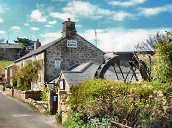 |
| Description - Route Directions - Statistics, Interest and Information |
|
Round Walk 09 - Zennor, River
Cove and Zennor Churchway - 8.93 miles - Route Directions
The primary route is 8.93 miles.
With Trevail/Treveal detour 9.30 miles. Short route 5.55 miles.
| Route with detailed GPS Data, grid refs, heights & distances --- Click here for easily printable PDF page |
| Route without GPS Data but occasional distance information --- Click here for easily printable PDF page |
| Statistics
Distance: 8.93 miles, with Trevail Mill detour 9.30 miles. Short route 5.55 miles. Ascent: Coast Path from Zennor to Hor Point total 1200 feet. Highest Point: 350 feet at Zennor. Coast Path 310 feet at Carn Naun Trig Point. Inland 440 feet at Boscubben. Biggest Climb: 210 feet up to Carn Naun Trig Point. 4 others over 100 feet including 1 inland from Hellesveor Cliff. Steps: On Coast Path, Up 49, Down 103, includes 60 rock steps down to Economy Cove. Stiles: Coast Path, just 4 stiles. Inland section, 53 stiles, mostly granite coffen or cattle stiles, of which 28 stiles in 1¼ miles between Wicca and Zennor. Gates: 5 only. Footing: Rocky, stony, massive boulders, on coast path. Good paths, tracks and field paths on to Zennor. Difficulty: Overall moderate but fairly strenuous on coast path.. Map: OS Explorer 102 Land’s End. |
| Interest
Feature on Zennor village On the primary route Zennor: See feature below. River Cove Clapper Bridge: The last of the many bridges between St. Ives and Pendeen Watch to be restored after the April 2009 floods. Its restoration was a triumph for tradition. Because of difficulty of access, and fears of damage, heavy machinery could not be used. So Robert Eddy’s two shire horses dragged the stones to the site and William Alford’s 1950s Field Marshall tractor winched the capstones into place. More on Clapper Bridges on my Miscellanea page. Carn Naun Point: High point of the coastal section at 310 feet, the views from here are superb. You look over St. Ives Bay to Godrevy Light and on to St. Agnes Head and Beacon, Kelsey Head and as far as Trevose Head. Zennor Churchway: Cornish historian and archaeological expert Craig Weatherhill has identified the inland part of this route as being part of the Zennor Churchway, running inland between coast and moors, from St. Ives, by Zennor and Morvah, to Pendeen. Much of the way is identified by Cornish Crosses and names with Cross in them. Description and map Cornish Stiles: Proper Cornish stiles are made not of wood (Cornwall Council and National Trust please note) but of local stone, usually granite or slate. They come in three main types, Cattle, Sheep and Coffen. You will also find what I choose to call Step Stiles and Crude Stiles, both self-explanatory. More on my Miscellanea page. Trowan: The farming hamlet had fallen into bad disrepair when Yorkshireman Phil Bradby drove past the turning in 2003 and saw the farmer putting up a For Sale sign. He bought it on the spot and, with the experience of redeveloping mills in Yorkshire and advice from the National Trust, restored the hamlet as 12 cottages. Three are permanent homes, the other nine second homes. The whole place looks lovely. Trevelgan: This ‘holiday farm’ is where my Trevail/Treveal detour starts. You could easily miss your way on the primary route here. The natural tendency is to continue on the same line, leaving a cottage on your left, through a couple of gaps, to pick up a waymarked path. This, in fact, is the beginning of the detour. For the primary route you need to go to the left of the cottage to find an obscured Zennor footpath sign. D. H. Lawrence: During the First World War, Lawrence and his wife Frieda stayed at the Tinners Arms in Zennor before renting Higher Tregerthen. The locals suspected they were German spies and eventually the police ordered them to leave. If you turn left up the lane at Tregerthen, you will come to Higher Tregerthen. On the short route and the Trevail/Treveal detour Trevail Mill: A footpath goes right through the garden and past the private house. The slate hung house is attractive, the garden delightful and a (presumably) former cart shed most unusual. Treveal: Owned by the National Trust, there are some interesting barns but the farm seems relatively unexploited by the NT although there are camping holidays arranged on the farm. |
| Useful Information
Parking: Zennor (inexpensive). Intermediate Parking: None. Getting There: From St. Ives, B3306 coast road, 6 miles, Zennor signed R. Refreshments: Zennor, Tinners Arms (all day),.Backpackers Hostel (seasonal). Toilets: Zennor (seasonal). |
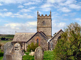 |
A tiny charming village, too easily passed by those on their way west towards the dreaded Land's End. Zennor consists of just an essentially Norman church, a cattle farm, the Tinners Arms Pub, a backpackers hostel with tea rooms, a group of holiday cottages known as Post Office Row, and the Wayside Folk Museum, excellent and surprisingly comprehensive for such a tiny village. Legends attach to the church. One concerns its founder St. Senara, accused of infidelity to her Breton King husband, cast afloat in Brittany in a barrel and washed ashore in Ireland, returning with her son, Budoc, who was born in the barrel at sea, via Cornwall where she founded the church. Another concerns The 'Mermaid seat' which has a bench end on which is carved a mermaid holding a comb and mirror. Legend has it that the mermaid entranced Matthew Trewhella and lured him to Pendour Cove where he drowned. It is said that on quiet nights the two can be heard singing beneath the waves. A memorial stone in the south wall of the church remembers John Davey, apparently the last person to speak Old Cornish, if only as an academic exercise. The Tinners Arms is open all day with cream teas in the afternoon. If you fancy a serious challenge, try heading up Zennor Hill, through rampant furze, to find a logan stone at The Carne and Zennor Quoit further on. |
|
|
Round Walk 10 - Pendeen
Watch, Chûn Castle, Morvah - 6½ miles
Easy. Farmland and heathland
up to Chûn Castle and Quoit;
farmland to the coast; moderate
returning on coast
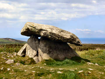 |
A counter-clockwise triangular walk, starting on the coast, heading inland and returning on the coast. But there is something different about this one: it includes three of West Penwith’s most important antiquities, Pendeen Vau Fogou, Chûn Castle and Chûn Quoit. As usual, you could do it clockwise but I prefer it this way for the views coming down off Chûn Downs and the afternoon sun as you return along the coast, best for seeing Portheras Cove and its Boat Cove at their best. The first leg heads inland on paths and tracks over farmland and open heathland, up onto Chûn Downs for Castle and Quoit. Take care at Calartha Farm, a waymark only points to Portheras Farm, you need to bear right to find your path. The second leg takes you down to Morvah village, offering grand views of Watch Croft, Carn Galver and later Gurnard’s Head. Again, be careful, maps show the field path to Morvah going through Carne Farm; it doesn’t but turns off earlier than the map shows. The final leg uses the coast path, taking in delightful sandy Portheras Cove and Boat Cove. Footing is generally OK: easy on tracks and crossing farmland, a bit muddy and rocky in places on the coast. Take care on the stepping stones above Portheras Cove and on the slipway at Boat Cove. And do take time to enjoy the view of cliffs and mines from Pendeen Watch. An easier walk than you might expect because gradients are easy. |
|
|
Oliver's Diary - Route Directions - Statistics, Interest, Info |
Round Walk 10 - Pendeen Watch,
Chûn Castle, Morvah - Oliver's Diary
| When I researched this walk in September 2010, it was the first time in this form. I had walked the coast path part on several occasions and I had been up to Chûn Castle and Quoit on many occasions, mostly while helping re-research the Land’s End Trail. Although views from Chûn Downs are less than from some West Penwith hills, they are still good and I am captivated by the several thousand years of history up there. With Jane and my sister Mary, I had also done a short round walk from Pendeen Watch that took in Morvah and the coast. But almost all the inland part of this walk was new to me. I was delighted that it seemed to work so well though I found a few places where both the Ordnance Survey map and Cornwall Council’s mapping web site need updating. Mostly the inland part is well waymarked though a waymark to lead you through Bojewyan Farm – they have a lovely herd of Jerseys – on what is a right of way, would be helpful. Although I took my camera, I was in low cloud much of the time so I missed out on photos. I didn’t go in Pendeen Vau fogou this time but can recommend it – with the farmer’s permission. And I strongly recommend the detour from the coast path down to Portheras Boat Cove, a lovely spot, still with part time inshore boats and some ramshackle net huts. A good, fairly easy moderate length walk with a great deal of archaeological interest. |  |
| Description - Route Directions - Statistics, Interest, Info |
|
Round Walk 10 - Pendeen Watch,
Chûn Castle, Morvah - Route Directions
| Route with detailed GPS Data, grid refs, heights & distances --- Click here for easily printable PDF page |
| Route without GPS Data but occasional distance information --- Click here for easily printable PDF page |
Round Walk 10 - Pendeen Watch,
Chûn Castle, Morvah
Statistics,
Interest and Useful Information
| Statistics
Distance: 6.34 miles. Ascent: 1050 feet. Highest Point: Inland, 710 feet at Chûn Castle. Coast, 355 feet at Chypraze Cliff. Biggest Climb: Inland, easy 200 feet up to Pendeen Gate. Coast, easy 225 feet up to Pendeen Watch. Steps: Up 25. Down 25. No flights to speak of. Stiles: 27, mostly crude or cattle stiles, mostly between Colvartha Farm and Bojewyan. Gates: 6 only. Footing: Mostly grass, path or track inland. Some stony on Chûn Downs. Some rocky, some muddy on coast path. Difficulty: Easy, unless you have problems with stiles. Map: OS Explorer 102 Land’s End. |
| Interest
Pendeen Watch: Operating since 1900, the lighthouse was automated in 1995. Its construction entailed the levelling of the headland and the destruction of a cliff castle. The light has a range of 16 miles and, in fog, the signal sounds every 20 seconds. Pendeen Manor and Pendeen Vau Fogou: There are several reasons for lingering here. The little manor house, now a farm, was the home of Dr. William Borlase, the first great Cornish antiquarian, born there in 1693. It was one of the locations used as Ross Poldark’s home, Nampara, in the first TV series. Those interested in antiquities will wish to see the fogou at the back of the farmyard. It’s well worth asking the farmer’s permission, which he is happy to grant. A fogou (Cornish ogo means cave) is an iron age underground chamber, purpose unknown. Chûn Castle: Almost 300 feet in diameter, its tumbled walls must have been at least six feet in thickness - and in 1951 Jacquetta Hawkes recorded that, in living memory, its walls had stood twelve feet high. Sadly it was robbed of stone to pave the streets of Penzance. Hawkes believed it to have been connected with the tin trade and traces of huts, a well and a smelting pit have been found. Methodist ministers preached from the walls here in the 19th century. While you will need to use considerable imagination, this is an impressively dominant site, which must have been much like an Irish rath and similar perhaps to Staigue Fort in Ireland's County Kerry. Chûn Quoit: One of West Penwith’s several neolithic portal dolmens, Chûn Quoit is much smaller than Mulfra and Zennor quoits but in a more original state, its capstone relatively undisturbed. As with Chûn Castle, outer stonework is believed to have been robbed for the streets of Penzance. Morvah: The small church is a disappointment, except for some impressive table tombs outside. The Old Schoolhouse has an art and craft gallery and a coffee shop – see Useful Information for opening times. Portheras Cove: The delightful sandy beach is usually empty of people though the occasional surfer will find his way there. At its western end, but accessible separately, is Portheras Boat Cove. A few part-time inshore fishermen operate from here. There are attractive stone-built net lofts. If exploring, be careful, the slipway can be just that and the former winch house is dangerous. |
| Useful Information
Parking: Pendeen Watch, by the lighthouse. Also at about 300 yards. Intermediate Parking: Woon Gumpus Common, B3318, opposite road to Trewellard (½ mile). Getting There: From Penzance, A30, A3071 (St. Just), B3318, keep straight on minor road to Pendeen, cross B3306, keep going. Refreshments: Schoolhouse Gallery, Morvah (summer Tue – Sun, winter Thu – Sun). Toilets: None. |
Round Walk 11 -
Pendeen Watch, Botallack, Boscaswell - 6½
miles
Easy. Lovely coastal views;
farmland back
Major mine remains; 2 mine museums, 2 fogous,
a holy well
 |
This is a walk with an immense amount of interest in its 6½ miles. So, although it can easily be done in 2½ hours or less, you may well feel that it is worth making a day of it and including the two mine museums (check openings). Unusually for my Coastal Round Walks, this one starts off with the coastal section, returning inland from Botallack with just a short final section along the coast at the end. Considering that it includes almost 3 miles of Coast Path, this is an extremely easy walk – unless you have difficulty with its 25 stiles. Even the long 140 foot climb up from Trewellard Bottoms is scarcely noticeable. Scenically, the coast section is lovely even though its views stretch only from Pendeen Watch to Kenidjack Head. The inland section is almost entirely pastoral. Along the coast, the walk does not keep religiously to the Coast Path but, where possible, stays closer to the cliffs for the enhanced interest. The mine remains along the coast are some of the finest in Cornwall and the two mine museums are both first class in their different ways. While you cannot visit either of the Poldark manors – unless enjoying B&B at them – you can visit both fogous and the holy well on the inland section. I have suggested a lunch stop at the Queens Arms in Botallack but a detour to Pendeen could include the North Inn, the Trewellard Arms, or the Radjel Inn. |
|
|
Oliver's Diary - Route Directions - Statistics, Interest. Info |
Round Walk 11 -
Pendeen Watch, Botallack, Boscaswell - Oliver's Diary
| This is one of my all-time favourite Cornish round walks. Whilst entirely different from walking on the high moorland of Bodmin Moor or of West Penwith, I rate it equally with any walks in those areas, only partly because of the vast amount of interest encountered along the way. I have walked it many times on my own and have walked it with sisters Mary and Frances, both of whom concur with my view of the walk. It is a walk I never tire of. You will see that I suggest the Queens Arms in Botallack for a lunch stop. I believe it still does good food though, on my August 2010 visit, I was less impressed by the landlord than by his predecessors. You will see that I suggest leaving the coast path for some of the way after Trewellard Bottoms. I am sure that, if you enjoy mine remains, you will prefer my route which sticks closer to the cliffs and includes Botallack arsenic calciner and a possible detour to the famed Crown engine houses, perched on the cliff edge. If you do take the ½ mile detour for the Crowns, be sure to be a little careful as the engine houses are perched right on the edge. And, if you decide to ask permission to see Pendeen Vau fogou, choose a time when the weather has been dry if you want to get in the inner chamber. |  |
| Description - Route Directions - Statistics, Interest, Info |
|
Round Walk 11 - Pendeen Watch,
Botallack, Boscaswell - Route Directions
| Route with detailed GPS Data, grid refs, heights & distances --- Click here for easily printable PDF page |
| Route without GPS Data but occasional distance information --- Click here for easily printable PDF page |
Round Walk 11 - Pendeen Watch,
Botallack, Boscaswell - Statistics, Interest, Useful Info
| Statistics
Distance: 6.51 miles. Ascent: 700 feet in all. Highest Point: 415 feet between Botallack and Lower Boscaswell. 340 feet at Roscommon trig point, on the coast path. Biggest Climb: Easy 140 feet aproaching Levant Mine. No other climbs of any significance. Steps: Up 7. Down 34. No flights of any significance. Stiles: 25, all between Botallack and Pendeen Watch, mostly crude granite stiles, a couple high. Gates: 1 only. Footing: Good paths and tracks to Botallack. Mostly grassy from Botallack back to Pendeen Watch. Difficulty: Easy, unless you have difficulty with stiles. Map: OS Explorer 102 Land’s End. |
| Interest
Feature on Mining Museums at Levant and Geevor Pendeen Watch: Operating since 1900, the lighthouse was automated in 1995. Its construction entailed the levelling of the headland and the destruction of a cliff castle. The light has a range of 16 miles and, in fog, a signal sounds every 20 seconds. East Levant mine: Major remains both at Trewellard Bottoms, below Geevor Mine, and on the climb up. Levant Mine. Botallack Mine: The superb remains include the Crowns engine houses, perched on the edge of the cliff, just above the sea, the Count House, in the care of the National Trust, and the considerable remains of an arsenic calciner, complete with chimney stack and flues. Poldark TV Locations: Two small manor houses were used as Ross Poldark’s Nampara home in the first series. Botallack Manor Farm now does B&B as does Pendeen Manor Farm. Pendeen Manor was the home of William Borlase, one of the earliest Cornish antiquarians, who was born there in 1693. It is also the location of Pendeen Vau fogou (see above). Geevor Mine Lower Boscaswell: The attractive village is the location of both a holy well and a fogou. Fogous: There are said to be eleven in Cornwall, all in West Penwith or on the Lizard.. Best is said to be Halligye on the Lizard. That at Carn Euny in West Penwith is most impressive and easily accessible. Boscaswell fogou, on this route, is unimpressive. All you seem to see appears to be no more than a tiny cave; in fact, the fogou is behind and roofless. Pendeen Vau is more impressive with two main chambers and a small subsidiary one. |
| Useful Information
Parking: Pendeen Watch, by the lighthouse. Intermediate Parking: Levant Mine. Geevor Mine. Getting There: From Penzance, A30, A3071 (St. Just), B3318 and keep straight on minor road to Pendeen, cross B3306 and continue to Pendeen Watch. Refreshments: Botallack, Queens Arms pub. Geevor Mine café (closed Saturday). Toilets: Geevor Mine. |
Mining Museums - Levant and Geevor Mines
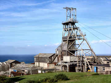 |
Levant Mine:
Cornwall's oldest working beam engine lay idle for 60 years. Built
in 1840, to power lifts taking miners down 1800 feet, and tin and copper
ore up, it operated continuously until Levant Mine closed in 1930.
In 1935 an enthusiast purchased it for £25, founding a preservation
group - later the Trevithick Society - to save it. Around 1990 the
'Greasy Gang' restored the engine, the only Cornish beam engine still operating
in its original engine house. It is now in the care of the National
Trust. The site is now part of the Cornwall and West Devon Mining
World Heritage Site. In addition to the engine, you can see a restored
electric winding engine and the pumping and winding shafts, take a short
underground tour and see a film. Geevor Mine: In existence since around 1700, the present mine was effectively started in 1911 by Cornish miners who had returned from South Africa during the Boer War. It closed in 1990 but re-opened in 1993 as a museum. There is a lot to see above ground. Buildings range from 18th to 20th century, many of them attractive. Production processes are demonstrated and a gallery has a major exhibition about the Holman engineering company. Underground tours of the 18th and 19th century workings are guided by former miners. Good facilities include a café and a well stocked shop. |
|
|
Description - Diary - Directions - Statistics, Interest, Info |
Round Walk 12 -Sennen
Cove, Chap Carn Brea, Gurland, Gwynver - 8 mls
Moderate. Farmland, Cornwall's
most westerly hill, prehistoric remains.
Glorious Whitesand Bay views
 |
There is less coast on this walk than on many of the preceding Coastal Round Walks. Despite that, the coast is in view much of the time. There are also, as you might expect of West Penwith, antiquities along the way. The first part of the walk passes one of them, Tregiffian Chambered Cairn, as it heads overall NE to Chapel Carn Brea, arriving there to see the other, the Neolithic chambered cairn on its summit. Views from here are panoramic. The second part heads across farmland, overall WNW, skirting Land’s End Airfield on its way towards Gurland Farm. The third part, the return route to Sennen Cove, turns south just before Gurland and passes within a hundred yards of the outward route at Tregiffian. You then follow a lane through the hamlet of Gwynver – not named on the map – before turning towards the cliffs. The route here is not waymarked but is easy enough to follow, meandering as it does along Escalls Cliff before descending to the beach. Views along Escalls Cliff are superb, taking in the complete sweep of Whitesand Bay from above. You should usually be able to use the beach to Sennen Cove but, if not, the marked Coast Path route is clear, if hard going on the dunes. Going is mostly easy with good tracks and field paths though it is a little rocky up Chapel Carn Brea and along part of Escalls Cliff. The two climbs give this some degree of difficulty but much of the way is easy. |
|
|
Oliver's Diary - Route Directions - Statistics, Interest, Info |
Round Walk 12 - Sennen Cove, Chapel
Carn Brea, Gurland, Gwynver - Oliver's Diary
| I originally did this as a longer walk starting from Land’s End when I was helping research the Land’s End Trail. I chose to start this one, done in October 2010, at Sennen Cove because I strongly dislike the tawdriness of Land’s End. I appreciate that some may not dislike Land’s End as I do and may like to start this walk from there so I have included the very simple route details for the additional two short legs after the main route directions below. The total distance would then be about 10.5 miles and would add nothing to the difficulty of the walk. Additional coastal views, on the return from Sennen Cove to Land’s End, would be good and, for antiquarians, there would be the added bonus of Maen Cliff Castle at 34821/25767 - and the wreck of the Mulheim just below in Castle Zawn. I actually did this walk twice walk in October 2010. The first time I tried the path through Gurland and discovered that it peters out at a locked gate at 36308/27833. It might perhaps be a route for the more adventurous. The second time I took the route described from before Gurland to the lane at Tregiffian. This time I foolishly carried an old OS map and discovered that two field paths from before Gurland have been partly superseded by a track. The route I settled on has the superior views as you walk along Escalls Cliff. |  |
| Description - Route Directions - Statistics, Interest, Info |
|
Round Walk 12 - Sennen Cove, Chapel
Carn Brea, Gurland, Gwynver - Route Directions
Includes a longer alternative,
starting from, and finishing at, Land's End - 10.50 miles
| Route with detailed GPS Data, grid refs, heights & distances --- Click here for easily printable PDF page |
| Route without GPS Data but occasional distance information --- Click here for easily printable PDF page |
Round Walk 12 - Sennen Cove, Chapel
Carn Brea, Gurland, Gwynver
Statistics,
Interest and Useful Information
| Statistics
Distance: 8.06 miles. Ascent: 1000 feet in all. Highest Point: 655 feet at the cairn on Chapel Carn Brea. Biggest Climb: 220 feet up out of Sennen Cove. 195 feet up Chapel Carn Brea. 2 others of around 100 feet. Steps: Up 4. Down 42, includes 38 down to beach at Whitesand Bay. Stiles: 19, all inland, mixture of granite and wooden. Gates: 10. Footing: Good field paths and tracks to Kerrow. Rocky on Chapel Carn Brea. Good field paths, tracks and lane to coast. Some awkward, sometimes muddy footing down to beach. Firm sand on beach. Difficulty: Moderate overall but with a lot of easy. Map: OS Explorer 102 Land’s End. |
| Interest
Sennen Cove: Very much a family holiday destination for its superb beaches along Whitesand Bay, the main beach running from the harbour in the south all along the village and continuing north to become Gwynver Beach (not very easily accessible except from Sennen). It is also a top surfing destination with the inevitable surf shops and beach café, this one called The Beach. If they are still up on Sennen's web site, take a look at the images taken during the storm of 10th March 2008; some are quite amazing and one appeared in several national newspapers. Tregiffian Chambered Cairn: I quote Craig Weatherhill's book Belerion, Ancient Sites of Land's End as follows: "This barrow has suffered dreadfully and it is only a shadow of the fine and unusual monument excavated by W.C.Borlase in 1878. It was then a kerbed mound 6.4m in diameter, containing a rather odd-shaped chamber. This was 2.4m long, 0.9m wide and just 0.5m high, but its inner end opened out to a width of 1.2m and a height of 1.0m. Like the tomb at Tregeseal the entrance was blocked by a single slab. The roof of the chamber consisted of three slabs and the tomb contained ashes and an urn". Sad that an important ancient monument - it is of the Scillonian type - should have been allowed to be so badly damaged. Chapel Carn Brea: Its correct name is just Carn Brea but it is usually known as Chapel Carn Brea, for the chapel which once stood on its summit, helpful in distinguishing it from Carn Brea south of Camborne. Cornwall's most westerly hill rises only to 650 feet but the panorama is quite stupendous, a patchwork of small fields, the settlement of St. Just, Land's End and both coasts. To the south-east you can see Lizard Point, 21 miles away; to the west you can see Longships Lighthouse off Land's End; to the south-west you may see the Isles of Scilly, some 31 miles distant. At the very top of the hill is a Bronze Age chambered cairn, a vast burial mound covered with rocks. It is very badly disturbed and degraded. A medieval hermitage was built here, using stones from the cairn and, in WWII, a radar station was built on it. There is also a charred area where local pagans burn midsummer bonfires. Land’s End Airfield: The OS map calls it Land’s End Airport but, with a grassy runway and minimal facilities, airfield is a better description. There is some private traffic but its main purpose is as the final stop for the Skybus service to the Isles of Scilly. (Improvements due 2014/15) Whitesand Bay: Including Gwynver beach, the sweep of firm sand extends for over a mile from Aire Point to Sennen Cove. It is very popular with surfers and is Cornwall’s most westerly surfing beach. On the extended walk from Land's End Maen Castle: An iron age promontory fort, soon after the Irish Lady rock. Below it, in Castle Zawn, are the remains of the wrecked Mulheim. Land's End: It should be wonderful but is awful, having had its 'end-of-the-world' feeling ruined by a down market theme park and almost a mile of cliff roped off for 'health and safety' reasons. What a dreadful shame it all is! You can't even have the satisfaction of walking all the way out to Dr. Syntax's Head, England's most westerly point. |
| Useful Information
Parking: Sennen Cove, by the harbour, slightly cheaper than main beach CP. Street free out of season. Intermediate Parking: NE foot of Chapel Carn Brea. Gwynver, on lane to Tregiffian at 36571/27513. Getting There: From Penzance, A30 to Sennen village, 1¼ miles before Land’s End, R for Sennen Cove. Refreshments: Sennen Cove, Old Success Inn, Beach Café, many cafés, restaurants, also Land's End. Toilets: Sennen Cove, main car park all year, harbour car park seasonal, also Land's End. |
Round Walk 13 -Porthcurno,
Roskestal, Gwennap Hd, Porthgwarra-4¼ mls
Easy. Farmland; fascinating
churchyard; attractive hamlet.
Windswept headland; theatre
and museum.
 |
This is a fairly easy short walk and could easily be combined with Walk 14 as a figure-of-eight walk of a little under 8 miles. It is a counter-clockwise walk. First it heads gently inland over grazing land, passing a Cornish Cross on the way to St. Levan with its fascinating churchyard. Then it climbs gently again, first through woods and then over farmland to the hamlet of Roskestal. Next it drops down into a valley before climbing over Open Access land to the National Coastwatch lookout on Gwennap Head. The Coast Path now leads along easy open land, passing a pair of daymarks, before dropping down again to the charming little fishing cove of Porthgwarra. All has been easy so far but the final section, from Porthgwarra back to Porthcurno, has some awkward rocky parts. It also has two serious staircases, the first of 115 steps down to Porth Chapel, passing St. Levan’s holy well, the second of 156 almost vertiginous steps down from the Minack Theatre to Porthcurno beach. This latter can be avoided if you don’t like the idea of it and the alternative route is described briefly. There is a great deal of interest along the way and coastal views, eastwards across Mount’s Bay to the Lizard, are most enjoyable. If the National Coastwatch Institution interests you, you are welcome to climb the stairs of the lookout to chat to the duty officer. |
|
|
Oliver's Diary - Route Directions - Statistics, Interest, Info |
Round Walk 13 - Porthcurno, Roskestal,
Gwennap Head, Porthgwarra - Oliver's Diary
| This October 2010 walk takes me back to my earliest days of Coast Path walking. Jane and I did this walk, and its companion Coastal Round Walk 14, way back in 2004, long before I developed the ambition to walk the whole of the Cornish Coast Path. Indeed, the main object of the outing was to visit Porthcurno Telegraph Museum, a fascinating place, and the Minack Theatre, a quite remarkable feat of construction. The walk to Gwennap Head and Porthgwarra was merely tacked on for a bit of fresh air and coastal scenery. We were very taken with Porthgwarra, one of relatively few fishing coves, as opposed to proper fishing harbours, in Cornwall. Later, on Walk 14, we discovered another fascinating fishing cove, that owned by the National Trust at Penberth. Others may be found at Portheras on Walk 10 and at Priest’s Cove set below Cape Cornwall. Each time I have been there, I have loved the churchyard at St. Levan with its delightful sturdy lych gates, complete with coffen stiles, and its collection of Cornish Crosses. But my favourite part of this walk, without a doubt, is the plateau of Gwennap Head, its daymarks, one red, one black and white, both surrounded by low furze and heather, best seen in summer when the ground is blanketed with colour. It is only a few inches high, little more than ankle depth and kept that way by the gales that sweep across the headland. |  |
| Description - Route Directions - Statistics, Interest, Info |
|
Round Walk 13 - Porthcurno, Roskestal,
Gwennap Head, Porthgwarra - Route Directions
| Route with detailed GPS Data, grid refs, heights & distances --- Click here for easily printable PDF page |
| Route without GPS Data but occasional distance information --- Click here for easily printable PDF page |
Round Walk 13 - Porthcurno, Roskestal,
Gwennap Head, Porthgwarra -
Statistics, Interest,
Useful Information
| Statistics
Distance: 4.20 miles. Ascent: 850 feet in all. Highest Point: 255 feet at the Cornish Cross after Rospletha. 235 feet at Gwennap Head NCI. Biggest Climb: 190 feet up from Porthgwarra. Only two others of over 100 feet.. Steps: Up 70, includes 40 up to Pedn-mên-an-mere. Down 315, includes 115 down to Porth Chapel, 156 down from Minack Theatre. Stiles: 5, all granite cattle stiles inland. Gates: 6, mostly kissing gates. Footing: Good field paths and tracks to Roskestal. Good footing on coast path to Porthgwarra. Some awkward rocky on coast path from Porthgwarra to Minack. Vertiginous steps (avoidable) down from Minack. Difficulty: Moderate overall but with some difficult on coast path and easy inland. Map: OS Explorer 102 Land’s End. |
| Interest
Feature on Porthcurno, the Telegraph Museum and Minack Theatre St. Levan: The church is largely 15th century but with an older tower. Inside are an ancient holy water stoup in the porch, carved roof bosses and a Norman font in the south aisle, and rood stairs in the south wall; the rood screen is not original. Outside are three ancient cross heads, a handsome tall carved Cornish cross; and the St. Levan Stone, split in two and said to have been venerated in pre-Christian times. Most remarkable are the two lych gates. Both have seats and coffin rests, neither has a roof; both have coffen stiles, the top one remains open to prevent animals straying from the field above. Roskestal: Hamlet with three farms and some attractive old barns. Gwennap Head: A delightful plateau of Open Access land, much of it covered with low heather and furze. Long views explained on a toposcope by the Coastwatch lookout. Two daymarks stand further east. Coast Watch: The National Coastwatch Institution (NCI), a voluntary organisation, keeps watch along the British coast. There are 40 active Coastwatch stations, many closely clustered in Cornwall. Daymarks: On Gwennap Head are two short conical towers, one black and white, one red. Apparently, when the red cone obliterates the black and white one the observer at sea is directly above the dangerous Runnel Stone. Keep your eyes open around the Cornish coast and you will spot many daymarks, some conical, some towers as on Gribbin Head. Porthgwarra: Charming small fishing cove with a rock tunnel, a steep slipway and a seasonal café. St. Levan’s Well: Levan - originally Selevan - was born in the 6th century, maybe at Boslevan near St. Buryan. He founded a cell on the cliffs above Porth Chapel and later a church where the present one stands. Reputedly a keen fisherman, this is commemorated by a sculpture in the church. Still standing on the cliff above Porth Chapel beach are the remains of St. Levan's Baptistry and Holy Well, its water still used for baptisms in the church. Originally there is said to have been a small chapel further down the cliff and in 1931 Reverend Valentine and Dr. Favell unearthed fify or so stone steps leading down to where it stood. |
| Useful Information
Parking: Porthcurno, between Telegraph Museum and beach, free winter. Intermediate Parking: St. Levan, free winter. Porthgwarra, free winter. Getting There: From Penzance, A30 past Drift, L B3283 to Trethewey, L to Porthcurno. Refreshments: Porthcurno, Cable Station Inn, Beach Café. Porthgwarra, café (seasonal). Toilets: Porthcurno, bottom of car park. Porthgwarra. |
Feature - Porthcurno, the Telegraph
Museum and the Minack Theatre
 |
Porthcurno: Attractive small cove with a steeply shelving beach. In the village is the Telegraph Museum. On the cliffs is the Minack Theatre. Telegraph Museum: The first world-spanning submarine cable came into Porthcurno from India in 1870. The tiny cove grew to be the world's largest cable station, fourteen cables coming in from all parts. The original Eastern Telegraph Company became the multi-national Cable and Wireless which remained until the 1990s. The original HQ building is now apartments; the later building and WWII tunnels now house a Museum, telling the story of submarine telegraphy and of Porthcurno's part, as a secret communications base, in WWII. Story boards are good and exhibits - many working - fascinating. Upstairs is a comprehensive exhibit about Isambard Kingdom Brunel's great cable laying ship, the massive 'Great Eastern'. Minack Theatre: Rowena Cade started work, creating her theatre on the windswept headland, in 1931, helped by her gardener, Billy Rawlings, and his mate Charles Angove. The theatre looks for all the world like an ancient Greek or Roman theatre. Seating looks out over the Atlantic and balconies, terraces and steps are all part of the unusual stage. There is an exhibition, a coffee shop, a shop and a small sub-tropical garden but you have to pay for entry to visit these. |
|
|
Description - Diary - Route Directions - Statistics, Interest, Info |
Round Walk 14 -
Porthcurno, Penberth Cove, Treen, Porthcurno
- 3½ miles
Easy. Coastal and beach
views; major promontory fort;
Charming fishing cove and village;
farmland; museum
 |
A fairly simple short walk which could easily be combined with Walk 13, also starting from Porthcurno, to make a good figure-of-eight walk of a little under 8 miles. Like Walk 13, this also goes counter-clockwise but first taking the Coast Path then using inland paths back to Porthcurno. It starts with a fairly steep and rocky climb up from Porthcurno to around 230 feet above Percella Point. Soon after, the Coast Path continues straight on but you would do better to go right to take the lower path for the views it offers back over Porthcurno and forward to Treryn Dinas and over Mount’s Bay to the Lizard. And, when you come to the outer rampart of Treryn Dinas, the half-mile detour out to the headland and back has been included as a must for interest and views. But, unless you happen to be an experienced rock-climber, you should not even consider trying to get up to the famous Logan Rock, perched on the third summit. The route on to Penberth Cove is straightforward but includes a fairly steep 143 steps down to the cove. It’s then a long but easy climb up to Treen village, first through woods, then over fields, followed by easy going across fields to Tredrennen and back down to Porthcurno. There is a lot of interest along the way. Views back west are short but those forward eastwards are striking and enjoyable. |
|
|
Oliver's Diary - Route Directions - Statistics, Interest, Info |
Round Walk 14 - Porthcurno, Penberth
Cove, Treen - Oliver's Diary
| As with Walk 13, also from Porthcurno, this was one of the earlier coastal walks that Jane and I enjoyed, back in 2004. On our original walk our purpose was primarily to see the iron age cliff castle of Treryn Dinas and to discover the National Trust fishing cove of Penberth Cove. Then we returned by the shortest route to Porthcurno. This walk takes a slightly longer but slightly easier route back. On a later expedition to Treryn Dinas, I tried to scramble up to the Logan Rock on Treryn Dinas. I never made it and concluded that this is something only for experienced rock climbers; I don’t mind a bit of rock scrambling but the Logan Rock is not for me. I enjoy the initial coastal section of this walk. Once up on the cliffs, the views west to Treryn Dinas are a delight, especially when the beaches are exposed at low tide, very photogenic. I love Penberth Cove and feel that the National Trust deserves plaudits for maintaining it as a real fishing cove. I am also very fond of Treen village, an attractive place with reasonably priced parking and an excellent pub, the Logan Rock Inn. Sadly, when I was there at October half-term in 2010, the café by the car park looked closed permanently [it was open, seasonally, again in 2014]. I enjoyed my new route from Treen to Porthcurno, mostly pasture, with a gentle descent to the museum and car park. |  |
| Description - Route Directions - Statistics, Interest, Info |
|
Round Walk 14 - Porthcurno, Penberth
Cove, Treen, Porthcurno - Directions
| Route with detailed GPS Data, grid refs, heights & distances --- Click here for easily printable PDF page |
| Route without GPS Data but occasional distance information --- Click here for easily printable PDF page |
Round Walk 14 - Porthcurno, Penberth
Cove, Treen, Porthcurno
Statistics, Interest
and Useful Information
| Statistics
Distance: 3.55 miles on the GPS. Ascent: 850 feet in all. Highest Point: 250 feet on Treen Cliff on Coast Path. 320 feet inland after Treen village. Biggest Climb: Easy 250 feet from Penberth Cove to Treen village. 180 feet up from Porthcurno. Only 1 other over 100 feet. Steps: Up 66. Down 147, includes 143 down to Penberth Cove. Stiles: 11, all inland, mostly mixed granite stiles. Gates: 3. Footing: Mostly good tracks and field paths inland. Some difficult rocky on Coast Path, some rock scrambling at Treryn Dinas. Difficulty: Easy overall but with some awkward rocky on Coast Path. Map: OS Explorer 102 Land’s End. |
| Interest
Feature - Porthcurno, the Telegraph Museum and the Minack Theatre - See Round Walk 13 Treryn Dinas: This must be the largest of Cornwall's cliff castles. It comprises a massive landward rampart (right on the coast path) as much as twenty feet high, an inner double bank and ditch, and a small seaward rampart, which is approached by a 'bridge', just before the incredibly rocky headland. There are said to be remains of two hut circles beyond this seaward defence. I find this a puzzling place. Why should anyone who could build the vast outer defences risk being trapped between their tiny final rampart and this rocky headland, with no way to escape? Is it possible that 2000 years have seen massive erosion here, changing the headland beyond recognition. Whatever the reason, it is a most impressive place. Penberth Cove: Conserved and managed by the National Trust, this is a very attractive fishing cove from which local inshore boats fish for crab and lobster. There are two clapper bridges, a massive one near the winch house and a smaller one, just upstream opposite a row of cottages. Many buildings are ‘cellars’ where nets, pots and fuel are stored. Treen: Attractive village with a working farm, parking, toilets, seasonal café and the excellent Logan Rock Inn. |
| Useful Information
Parking: Porthcurno, between Telegraph Museum and beach, free winter. Intermediate Parking: Treen (inexpensive). Getting There: From Penzance, A30 past Drift, L B3283 Trethewey, L to Porthcurno. Refreshments: Porthcurno, Cable Station Inn, Beach Café. Treen, Logan Rock Inn, café (seasonal). Toilets: Porthcurno, bottom of car park. Penberth Cove, near massive clapper bridge. Treen, by car park entrance (may be closed). |
Round Walk 15 - Antiquities Walk from Lamorna Cove - 5,
6¼ or 6¾ miles
Inland route easy. Coastal
option makes it overall moderate.
A stone circle, menhirs, Cornish
crosses and a fogou.
 |
Although this walk starts on the coast path at Lamorna Cove, none of it is actually on the coast path. Instead it is an inland circular walk, designed to include most of the antiquities in the Lamorna Area. It has to be said that parking at Lamorna Cove is expensive, even in winter. At quiet times you might feel justified in starting your walk at one of the two small parking areas on the Newlyn to Land’s End road – but better not at busy times or with more than one car. If you do so, and miss out Lamorna Cove, you will save approximately ¾ mile of road walking but still pass the charming Lamorna Wink Inn. This is an easy walk as, once you have made the initial climb up from the coast, terrain is more-or-less flat and the 15 stiles pose no problem. Leaving Lamorna Cove, you are up to 300 feet after a mile and stay at around that height till heading back down to Lamorna. The antiquities visited are, in order, Boscawen Ros menhir (longstone), Boskenna Cross, Moorcroft Cross, Gûn Rith menhir, Tregiffian Chambered Tomb and the Merry Maidens stone circle. If you choose the full 6¼ or 6¾ mile route, you would also see the massive Pipers menhirs and the impressive Boleigh Fogou. Please bear in mind that these are on private land. You may feel you should ask permission for the Pipers, certainly you must for the fogou. Contact details are provided under 'Interest'. |
|
|
Oliver's Diary - Route Directions - Statistics, Interest, Info |
Round Walk 15 - An Antiquities
Walk from Lamorna Cove - Oliver's Diary
| I have done this walk many times but previously with some variations. On this occasion, walking with Bob in November 2010 for research purposes, I settled on a shortish totally inland walk that included all the important antiquities on publicly accessible land. However, I also offer two alternative routes. The first includes a stretch of coast path between Lamorna Cove and St. Loy’s Cove; it omits just the Boscawen Ros menhir. The second includes the two major antiquities on private land, the Pipers and Boleigh Fogou. So the walker’s choice ranges from the basic 5 mile route, through the 6¼ mile Fogou route, to the full 6¾ mile Coast Path and Fogou route. The going along the Coast Path is quite rocky and awkward, so more casual walkers may prefer to give this route a miss. Since my view of this walk is as a tour of the antiquities of the Lamorna area, my preference is for the inland route with the addition of the Pipers and Boleigh Fogou. This is the route that Bob and I took, having called Rob and Laura at Rosemerryn Wood to ask permission to visit their fogou – no problem. I was impressed by the fogou, well constructed and easy to access though progressively muddier. There is another Cornish cross that I haven’t included. If you want to include it, continue on the road past the Merry Maidens for a couple of hundred yards. It’s on the verge on the right but may be overgrown. |  |
| Description - Route Directions - Statistics, Interest, Info |
|
Round Walk 15 - An Antiquities
Walk from Lamorna Cove - RouteDirections
Includes directions for the Coastal
Option and Pipers and Boleigh Fogou detours
| Route with detailed GPS Data, grid refs, heights & distances --- Click here for easily printable PDF page |
| Route without GPS Data but occasional distance information --- Click here for easily printable PDF page |
Round Walk 15 - An Antiquities
Walk from Lamorna Cove - GPS Data
| Distance: 4.90 miles. To include Boleigh Fogou detour 6.15 miles. To include also Coast Path Route 6.60 miles. Ascent: 500 feet. To include Pipers and Boleigh Fogou 620 feet. To include also Coast Path 1320 feet. Highest Point: 370 feet at Moorcroft Cross. Biggest Climb: Moderate 270 feet out of Lamorna Cove. On Coast Path route easy 365 feet up from St. Loy’s Cove. Steps: None on basic inland route. On Coast Path route 55 steps up, 73 steps down. Stiles: 15, all mixed granite stiles, mostly fairly crude. Additional 6 stiles on Coast Path route. Gates: Only 2. Additional 2 gates on Coast Path route. Footing: Mostly good tracks and field paths. Farm tracks may be muddy. Some road. Coast path, some strenuous parts with awkward rocky footing. Difficulty: Overall Easy but with an initial long moderate climb. Coast Path route makes it overall moderate. Map: OS Explorer 102 Land’s End. |
| Parking: Lamorna Cove (expensive). Intermediate Parking: 2 small lay-bys on B3315, at Merry Maidens and Boskenna Cross. Getting There: From Penzance, A30, L 3317 Newlyn, R B3315 Trewoofe, L to Lamorna Cove. Refreshments: Lamorna village, Lamorna Wink Inn. Lamorna Cove, café (seasonal). Toilets: Lamorna Cove. |
| Lamorna Cove: A popular tourist spot but the car park is too expensive and the place a little disappointing. The café has an interesting local seafood menu. For interest, you would do better to walk up the hill to the village. Cottages, some attractive, some a little ramshackle, are tucked away in the woodland on either side of the lane. Up a side turning is a charming row of cottages, a little way beyond them a tiny watermill. Lamorna Wink: Pleasant pub, less than ½ mile uphill from the cove. Good simple food, speedily served. Tables outside in sun. Tregiffian Farm: Attractive hamlet, much of which is now holiday cottages and B&B. Boscawen Ros: Nice group of farm buildings includes several old barns, one with tallet steps. Boscawen Ros was the origin of the family now at one of Cornwall’s greatest houses, Tregothnan, as Earls of Falmouth. In 1335 John de Boscawen Ros married the heiress Johanna de Tregothnan. The family hasn’t looked back since. Cornish Crosses: There are several along, and just off, this route. None is intact but the heads all survive. Menhirs: The Cornish word means long stone, mostly referred to just as standing stones. Those along this route are mostly genuine long stones. The Boscawen Ros stone is about 8 feet tall, Gûn Rith stone, also known as The Fiddler, is 11 feet tall and the Pipers are 13 and 15 feet tall. Quite an impressive collection. Tregiffian Chambered Cairn: Sadly, half of this Neolithic tomb was lost to road construction. The half which remains at the roadside is impressive. Kerb and capstones are more or less intact and, just inside the kerb ring, there is a most unusual stone, indented with cupmarks. In fact this is a copy, the original is in the Royal Cornwall Museum in Truro. Merry Maidens: Thought to be complete, these 19 stones form an almost perfect 80 foot circle. When constructed, the Pipers and the Gûn Rith stone would have been visible from it. Sadly, not so now. Boleigh Fogou: Unlike most others, Carn Euny is the great exception, this fogou has a high enough roof to walk straight in. Beautifully constructed, its main passage is around 35 feet long. On the left jamb of the entrance is the only known iron age carved figure in Cornwall. A side passage has only a small opening. The fogou, purpose, like all the others, unknown, is in the garden of Rosemerryn Wood. To visit, telephone Rob and Laura on 01736 810530 or email them, there is a link on their website. |
Round Walk 16 - Loe
Bar, The Loe and the Penrose Estate - 7 miles
Easy, mostly level walking.
A tranquil lake, mixed woodland and a short stretch of coast path.
 |
This is a very easy walk that should be within the capabilities of all. Apart from the short climb at the start, there is little exertion required anywhere. Nor does it require much, if anything at all, in the way of route directions. I have therefore kept them very brief. If you feel the need of a map, rather than use OS103, which doesn’t show most of the permissive paths on the Penrose Estate, you should obtain the National Trust’s Cornwall Leaflet number 12, which is to a large scale and is very informative about the estate. Most of the walk is in woodland but there are plenty of viewpoints along the way. You start on the coast path and head to Loe Bar, easily crossed on firm gravelly sand. The route then does a counter-clockwise circuit of the Loe, first following round Carminowe Creek, mostly in light woodland. Soon after Lower Pentire there is an open field with a good view back to Loe Bar, then you enter Degibna Wood, leaving The Loe after a while and staying in woodland most of the way to Helston, ending on a track that passes ruined Castle Wary mine engine house. You leave Helston along the River Cober but soon join the former carriage drive to Penrose House, continuing on it back to Loe Bar. Footing is generally good but some paths can get quite muddy, around the south side of Carminowe Creek and in parts of Degibna Wood. Carriage drive is stony but not uncomfortable. |
|
|
Oliver's Diary - Route Directions - Statistics, Info, Interest |
Round Walk 16 - Loe Bar, The Loe
and the Penrose Estate - Oliver's Diary
| I have walked the Penrose Estate many times, first with Jane, later with my sister Mary, subsequently several times on my own. This November 2010 research walk was done with friends and neighbours Bob and Pam. When I walk here with Jane, we like to do a one way walk. We park in the vast free car park opposite Coronation Park in Helston, walk one side or the other of The Loe and continue on the coast path into Porthleven. After lunch, usually fish and ships from Roland’s Plaice, we then take the hourly bus back to Helston. Nice easy 5¼ mile scenic outing which we always enjoy, partly because we are very fond of Porthleven which, despite all its holiday homes remains a real place with a working fishing harbour. On this occasion, we were very much in Cornwall’s November rainy season and, although we had a lovely sunny day for it, much of the path round Carminowe Creek and the east side of the Loe was quite muddy and occasional avoiding action was called for. As we had taken sandwiches with us, I rather missed the usual coffee and snack at the excellent Lakeside Café in Coronation Park. I console my self that, when my sister Frances visits soon, we shall most probably do our one way walk from Helston to Porthleven. Ah! Lakeside’s coffee and Roland’s fish and chips are something to look forward to. Altogether, one of our favourite easier walks. |  |
| Description - Route Directions - Statistics, Info - Interest |
|
Round Walk 16 - Loe Bar, The Loe
and the Penrose Estate - Directions
| Route with detailed GPS Data, grid refs, heights & distances --- Click here for easily printable PDF page |
| Route without GPS Data but occasional distance information --- Click here for easily printable PDF page |
Round Walk 16 - Loe Bar, The Loe
and the Penrose Estate - GPS Data
| Distance: 7.01 miles. Ascent: 500 feet but scarcely noticeable. Highest Point: 125 feet on Parc-en-Als Cliff at start of walk. Biggest Climb: 90 feet in Degibna Wood. Steps: Up 18. Down 21. Stiles: None. Gates: 3. Footing: Well made stretch of Coast Path. Firm sand over Loe Bar. Good paths (can be muddy) on E side of The Loe. Stony track on W side of The Loe. Difficulty: Very easy. Map: OS Explorer 103 The Lizard. |
Round Walk 16 - Useful Information
| Parking: On cliffs E of Porthleven at 63604/24913 (another one just up the lane). Intermediate Parking: NT Degibna CP at approx. 653/252. Helston, 200 yards down B3304 Porthleven road. NT Penrose Hill CP, signed off B3304 to Porthleven (all free). Also inexpensive parking in Porthleven. Getting There: From A394 at Helston, take B3304 Porthleven road; after 1½ miles, halfway up hill, turn L following Loe Bar signs; keep going to cliffs. Refreshments: Helston, Lakeside Café, Coronation Park. Many possibilities in Porthleven. Toilets: Helston, behind Lakeside Café. Porthleven. |
Round Walk 16 - Loe Bar, The Loe
and the Penrose Estate - Interest
Usually, Interest
would take the form of a variety of material in a single box.
Instead, just two
items - The Penrose Estate and The
Loe and Loe Bar
 |
The finest estates in Cornwall, open all year to the public, are Lanyhdrock, Trelissick and Penrose, all owned by the National Trust. Penrose is perhaps the most historic. Known to have been in the ownership of the Penrose family since at least 1281, it was sold to the Rogers family in 1771. They extended it all the way to Gunwalloe Church Cove and it was they who created the wooded estate that you see today. In 1974 it was left to the National Trust, though a Rogers still lives in the house. The estate is heavily wooded. Most is mixed woodland but there is a fine oak grove to the west of The Loe, Monterey Cypress and Pine near Bar Lodge and bamboo, tree ferns and palms near the house. North of the house is a restored eyecatcher bridge and nearby is a bath house of the 1830s. Around the River Cober is Loe Marsh, an Everglades-like swamp. Parts of the estate were once mined for lead, silver and zinc; the only worthwhile visible remains are of a Castle Wary Mine engine house. The Loe was once renowned for its trout; sadly, the escape of rudd from the Coronation Park lake means that few remain now. Penrose played its part in World War II. Timber booms covered The Loe, to prevent enemy seaplanes landing. Sir William Penney did torpedo research from Lower Pentire and The Loe was used for aircraft rocket firing practice. |
|
|
Back to Interest |
| This is a delightful spot and one which causes not a little confusion. Most people call The Loe Loe Pool but this is repetition. The Cornish word Loe is the same as the Irish Lough and the Scottish Loch, meaning a pool. And no one knows how the Bar formed, turning the estuary of the River Cober into a freshwater lagoon. Some say it was Atlantic storms, some claim longshore drift, some suggest silt from upstream mines. The likelihood is that it was a combination of all three. From a distance Loe Bar looks like sand but turns out to be mostly very fine gravel with a sprinkling of colourful small sea-washed stones. High seas can occasionally cover it. National Trust Cornwall leaflet 12 on The Loe and Mount's Bay includes good information. The Anson Memorial, on the south-east side of Loe Bar, commemorates the 100 men who lost their lives in December 1807 when HMS Anson was wrecked on the Bar. The good thing that came of this disaster was that Helston man Henry Trengrouse was so affected by the loss of life that he devised a rocket apparatus to fire a line from shore to ship, later improved on as ship to shore. Tennyson's description in Idylls of the King, The Passing of Arthur is taken by some to suggest The Loe as the location where Sir Bedivere threw Ecalibur into the water. "On one side lay the ocean, and on one lay a great water" Others prefer the less appropriate Dozmary Pool on Bodmin Moor. |  |
| Back to Interest |
|
Round Walk 17 -Mullion
Cove and Predannack Wollas - 4 miles
A easy walk. Heath and
farmland inland. Easy going on cliffs, glorious views
 |
This is a short and easy walk, ideal for a morning or afternoon. Those who would like a more extended walk should add it to Round Walk 18. This would offer several route possibilities for a 10 mile walk. A circular (more oval) walk, inland or coast first, from either Mullion Cove or Kynance Cove. Or a figure of eight walk, starting at Mullion Cove, Kynance Cove or Predannack Wollas. My own preference would be to start at Predannack Wollas, inland to Kynance, coast to Predannack, inland to Mullion and coast to Predannack. This provides variety and, for photography, gets the light on the coast. Walk 17, researched as a 4 mile walk, starts at Mullion Cove, heads inland, with moderate and easy ascents and a preponderance of field paths, to the fascinating farmland hamlet of Predannack Wollas. It is then an easy 250 yards or so to join the coast path back to Mullion Cove. You might expect this coast section to be tough, like much of the Cornish Coast Path, but going is easy and grassy and offers the best views of the walk, forward over Mount’s Bay and, near the end, to the islands and harbour of Mullion Cove. Keep left approaching the Cove for the best views. Two minor considerations are that there are quite a lot of stiles on the inland leg and that, after rain, both legs can get quite muddy, though with helpful stepping stones along the muddiest parts of the coast. |
|
|
Oliver's Diary - Route Directions - Statistics, Info, Interest |
Round Walk 17 - Mullion Cove and
Predennack Wollas - Oliver's Diary
| I have walked along the coast here on several occasions, first in 2005 and recently as research for my Cornish Coast Path page. On this occasion, in November 2010, I walked with Bob. The cold snap had just started but the forecast for The Lizard was just light rain showers with sunny intervals. How wrong could it be! What we got was rain, sleet, hail and snow with occasional sun. The inland leg of the walk was new to me but easily followed. We set off in warm sunshine but had waterproofs on within a couple of hundred yards. Once out of Mullion Cove we found the going easy but wet and muddy on sheltered footpaths and across farmland. Most of the stiles occur on this leg, mostly granite cattle stiles but low enough almost to be coffen stiles. I was puzzled to find one had a wooden lift bar on top: a totally superfluous addition, probably the work of Cornwall Council. I find it a great shame that proper Cornish stiles get messed about and that the National Trust, of all bodies, should use alien English wooden stiles so inappropriately. Despite the wintry showers, as we approached Mullion Cove on the return leg, the sun broke through and the rocks and islands near the Cove were illuminated by the strongest possible low winter light, a glorious sight after what had been a rather cheerless day. |  |
| Description - Route Directions - Statistics, Info, Interest |
|
Round Walk 17 - Mullion Cove and Predannack Wollas - Route Directions
| Route with detailed GPS Data, grid refs, heights & distances --- Click here for easily printable PDF page |
| Route without GPS Data but occasional distance information --- Click here for easily printable PDF page |
Round Walk 17 - Mullion Cove and
Predannack Wollas - GPS Data
| Distance: 3.90 miles. Ascent: 800 feet, of which 400 feet inland, 400 feet on coast path. Highest Point: 300 feet at Predannack Manor, inland. 250 feet at Higher Predannack Cliff on coast path. Biggest Climb: Moderate 195 feet out of Mullion Cove. Easy 150 feet up to Predannack Manor. Nothing of 100 feet on coast Path. Steps: Up none. Down 12. Stiles: 14, of which 10 inland, 4 on coast path. Mostly granite cattle or coffen stiles. Gates: None. Footing: Good tracks and grassy fields to Predennack Manor. Farmland and lane to Predannack Wollas. Good footing, mostly on grass, along coast path. Difficulty: Easy, though may be muddy in places. Map: OS Explorer 103 The Lizard. |
| Parking: Mullion, free in quarry off road at 67105/18036. Free by Mullion Cove Hotel, above the harbour on the N side. Also large pay CP back up road. Street free in winter. Intermediate Parking: Predannack Wollas, NT CP at 66911/16226. Getting There: From A394 at Helston, take A3083 Lizard Town for about 6 miles, R B3296 Mullion, keep L for Cove. Refreshments: Mullion Cove, seasonal café. Mullion village, pubs and cafés. Toilets: Mullion Cove, on L before harbour. |
| Mullion Cove: For a small harbour in the care of the National Trust, Mullion Cove can disappoint. Neatly enough kept, few of the buildings are very interesting and, with the enclosed harbour and high cliffs, there are no views so you may get a somewhat oppressive feeling. To get any views you will need to climb to a hotel high above the north side or to Mullion Cliff on the south side. The harbour walls suffer badly from storms and in 2007 the National Trust decided on a policy of 'managed retreat' which means that, in due course, they will no longer maintain the harbour walls which, like those at Trevaunance Cove on the north coast at St. Agnes, will eventually crumble. There is a seasonal tea room by the harbour. Toilets nearby. Ample parking spread around. Cornish Crosses: Look out for two along the inland leg. The first, where you leave the track up from Mullion Cove, has lost its head but the second, in a field shortly before Predannack Farm, is a fine one. Predannack Wollas: An interesting place name, Predannack, which Cornwall’s expert on the subject interprets as meaning British and perhaps having once been the name for the whole of the Lizard Peninsula. Another interpretation is "bracken headland". Nearby is Predannack Manor Farm, so this farming hamlet must once have been owned by it, the Wollas part of the name meaning Lower. Predannack Wollas is a grouping of three farms, Upper and Lower (gets confusing, doesn’t it), both now owned by the National Trust and raising Dexter cattle, and Windyridge Farm, still in private hands. Be that as it may, this is a charming farming hamlet. Watch out for the overview of it as you head for the cliffs. Lizard National Nature Reserve: Not one clearly defined area but a number of separate areas spread across the Lizard. It is a mix of heathland, grazing land, cliffs and beaches. Largest area is near the strange dishes of Goonhilly Earth Station, which has an exhibition about the reserve in its visitor centre. Goonhilly Down is open heathland, best from June when gorse, heaths and heathers bloom. Here you may see adders, lizards, buzzards and owls. Next major area is the most exciting, along the west coast between Mullion and Kynance Coves, its two parts linked by the National Trust's Predannack Estate. Rare wild flowers abound: Cornish heath and bell heather, green winged and marsh orchids, short stemmed ox-eye daisies and wild asparagus. You may see peregrine falcons, ravens, choughs, skylarks and stonechats. Herds of Highland cattle and Shetland ponies graze the clifftops. Smaller areas include Kennack Sands - where there are red serpentine pebbles on the beach and basking sharks in the sea - and Main Dale, near St. Keverne, with its heath-spotted orchids and bog asphodel. Mullion Cliff: From here you get stunning views of the full curve of Mount’s Bay and down to the harbour at Mullion Cove and its rocks and islands. |
Round Walk 18 -Kynance
Cove and Predannack Wollas - 5¾ miles
Easy walk. Mostly level
inland. Coast Path mostly level, glorious coastline.
 |
This is a shortish and easy walk, ideal for a morning or afternoon. Those who would like a more extended walk should add it to Round Walk 17. This would offer several route possibilities for an up to 10 mile walk. For more ideas on that see Walk 17. Almost all of this Walk 18 is on Lizard National Nature Reserve land or on National Trust land. It starts with a short steep climb up from Kynance Cove and continues on clear waymarked paths, a bit muddy in some places, over more or less level ground, past Kynance Farm and Jolly Town, with Predannack Airfield a little way off to your right, to reach the largely National Trust owned hamlet of Predannack Wollas. You then retrace your steps for about 250 yards before heading right to pick up the Coast Path to return to Kynance Cove. Views south are shortish until you reach Kynance Cliff, when they open out to take in Old Lizard Head. Westwards, you have a fine panorama across Mount’s Bay as far as Penlee Point. Going is generally easy inland, despite occasional mud. Apart from the descent and ascent at Gew Graze Cove, going is also generally easy on the Coast Path, mostly on grass. Interest along the way includes ruined farm buildings around Kynance Farm, the mock aeroplanes on Predannack airfield, the charming farming hamlet of Predannack Wollas and the old soapstone workings above Gew Graze Cove. |
|
|
Oliver's Diary - Route Directions - Statistics, Info, Interest |
Round Walk 18 - Kynance Cove and
Predannack Wollas - Oliver's Diary
| The snows of December 2010 made access to parts of the coast path quite difficult but Bob and I managed to fit this one in after the first snow had gone and before the second lot arrived. It’s not that I mind walking in the snow, rather that some coastal access lanes can get very dangerous. I had done this walk, though starting at Predannack Wollas, back in May 2007. I had also walked the Coast Path leg in February 2007, as part of my full Coast Path trek. When planning this walk I had noticed on OS103 that there seemed to be an alternative inland route, starting north-east over Lizard Downs, then turning north-west to locate a track just inside the perimeter of Predannack Airfield. So what Bob and I actually did was to take the route I have used here from Kynance Cove to Predannack Wollas and use the alternative route back. Don’t try it. Between the airfield and Kynance Cove there is no clear path and much of the going is over very boggy ground with at least one awkward ford to cross. On the featureless heathland even judicious use of GPS, map and compass were of little use. If you are doing this walk using my full GPS route version, you will find that the grid references along the Coast Path are only 6 figure ones, so less help than usual, not that that’s important along the coast. | 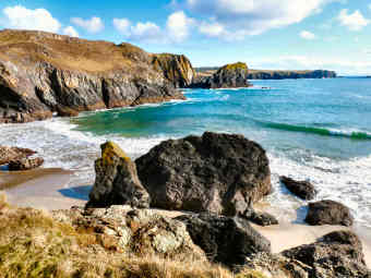 |
| Description - Route Directions - Statistics, Info, Interest |
|
Round Walk 18 - Kynance Cove and
Predannack Wollas - Route Directions
| Route with detailed GPS Data, grid refs, heights & distances --- Click here for easily printable PDF page |
| Route without GPS Data but occasional distance information --- Click here for easily printable PDF page |
Round Walk 18 - Kynance Cove and
Predannack Wollas - GPS Data
| Distance: 5.76 miles. Ascent: 800 feet, of which 350 feet inland, 450 on coast path. Highest Point: 270 feet between Kynance Farm and Predannack Wollas, inland. 250 feet on Kynance Cliff on coast path. Biggest Climb: Steepish 170 feet out of Kynance Cove. Thereafter, only one climb over 100 feet on Coast Path. Steps: Up 45. Down 70. Only flights 40 up from and down to Kynance Cove. Stiles: Only 6, of mixed types. Gates: 4. Footing: Grass, scrub and tracks to Predennack Wollas. Good footing, mostly on grass, mostly fairly level, along coast path but several streams to cross on stepping stones. Open Access: Much of the route, inland and coast, is on Open Access land and on the Lizard National Nature Reserve. Difficulty: Easy. Map: OS Explorer 103 The Lizard. |
| Parking: Large NT car park above Kynance Cove, 675 yards from beach, adds ¾ mile in all. Intermediate Parking: Predannack Wollas, NT CP at 66914/16220. Getting There: From A394 at Helston, take A3083 to beginning of Lizard Town, then signs R on lane to large car park. Refreshments: Kynance Cove NT CP snack-shack (seasonal). Kynance Cove café (seasonal). Toilets: Kynance Cove NT CP (seasonal). Kynance Cove (seasonal). Going: Grass, scrub and tracks to Predennack Wollas. Good footing, mostly on grass, mostly level along coast path. Open Access: Much of the route, inland and coast, is on Open Access land, some NT, most on Lizard National Nature Reserve. |
| Kynance Cove: See feature below. Lizard National Nature Reserve: See feature below. Predannack Wollas: See Round Walk 17 above. Gew Graze: Strange, partly man-made valley where soapstone was quarried. Soap Rock has remains of quarry buildings. Ogo Pons: Just north of Gew Graze and best seen from the ascent heading south, a rock looking as its name translates from Cornish, bridge cave. |
| Predannack Airfield: WWII night-fighter, anti-submarine and convoy support airfield, now part of RNAS Culdrose and used for glider and fire-fighting training. After WWII Barnes Wallis – of bouncing bomb fame – worked here on the development of swing-wing aircraft. Some historic aircraft can be seen parked on the airfield but what look at a distance like the wrecks of a plane and a helicopter are, in fact, mock-ups used for fire-fighting training. |
 |
This must be just about the most photographable - and photographed - spot in Cornwall, and no wonder, it's ravishing and relatively peaceful, even on my first visit, during a high season walk from Mullion to Lizard Town, on a fine Saturday in late June 2005. Kynans is Cornish for ravine and even down on the beach you still feel almost as if you are in a ravine, surrounded as you are by vast isolated rocks rising from the sand. The surrounding scenery is glorious. The cliffs to the north are part of the Lizard National Nature Nature Reserve; to the south-west thay are owned by the National Trust. The car park is out of sight on National Trust land. Down in the cove there are just a few privately owned homes and a good café where I enjoyed a cream tea. A stream tumbles down the ravine, past the cottages; just above it is an unusual seat, settle-like and apparently made from wood salvaged from a wreck. Because of the fairly steep descent from the car park, and the restricted parking space, the beach doesn't get too crowded. Sands are golden and firm but beware, at high tide there is little or no beach at all. To get to Kynance Cove, from the A394 from Falmouth to Penzance at Helston, by Culdrose air base, take A3093 for Lizard, and turn right before Lizard Town. |
|
|
Lizard National Nature Reserve |
Lizard National Nature Reserve
| Lizard National Nature
Reserve is highly unusual as nature reserves go in that it is not one clearly
defined area but a number of separate areas spread across the southern
part of the Lizard peninsula. There is no cohesive pattern but a
mix of heathland, grazing land, cliffs and beaches. Largest area
is near the strange dishes of Goonhilly Earth Station, which has an exhibition
about the reserve in its visitor centre. Goonhilly Down is open heathland,
best from June when gorse and many heaths and heathers bloom. Here
you may see adders, lizards, buzzards and owls. Next major area is
the most exciting, along the west coast from Mullion Cove to Kynance Cove,
along Mullion, Predannack and Kynance cliffs, its two parts linked by the
National Trust's Predannack Estate. Many rare wild flowers abound:
Cornish heath and bell heather, green winged and marsh orchids, short stemmed
ox-eye daisies and wild asparagus. You may see peregrine falcons,
ravens, choughs, skylarks and stonechats. Highland and other rare
cattle graze the clifftops. Smaller areas include Kennack Sands -
where there are red serpentine pebbles on the beach and basking sharks
in the sea - and Main Dale, near St. Keverne, with its heath-spotted orchids
and bog asphodel.
More information on Natural England's web site. |
 |
| Kynance Cove |
|
Round Walk 19 - Landewednack,
Cadgwith, Poltesco, St. Ruan - 6 miles
Moderate - Scenic coves, industrial history, an NT farm, farmland, holy sites.
 |
A fairly easy walk of moderate length with a great deal of interest along the way. It starts from Landewednack church and then follows the coast path through charming Cadgwith Cove, well worth lingering in, to fascinating Carleon Cove. It then turns inland up the valley of the little Poltesco River to the National Trust’s delightful Poltesco hamlet. A short section of quiet lane follows, by way of the restored Poltesco Mill and a steep climb towards the village of Ruan Minor. From there the route is almost all on field paths and tracks, taking in St. Ruan’s Well and Grade church on the way to Trethvas Farm. There is then a short but potentially very muddy farm track. Should this prove impassable, take the signed path from the farm to Cross Common and the lane back to the start. Leaving Landewednack church, you really should make a short detour to visit Landewednack Church Cove (not to be confused with Gunwallow Church Cove on the Lizard’s west coast). If you then take the coast path briefly south you will see the Lizard Lifeboat Station at the foot of a steep zawn (Cornish for chasm). The whole detour is only a few hundred yards. If you only like short walks, you could make two round walks of this one, both including Cadgwith Cove. The link to add to each walk, to make the full 6 mile walk, is the path that joins Cadgwith to St. Ruan, passing through the car park above Cadgwith. |
|
|
Oliver's Diary - Route Directions - Statistics, Info, Interest |
Round Walk 19 - Oliver's Diary
| I walked this in early January 2011. Because of lengthy travel and short days, I divided it in two. I walked to Cadgwith on the coast path and back inland, solo. With Bob I walked Cadgwith to Caerleon Cove and back inland to Cadgwith. I was particularly pleased with the results of these researches. Previously I knew Landewednack Church Cove, Cadgwith and Carleon Cove well, having visited each several times over the years. What pleased me was being able to spend time at Poltesco and discovering the odd Grade church and St. Ruan’s Well. I feel that these add to what I already know to be an interesting walk. I had chosen days of sunny intervals and was pleased to get photos of Cadgwith Cove, Poltesco and Ruan Minor in the sun, the first time I had got a good look at Poltesco and the first time I had been in Ruan Minor. I found the walk relatively easy, the coast path no more than moderate and the inland return fairly level after the steep climb up towards Ruan Minor. What I did find, though, was a very muddy farm track after Trethvas Farm. Unless your boots are fully waterproof, it might be as well to be sure of choosing a dry period for this part. All in all, I would rate this yet another excellent Lizard peninsula walk. Next on the Lizard list is a walk from Coverack. I have already done this and may not need to repeat it. |  |
| Description - Route Directions - Statistics, Info, Interest |
|
Round Walk 19 - Landewednack,
Cadgwith, Poltesco, St. Ruan - Route Directions
| Route with detailed GPS Data, grid refs, heights & distances --- Click here for easily printable PDF page |
| Route without GPS Data but occasional distance information --- Click here for easily printable PDF page |
Round Walk 19 - Landewednack,
Cadgwith, Poltesco, St. Ruan - GPSData
| Distance: 5.99 miles. Ascent: 1200 feet, of which 650 on coast path, 550 inland. Highest Point: 210 feet on coast path before Devil’s Frying Pan. 250 feet inland at St. Grade church. Biggest Climb: Moderate 200 feet out of Cadgwith, 125 feet out of Church Cove. Steep 100 feet up from Poltesco Mill. Steps: Up 59, Down 90, mostly on coast path. No long flights. Stiles: 31 of mixed types, mostly granite. Gates: 11, of which 4 kissing gates. Footing: Mostly OK on Coast Path, some slippery rock. Tracks, lanes and field paths (some muddy) inland. Difficulty: Moderate overall. Moderate to St. Ruan. Easy from there but some very muddy patches. Map: OS Explorer 103 The Lizard. |
| Parking: Small car park below Landewednack Church at 71170/12663. Intermediate Parking: Cadgwith, on hill down from St. Ruan at 71891/14790. Free NT CP at Poltesco. Donation CP by Methodist Chapel at Ruan Minor. Getting There: From A394 at Helston, take A3083 to beginning of Lizard Town, then signs L for Church Cove. Refreshments: Cadgwith, pub and cafés (one seasonal). Toilets: Lizard Town. Cadgwith. |
| Landewednack Church Cove: The Ordnance Survey just shows it as Church Cove – both the village and the Cove itself – and confusion would be easy with Gunwalloe Church Cove on the Lizard’s west coast. It consists of a few houses, a church up the hill and the former busy fishing cove below. The buildings in the cove make a delightful grouping: the old Fish Cellars, an attached Roundhouse, the former Winch House and the old Lifeboat House. It must have been difficult enough to launch cove boats from here, the lifeboat must have been almost impossible. All these buildings are now holiday or second homes. As at Gunwalloe, the church is dedicated to St. Winwaloe; note the unexpected sheep stile up from the car park. Winwaloe was also known as Wednack and the church at Towednack near St. Ives is also dedicated to him, as is that at Poundstock. Devils’s Frying Pan: Massive blow hole, just before Cadgwith, where a cave has collapsed leaving an entrance through which, at the right state of the tide, the sea can blast. Cadgwith: See feature. Carleon Cove: See feature. Poltesco: NT estate, given by Margaret Ironside in 1974 and 1990, includes Poltesco House and Farm, Carleon House, a restored mill at the bottom of the hill and ruins of another former mill, just beyond the farm. CP at farm. Poltesco Mill: Water mill, building mostly C18 and C19 including datestone F.C.A. 1786 with some early work possibly dating from C14. 17' 6" overshot hybrid (metal and timber) wheel dating from the 1870s. Ruan Minor: A church of great contrast. The massive 15th century single-stage tower is built of serpentine blocks. In comparison the nave and aisle are tiny. Inside is a small Norman font with zig-zag carving. St. Ruan’s Well: The well house is just over the hedge from the road from St. Ruan to Grade. St. Ruan (or Rumon, there are several other spellings) is both credited with driving wolves from Cornwall and believed by some himself to have been a werewolf. Grade Church: An oddity. The small church stands on a level raised platform, surrounded by hedge and ditch, so may be on older site. Sadly, in 1862 all but the tower (of serpentine blocks) was torn down and replaced by an un-Cornish building, plain and ugly inside. All that is of interest is a 13th century font and a brass of 1522 to landowner James Erisey. |
 |
One of the most popular villages on the Lizard - along with Coverack, which I don't much like, and Mullion, which I do (my favourite is St. Keverne) - pretty Cadgwith is tucked away on the east coast between Lizard Town and Coverack. Since 2011 it has been better known than before thanks to Monty Halls Fisherman's Apprentice TV programme. There are two roads down; the car park is on the western of the two and seems a long way from the cove but there is a fairly short footpath down. Down by the cove there are pretty thatched and whitewashed cottages; one stands on the Todden, a small point overlooking the harbour. Old net lofts and pilchard cellars are now shops, a tea shop and restaurant. The Cadgwith Cove Inn has folk music on Tuesday night, traditional Cornish singing on Friday. Cadgwith has the largest fishing fleet on the Lizard, inshore boats no longer after the pilchards but now seeking crab, lobster, mackerel, mullet, sea bass and shark. They are quite a sight drawn up on the beach. A mile north on the coast path is Carleon Cove where part of the old serpentine works still stands. A few hundred yards south is the Devil's Frying Pan, a massive blow hole formed when a large cave collapsed. It's worth trying to catch the sea at the right state of the tide to appreciate the impressive effect. |
|
|
Carleon Cove and Serpentine |
| The beach here has massive sea-rounded stones and remains of two former industries. There was once a flourishing pilchard fishery. After 1846 the buildings were added to and operated as a serpentine factory. A warehouse and capstan house still stand complete and remains of several other buildings survive. Serpentine: To give it its full geological name, serpentinised mantle peridodites is found nowhere else in England. It really shouldn't be here at all as it's part of the earth's mantle and should be some 10 miles below the surface. Serpentine once provided a major Cornish industry and still flourishes on a small scale. It was a visit to Cornwall in 1846 by Queen Victoria and Prince Albert that started the craze for Serpentine. The dark green rock, with its blue and red veins, polishes like marble to a wonderful deep sheen. It was much used for architectural and outside decorative features and for monumental masonry. Sadly, it does not weather well and those uses have died out. However, it is still worked for small decorative objects. A favourite is the miniature lighthouse, stocked by half the shops in Lizard Town. The beach is covered with massive rounded rocks, presumably sea-washed industrial waste. Even the cliffs show evidence of serpentine quarrying. Carleon Cove is a rocky, charming and tranquil cove accessible only from Poltesco or from the coast path. |  |
| Cadgwith |
|
Round Walk 20 - Coverack,
Porthoustock, St. Keverne, Coverack - 8 miles
Easy walk.
Quarries along the coast. Wooded valley to St. Keverne. Farmland
downhill back.
Combine Round Walks 20 and 21 for a round walk of 10.16 miles - see
route directions
 |
This is an easier walk than you might expect. The coastal leg harbours none of the usual climbs, the two inland ascents are both moderate and the final leg, from St. Keverne back to Coverack, is almost all downhill. The walk is 7.84 miles but, if you are not interested in Coverack itself, you could reduce that to about 7 miles by using the donation car park on the way into the village. Those who would like a longer walk should consider combining the first two legs of this walk with the first two legs of the next one, Round Walk 21, which starts from Porthoustock and goes to St. Keverne by way of Porthallow, for a total distance of 10.16 miles. The first 0.78 miles of this Round Walk 20 is on road or tarmac lane. Thereafter, the first leg is very easy by coast path standards but, as far as Lowland Point, footing can be awkward over mud and stepping stones. There is better footing through Dean Quarry to Godrevy Cove. The second leg, to Porthoustock, despite being waymarked as coast path, is inland, avoiding working quarries on the coast. The third leg, on to St. Keverne, is up a mostly wooded valley, an easy climb to 295 feet. The final leg is an easy descent through pasture land back down to Coverack. Views don’t really begin until you reach Lowland Point, then you see the vast sweep of coast east to Rame Head and Devon. |
|
|
Oliver's Diary - Route Directions - Statistics, Info, Interest |
Round Walk 20 - Coverack, Porthoustock,
St. Keverne, Coverack - Oliver's Diary
| I have walked this way many times. First with Jane, when she could still cope with the coast path. Later with both sisters and then again, researching for this walk, in February 2010, followed by a March 2010 coast path walk with Bob and Pam, the latter as part of my Cornish Coast Path project. I particularly enjoy this one. The coastal leg is an easy one (in my mid-70s the Coast Path gets steadily still more demanding); then, while I don’t much like Coverack, I am enchanted by the unusual fishing cove and quarry terminal at charming little Porthoustock. Finally because I love St. Keverne, for its history and because it one of the few villages that still feels like a real one. I have also done the longer version of this round walk, the version which continues along the coast to Porthallow (yes, I do mean along the coast, see Round Walk 21) before turning inland to St. Keverne. There’s yet another reason, too, and that’s the fact that the final 2½ mile leg is downhill almost all the way. I have to confess that, when I do this walk, I prefer the slighter shorter 7 mile route, starting from the donation car park on the north side of Coverack. Since I first did the walk, one thing has changed a bit. When I first passed this way, Dean Quarry was still producing gabbro, now it has shut and machinery and many buildings have gone, leaving it a sad place after its former atmosphere of activity. |  |
| Description - Route Directions - Statistics, Info & Interest |
|
| UPDATE JULY 2015:
Dean Quarry. News is that the quarry will re-open in 2016 to
provide gabbro stone for a massive breakwater at Swansea. While locals
will probably welcome the jobs this will create, there is a vocal environmental
movement which is strongly protesting about the possible effect on the
marine environment off Dean Quarry. Falmouth Packet article July 2019 |
Round Walk 20 - Coverack, Porthoustock,
St. Keverne, Coverack - RouteDirections
| Route with
detailed GPS Data, grid refs, heights & distances --- Click
here for easily printable PDF page
Please note that these directions contain only 6 figure grid refs. I hope to walk this again and upgrade to 10 figure grid refs later. |
| Route without GPS Data but occasional distance information --- Click here for easily printable PDF page |
| Combine Round Walks
20 and 21: Walk 20 to Porthoustock 4.15 miles. Continue
with Walk 21 to Porthallow 1.65 miles. Continue with Walk 21 to St.
Keverne 1.76 miles. Finish with Walk 20 St. Keverne to Coverack 2.60
miles. Total round walk 10.16 miles. |
Round Walk 20 - Coverack, Porthoustock,
St. Keverne, Coverack - GPS Data
| Distance: 7.84 miles. Ascent: 1100 feet, of which only 400 feet on coast. Highest Point: 330 feet approaching Trevalsoe, inland. Biggest climb: Easy 225 feet up to St. Keverne. Easy 220 feet from Godrevy Cove up to Rosenithon. Steps: Up 31. Down 26. No flights. Stiles: 38, mostly stone stiles of mixed types. Gates: 9, mostly kissing gates. Footing: Coast path to Lowland Point a bit rocky, also wet and muddy but with stepping stones. Good elsewhere. Difficulty: Overall fairly easy. The two long climbs are no more than moderate. Map: OS Explorer 103 The Lizard. |
| Parking: Coverack, donation parking beyond Paris Hotel, street parking free ex summer, donation car park at ½ mile. Intermediate Parking: Porthoustock, on beach. St. Keverne, in square. Getting there: From A394 at Helston, take A3083 Lizard to end of airfield, L B3293 then R B3294 Coverack. Refreshments: Coverack, Paris Hotel, Harbour Lights and Waves cafés (seasonal), Old Lifeboat House restaurant. St. Keverne, Three Tuns and White Hart pubs. Toilets: Coverack, near harbour and above donation car park ½ mile (seasonal). St. Keverne. |
| Coverack: Loved
by holiday makers for its family-friendly beach - even though the beach
is more rock than sand, even at low tide. There is a fair amount
of wind-surfing in the sheltered bay - and there are several attractive
thatched cottages. The village's one serious claim to fame was its
lifeboat. Over the centuries Coverack's lifeboats saved numerous
lives, many from ships wrecked on the dreaded Manacles reef. In 1898
the Mohegan was wrecked there with the loss of 106 lives, their grave is
in St. Keverne churchyard. The following year the American liner
Paris went aground on Dolor Point but no lives were lost. The village's
pleasant pub, the Paris Hotel, commemorates the occasion. There is
no longer a lifeboat in Coverack and the former lifeboat station is now
a restaurant. Harbour Lights café is open all year.
Dean Quarry: The coast path skirts the site, following the
line of the cliffs. Greenstone and gabbro were quarried here.
Closed in the early 21st century, the machinery and many of the buildings
have now gone. But note above, re-opening threatens in 2016.
Other Quarries: West of England Quarry, on Manacle point
just before Porthoustock is still very active, producing gabbro primarily
for roadstone. The quarry can be seen from Porthoustock beach and
you may see freighters loading at the quay on the south side of the beach.
St. Keverne Quarry, north of Porthoustock is closed and you can walk through
it. Porthoustock: See feature. St. Keverne: See feature. |
 |
Jane and I were fascinated by Porthoustock when we visited a few years ago. Now I have been back I am even more taken with the place. I was there in November 2005 in the course of a walk that took in St. Keverne, Porthoustock, Porthkerris and Porthallow. While on Porthoustock beach I had a long chat with retired fisherman Roy Curnow and learned a lot about the locality. Four miles of coast here is riddled with stone quarries and it is they which have determined the character of Porthoustock, Porthkerris and Porthallow. Their beaches have been formed by longshore drift of dark quarry spoil; that at Porthoustock rose gradually by eight feet when a massive groyne was built with a stone hopper on it to load ships. Former winch huts are now used for storage, a tractor draws boats up the beach. An earth mover maintains the height of the beach. Most cottages were once quarrymens homes; some are still lived in by descendants who make a small living from the sea but most are now second homes. There is a lovely thatched terrace just up the valley. West of England quarry still operates but St. Keverne quarry closed in 1958. Until the 1970s two cotils, small steep south facing fields, were used to grow early potatoes, harvested in March or April. Porthallow, on Round Walk 21, is now also largely second home territory. |
|
|
St. Keverne |
| One of the most attractive villages on the Lizard peninsula, St. Keverne is worth lingering in for its history, its church and its pubs. I had passed through the village on several occasions on the way to walks but in November 2005 I parked there for a walk to Porthoustock and Porthallow and had time to explore after. Unlike some Cornish villages, St. Keverne still has the feeling of a real place with a life of its own - to the extent that it can boast a Silver Band and Male Voice Choir and Ox Roast, Carnival and Rodeo festivals. A mere eleven miles from the supermarkets of Helston, it has happily managed to retain some shops. St. Keverne's main historic claim to fame goes back to 1497. The Cornish had expected that Welsh Henry VII, who claimed the English throne in 1485, would treat his fellow Celts well and at first he did. Then heavy taxes were imposed to support Henry's Scottish wars, a matter the Cornish felt no concern of theirs. A Cornish force, led by Lord Audley, Michael Joseph the St. Keverne blacksmith ( An Gov) and Thomas Flamank, a Bodmin lawyer, marched on London to be routed by Henry's army at Blackheath. Joseph and Flamank were cruelly executed. Their memorial is by the lych gate, their statue up the Helston road. Of the two pubs I like the Three Tuns, where I have been made welcome by landlord and locals and have enjoyed several lunches. |  |
| Porthoustock |
|
Round Walk 21
Porthoustock,
Porthkerris, Porthallow, St. Keverne - 4.56 miles
An unofficial route along the
coast to Porthallow.
Woods and farms up to St. Keverne and down to
Porthoustock.
Option
to combine Round Walks 20 and 21 for a round walk of 10.16 miles - see
route directions
 |
There are two purposes to this walk. The first is to provide a longer alternative to Round Walk 20, making a total walk of 10.16 miles, instead of 7.84, and adding some more coast to Porthallow. The second is to show that there is no need to take the inland official Coast Path route, much of it on road, between Porthoustock and Porthallow. Instead, you can use a route well used by locals that hugs the coast to Porthkerris and stays close to it on to Porthallow. The walk starts by the entrance to the beach at Porthoustock and follows a track up through the defunct St. Keverne Quarries. There is then one awkward bit, but with an easy alternative, before descending to Porthkerris, a major diving centre. You leave Porthkerris on a tarmac lane but soon head off through woodland and fields to pick up a path, shown on OS103, down to Porthallow. From there it’s up a wooded valley and through farmland to charming St. Keverne, worth lingering in. Finally, it’s all downhill, down another wooded valley back to Porthoustock. At little over 4½ miles, this is only a very short walk but the interest in the three villages is sufficient to justify at least a half day. Please note, however, that, although the route from Porthoustock to Porthallow is a well used one and is mostly on permissive paths, it is an unofficial one and most, not being definitive rights of way, are not shown on maps. |
|
|
Oliver's Diary - Route Directions - Statistics, Info, Interest |
Round Walk 21 - Porthoustock,
Porthkerris, Porthallow, St. Keverne - Oliver's Diary
| On several occasions, when visiting Porthoustock, Porthkerris and Porthallow, I spotted people variously heading up towards the former St. Keverne Quarries from Porthoustock, heading down a steep incline into Porthkerris and setting off up a wooded path from the southern end of Porthallow beach. I had always wanted to find a way that avoided the Coast Path’s official route between Porthoustock and Porthallow, so I took a look at Cornwall’s Council’s mapping web site. It shows tracks, former quarry tramways, almost joined, between Porthoustock and Porthallow. Beyond Porthkerris, it shows a track leading from the lane to a path, shown on OS 103, down through woodland to Porthallow. So, on a sunny March 2010 day, I parked in Porthoustock and set off to find my coastal route. I found it! In fact I found three possibilities. My own preferred route includes a slightly precipitous section soon after the Porthoustock tramway ends. I shouldn’t recommend this to everyone, so I describe a totally safe, very slightly inland, way in the Route Directions. I also describe alternatives for high spring tide times and for cattle avoidance. When I re-checked the route in January 2011 a sign on a gate near Porthoustock now actually said permissive access and the route from the lane up from Porthkerris had recently been cleared when I walked it in March 2010. I am now sure that my route is on official and permissive paths. |  |
| Description - Route Directions - Statistics, Info, Interest |
|
Round Walk 21 - Porthoustock,
Porthkerris, Porthallow, St. Keverne - Route Directions
| Route with
detailed GPS Data, grid refs, heights & distances --- Click
here for easily printable PDF page
These directions contain some 6 figure grid refs. I hope to walk this again to check directions and upgrade to 10 figure grid refs later |
| Route without GPS Data but occasional distance information --- Click here for easily printable PDF page |
| Combine Round Walks 20 and 21: Walk 20 to Porthoustock 4.15 miles. Continue with Walk 21 to to Porthallow 1.65 miles. Continue with Walk 21 to St. Keverne 1.76 miles. Finish with Walk 20 St. Keverne to Coverack 2.60 miles. Total round walk 10.16 miles. |
Round Walk 21 - Porthoustock,
Porthkerris, Porthallow, St. Keverne - GPS Data
| Distance: 4.56 miles Ascent: 1400 feet, of which only 430 feet on coast. Highest Point: Inland, 330 feet soon after St. Keverne. Coast, 235 feet after Porthkerris. Biggest climb: Easy 160 feet up from Porthoustock. Fairly stiff 220 feet up from Porthkerris. Easy 330 feet, in two stages, up to St. Keverne. Steps: Up 15. Down 58, includes 51 down to Porthallow. Stiles: 19, mostly stone stiles of mixed types. Gates: 8, includes 4 kissing gates. Footing: Some muddy and awkward before Porthkerris on the alternative route. Generally good from there. Difficulty: Overall moderate. The two long climbs are not difficult, one mostly on tracks, the other on lane. Map: OS Explorer 103 The Lizard. |
| Parking: Porthoustock, donation parking on beach. Intermediate Parking: Porthkerris, pay & display. Porthallow, donation parking on beach. St. Keverne, in square or just up Porthoustock road. Getting there: From A394 at Helston, take A3083 Lizard to end of airfield, L B3293 to St. Keverne, straight on for Porthoustock. Refreshments: Porthkerris, seasonal snack wagon. Porthallow, Five Pilchards pub and seasonal beach café. St. Keverne, Three Tuns and White Hart pubs. Toilets: Porthoustock, by road. Porthkerris (seasonal). Porthallow. St. Keverne. |
| Porthoustock: See feature in Round Walk 20. The Manacles and Porthkerris: Over the centuries a multitude of ships have foundered on the Manacles reef. As many as four hundred victims are buried in St. Keverne churchyard. Manacles sounds an odd name but the explanation is simple. The tower of St. Keverne church is used as a daymark for vessels needing to avoid the rocks, hence the spire, unusual for Cornwall. The Cornish for the reef is Maen Eglwys, meaning church rock. Major shipwrecks here include the John bound for Canada in 1855; 190 out of 233 died because of the captain’s incompetence and the crew’s cowardice. In 1898 the Mohegan hit the Manacles with the loss of 106 lives. In 1809 the Primrose and the Dispatch both went down with 250 lives lost. The reef is popular with divers and Porthkerris, 1½ miles from the Manacles, is home to Porthkerris Land and Sea Sports and to Porthkerris Divers. The latter provides dive tuition, equipment sales and hire, and diving, both shore diving around the cove and wreck diving out at the Manacles. Dive Action of St. Keverne also offers tuition, kit hire and sales. Both can arrange accommodation. Porthallow: Another attractive fishing and pleasure boat cove. A larger village than Porthoustock but around half the cottages are second or holiday homes so there is not much sense of community except at weekends and in summer. Shops have closed and the hours of the Five Pilchards Inn are uncertain. A massive stone plaque on the beach (donation parking) records that this is the halfway point on the full South West Coast Path from Minehead to Poole. Toilets all year. St. Keverne: See feature in Round Walk 20. |
Round Walk 22 - Helford village,
St. Anthony-in-Meneage, Manaccan, Frenchman's Creek, Helford village - 6.40 miles
Coastal
woodland, charming villages, farmland and a creekside walk
 |
Very much a walk of three parts, with a great deal of woodland and of water along the way. It is probably best done in a dry period in early spring when trees are newly in leaf and wildflowers are blooming. In winter the woodland can seem a little bleak and can be very muddy in places. The first leg, from Helford to St. Anthony-in-Meneage, is almost entirely in woodland for its first 1¼ miles or so, with no more than tantalising glimpses of Helford Passage and Durgan across the river, but happily opens out after that. The detour out to Dennis Head is recommended for views over Falmouth Bay and on to St. Mawes and Nare Head. It is then open again down to St. Anthony with good views over Gillan Creek. On the second leg, the mile to Carne is on a quiet lane, mostly in woodland with the creek to your left. There is a mix of woodland and field paths between Carne and Frenchmans Creek. Woodland continues all the way along Frenchmans Creek but with good creek views, best at high tide. The final 1¾ miles from there to Helford village is mostly on tracks and lanes, often with lovely views, the best looking back up the Helford River and across to Porth Navas Creek. Helford village is worth exploring, as is Manaccan, and St. Anthony-in Meneage and Carne are charming spots, so there is a fair amount of interest along the way. |
|
|
Oliver's Diary - Route Directions - Statistics, Info, Interest |
Round Walk 22 - Helford, St. Anthony-in-Meneage,
Manaccan, Frenchman's Creek - Oliver's Diary
| I first did this walk in 2003 with my sisters Mary and Frances and Frances's friend Victor. I wrote a report then and see that, despite a dull day, I then enthused about the walk. It must have been the company because, when I returned in March 2007 for photos, I was much less impressed. Then all I really enjoyed - apart from seven miles of exercise - were the village of St. Anthony-in-Meneage, nearby Carne hamlet, lunch at the good value New Inn in Manaccan and the mystery of Frenchman's Creek. I felt that far too much of the walk was in woodland with, even before trees were in leaf, little more than glimpses of the Helford River and Gillan Creek. I include this walk, done in February 2011 with Bob and Pam, largely because I know people love the Helford River and because, in springtime there will be plenty of colour in the woods of the Bosahan estate. At different times you will see snowdrops, daffodils, wild garlic, bluebells and, escaped from Bosahan’s Garden, bamboo, rhodos and hydrangeas. St. Anthony is best seen once the second homers arrive and start to take their boats out. Manaccan’s church is well worth investigating. And, when you come to Frenchmans Creek, do make the short detour south to see the Landmark Trust’s Frenchmans Pill. Helford village itself always disappoints me; except in summer, all the empty second homes make it seem abandoned. |  |
| Description - Route Directions - Statistics, Info, Interest |
|
Round Walk 22 - Helford, St. Anthony-in-Meneage,
Manaccan, Frenchman's Creek - Directions
| Route with detailed GPS Data, grid refs, heights & distances --- Click here for easily printable PDF page |
| Route without GPS Data but occasional distance information --- Click here for easily printable PDF page |
| Distance: 6.40 miles. With Dennis Head view detour 6.67 miles. Ascent: (Figures unreliable, as so much in woodland) 1400 feet, of which 850 feet inland. Highest Point: 140 feet, leaving Padgagarrack Woods, on Coast Path. 180 feet after Frenchman’s Creek on inland leg.. Biggest Climb: 140 feet, leaving Padgagarrack Woods on Coast Path. 165 feet up from Frenchmans Creek on inland leg. Steps: Up 72. Down 81. No flights to speak of. Stiles: 19, mostly granite cattle stiles, almost all on inland leg. Gates: 12, mostly kissing gates. Footing: Coast path to Dennis Head rocky in places, many tree roots, can be very muddy in winter. Quiet lane from St. Anthony to Carne. Can be muddy in woodland to Kestle and along Frenchmans Creek. Good lanes and tracks from there to Helford. Map: OS 103 The Lizard. |
Round Walk 22 - Useful Information
| Parking: Large CP above village at 75910/26079, reasonably priced. Intermediate Parking: St. Athony-in-Meneage, Manaccan. Getting there: From A394 Helston by-pass, take A3083 (Lizard) to roundabout at end of Culdrose Airfield. L B3293 (St. Keverne) to next roundabout. 2nd exit and follow Helford signs on narrow lanes, through Mawgan and St. Martin. Refreshments: Helford, seasonal tea garden in car park, Shipwrights Arms down by water. Manaccan, New Inn down hill and South Café up hill. Toilets: Helford, in Car Park. May be in Manaccan. |
| Helford Village: Ten miles from Helston, by narrow lanes, Helford is an awkward place to live unless you are a boat-owning second home owner, which much of Helford's population is. If you are a small-boat owner it's an ideal place with a boat club, pontoon and river anchorages and sheltered waters. Disadvantage is that you can't get much benefit from village anchorages as the tide leaves them high and dry for half the day. Relations between second-homers and the local fishermen are not good, the former opposing the latter’s plans for a new small quay to land their catch. Bosahan Estate: Most of the way from Helford to Dennis Head, you are in the woodland of the Bosahan estate. The garden opens to the public late March to early September M-F. It features tender plants from both hemispheres with rhododendrons, azaleas, magnolias, southern hemisphere trees and shrubs, palms, Maidenhair trees and a meandering stream. The mansion was built by the Grylls family in the early 19th Century. Early planting was by Arthur Pendarves Vivian, who took over the estate in 1885. Near Constantine are Bosahan Granite Quarry and Bosahan Farm, home of the Bosahan British Simmental herd. Dennis Head: The headland takes its name from the promontory fort (Dinas) which is now impossible to identify. Well worth the detour for the views over Falmouth Bay and on to St. Mawes and Nare Head and, on a clear day, all along the south coast. St. Anthony-in-Meneage: (Meneage probably means Monk's land) is second-home territory for small boat people. Gillan Creek pretty well dries up at low tide so there is little anchorage; instead boats are pulled up on the hard. Next to the church is Lantinning Farm so Anthony may well be a corruption of Intenyn, perhaps the founder of the original small monastic settlement here. There are traces of the Norman period in the church but it was largely rebuilt in the 15th century. Inside are rood stairs, a nicely carved 15th century font, a 15th century German carving of the Last Supper, carved bosses on the wagon roof and a holy water stoup in the porch. Outside is a much degraded Cornish cross and, in the graveyard extension, a tiny stone well-housing. Manaccan: The name is probably derived not from a saint but from the Cornish for (church) of the monks. It was also at times called Minster in English because it may once have had a Celtic monastery. "St Manacca" is recorded as the patron as early as 1308. The present church is dedicated to St Mannacus and St. Dunstan. There was a Norman church here and fragments of it remain; the doorway is one of the best specimens of Norman entrances in Cornwall. The rest of the structure is of the 13th and 15th centuries. The west tower is built of slate. The church is well-known for a large and flourishing fig-tree which grows out of the western part of the south wall and has been there for at least 250 years. Kestle Barton: The 16th century farmhouse is most attractive. Some of the listed barns have been restored to provide holiday accommodation and an exhibition space for art, performance and workshops. Frenchmans Creek: The National Trust owns the land on the east bank of Frenchman's Creek but Landmark Trust seems to own, and presumably rent out, the cottage in the woods at Frenchman's Pill. This is a secretive feeling place where trees grow right down to (and in) the creek and where dead trees litter the banks and rot in the mud. At low tide there is little water in the creek, at high tide the water is eerily still. An atmospheric place. |
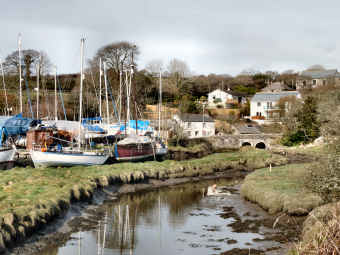 |
It is marked on the map as the Helford River, and that's what everyone calls it, but really it is just a ria, a drowned valley. A few unimpressive nameless streams debouch into it in the course of its six miles from the sea to the tidal limit at Gweek; the longest, of about three miles, looks to rise just to the east of Helston. More striking are the many creeks that these streams enter the Helford River by. Best known is the sombre Frenchman's Creek, made famous by Daphne Du Maurier in her novel of that name. Most attractive is Porth Navas Creek, filled with small boats, lined with expensive second homes and location of the Duchy Oyster Fishery. Helford village, too, is second home and boating territory. Gweek, at the tidal limit, has a boatyard, houseboats and an engineering works - and is home to the renowned Cornish Seal Sanctuary. The best way to enjoy the Helford River is undoubtedly from a small boat. As a walker, it saddens me that there is so little foot access - really only one bank of Frenchman's Creek and the coast path as far as Helford Passage on the north bank, Helford Village on the south. The two are linked by a summer ferry and each has a pub, the Shipwright's in Helford, the recently much improved Ferryboat in Helford Passage. On the north bank several valley gardens run down to the river - Glendurgan, Trebah, Meudon Hotel's garden and Carwinion. Our favourite of these is Trebah. |
|
|
Round Walk 23 -
Roseland 1 - Porth Farm, St. Anthony Head, Place
- 6 mls
Easy coast walking.
Woodland, Percuil River, woodland back to Porth Farm.
Combines
with Round Walk 24 to make a walk of just under 11½ miles.
 |
This is the first of two linked walks on the Roseland Peninsula. Both start at Porth Farm, on the road to St. Anthony Head. Both are easy. So, if you prefer a longer walk, you can finish this one and immediately continue with the second, which includes Gerrans and Portscatho, to make a moderate round walk of almost 11½ miles. The first 2½ miles of this walk is on the Coast Path to St. Anthony Head. The next 2 miles are still on the Coast Path but not along the sea, rather along Carrick Roads, Falmouth’s outer harbour, to Place Quay. Here the Coast Path continues by taking the little ferry across to St. Mawes and the main ferry to Falmouth. You continue, now mostly in woods, along the Percuil River and Porth Creek to return to Porth Farm. While it is an easy walk, going on the Coast Path can occasionally be muddy, but easily avoidable. In the woods after Place Quay, the lack of sunlight can mean that, particularly in winter going can be somewhat sticky and occasionally rather slippery. Views along the coast, though not especially long, are delightful. Forward you look across Falmouth Bay to Rosemullion Head. The best views are back over Gerrans Bay to Nare Head, Gull Rock and the Dodman. After Place, there are only occasional views as the woods have been allowed to grow, obscuring views. Best views here are of Percuil, Trewince Quay and Froe. |
|
|
Oliver's Diary - Route Directions - Statistics, Info, Interest |
Round Walk 23 -
Roseland 1 - Porth Farm, St. Anthony Head, Place - Oliver's Diary
| I have known the Roseland, that delightful area below St. Just-in Roseland and Portscatho for almost 60 years. The name Roseland is most often used to describe a larger area, stretching as far as Veryan, but this is no more than an estate agent’s device. It is an area I have often walked, mostly while Jane visits friends in Portscatho, but never doing proper round walks. So it was a pleasure, in January 2011, to do the first of my two proposed Roseland round walks. I have walked between Portscatho and St. Anthony Head many times and I must confess that, unlike my round walk, the best way to do this is really in the reverse direction; thus one of the south coast’s finest views occurs, looking across Gerrans Bay to Nare Head, Gull Rock and the Dodman. So on this occasion, I looked back often. It has been a wet January so far, to the extent that the coast path, usually quite dry here, was muddier than I have known it. The rain had had quite an effect, too, on the woodland from Place onwards. Rotting leaves and mud made the going quite slippery in places. Yet winter can be the best time for this section; then you get glimpses of the lovely views across to Percuil and Trewince Quay, and along Porth Creek to Froe. I am now looking forward to my second Roseland walk, again from Porth Farm, taking in Percuil and Porthscatho. |  |
| Description - Route Directions - Statistics, Info, Interest |
|
Round Walk 23 - Roseland 1 - Porth
Farm, St. Anthony Head, Place - Route Directions
| Route with detailed GPS Data, grid refs, heights & distances --- Click here for easily printable PDF page |
| Route without GPS Data but occasional distance information --- Click here for easily printable PDF page |
| Combine Round Walks 23 and 24: Both walks start and finish at Porth Farm so, to make a figure-of-eight walk, finish one, start the next. |
Round Walk 23 - Roseland 1 - Porth
Farm, St. Anthony Head, Place - GPS Data
| Distance: 6.00 miles. Ascent: 1150 feet, of which 420 feet on coast path. Highest Point: 210 feet, shortly before St. Anthony Head, on Coast Path. Biggest Climb: 130 feet on coast path, approaching Zone Point. No other climbs over 100 feet. Steps: Up 10. Down 56. No flights to speak of. Stiles: 3 only. Gates: 14, mostly inland. Footing: Very good, mostly on grass, on Coast Path. After Place, it can be sticky and slippery in the woods, particularly in winter. Difficulty: Easy. Map: OS Explorer 105 Falmouth and Mevagissey. |
| Parking: NT upper and lower CPs at
Porth Farm, upper at 86762/32921. Intermediate Parking:
Narrow lay-by near Bohortha above Porthbeor Beach at 86156/32125.
St. Anthony Head at 84765/31303. No parking at Place.
Getting There: From A3078 Tregony to St. Mawes, L signed Gerrans, then continue on narrow road just under 2 miles. Refreshments: Nearest Portscatho, Plume pub and seasonal tea shop. Gerrans, Royal Standard Inn and seasonal tea rooms. Toilets: Porth Farm. St. Anthony Head. |
| Porth Farm: Now owned by the National Trust, the farmhouse, a holiday let, is a delightful traditional stone building. Across the road is an unusual small yard with one stable, a cart entrance and toilets. Wreck Post: Above Towan Beach, a delightful sandy beach, stands a wooden post at 86898/32750. This was formerly used to fire a line to practise a breeches buoy rescue. St. Anthony Head: Recently revealed on St. Anthony Head are its late 19th century defences, an artillery fort to protect Falmouth harbour in conjunction with the castles at St. Mawes and Pendennis at Falmouth. It is worth your while to spend some time here, walking out to the Gun Emplacements and the Observation Post. The Officers Quarters up on the Head are now holiday rentals as are the keepers' cottages at St. Anthony lighthouse. Place: Place has an interesting history. Its present owners call it 'Place House', tautologous as Place (Cornish plâs) means 'palace' or 'big house'. The taller of two spires is of the church, with likely origins in the 7th century. It was rebuilt in the 13th century and became the focus of a small priory. Place itself incorporates part of the priory. After Henry VIII closed the monasteries it became the home of the Spry family, notable for its admirals whose memorials are in the church. Froe Tide Mill: Originally part of the Place estate of the Sprys, Froe house stands on a small eminence above the tidal limit of Porth Creek. There were once three tide mills on the Roseland. Only the ruined dam stands at Gerrans Mill on Polingey Creek. The mill at Place was demolished and the mill pool is now the front lawn. However the mill at Froe remains more or less complete and is clearly visible from the road. |
Round Walk 24 -
Roseland 2 - Porth Farm, Percuil, Portscatho
- 5.35 miles
Quiet road and
farmland to Percuil. Woods, river and valley to Portscatho.
Coast Path back.
 |
This is the second of two linked walks on the Roseland Peninsula. Both start at Porth Farm, on the road to St. Anthony Head. Both are easy. So, if you prefer a longer walk, you can finish this one and immediately continue with Round Walk 23, which includes St. Anthony Head and Place, to make a moderate round walk of almost 11½ miles. Starting from Porth Farm, there is a short woodland path to the road before Froe. The 1050 yards on road from there includes a steep climb up to Trewince. Between there and Pelyn Creek there is a fairly steep descent in woodland with awkward footing, followed by an easy section to Percuil. From Percuil to Gerrans the route is mostly through woodland on paths which can get very muddy and slippery in bad weather. A tarmac path and a short stretch of road then take you to the harbour at Portscatho. The final 2 mile leg back to Porth Farm is on very easy coast path, nowhere rising to more than 120 feet. Although this coastal section can also get muddy in bad weather, the mud is mostly easily avoidable as you are in grassy fields. On the inland legs you are mostly in woodland with delightful intermittent views over river and creeks. On the coastal leg views forward are short. Views back, however, should not be missed, over Gerrans Bay to Nare Head, Gull Rock and the often threatening-looking Dodman. |
|
|
Oliver's Diary - Route Directions - Statistics, Info, Interest |
Round Walk 24 - Roseland 2 - Porth
Farm, Percuil, Portscatho
Oliver's Diary
| I have known the Roseland, that delightful area below St. Just-in Roseland and Portscatho for almost 60 years. The name Roseland is often used to describe a larger area, stretching as far as Veryan, but this is no more than an estate agent’s device. It is an area I have often walked, mostly while Jane visits friends in Portscatho, but never doing proper round walks. So it was a pleasure, in January 2011, to do the second of my two linked Roseland round walks. Although I know the coastal leg of this walk well, having walked it many times, I had only once previously done the route from Porth Farm to Portscatho. It is difficult to balance what time of year is best for these two walks. In winter, the river and creek views are better but lack the activity on the water. However, in the middle of a very wet January 2010, I found the going very muddy and slippery. In summer, the views may be less but the paths should be drier and the woodland is a summer delight. Perhaps a dry spring or autumn would be the best bet. I found Porth Farm, now the National Trust has removed the ugly caravan site, delightful, as I did Froe. The latter’s tidal mill remains happily almost intact; more on this in the Interest section. All in all, despite the January mud, I have enjoyed both of these walks. |  |
| Description - Route Directions - Statistics, Info, Interest |
|
Round Walk 24 - Roseland 2 - Porth
Farm, Percuil, Portscatho - Directions
| Route with detailed GPS Data, grid refs, heights & distances --- Click here for easily printable PDF page |
| Route without GPS Data but occasional distance information --- Click here for easily printable PDF page |
| Combine Round Walks 24 and 23: Both walks start and finish at Porth Farm so, to make a figure-of-eight walk, finish one, start the next. |
Round Walk 24 - Roseland 2 - Porth
Farm, Percuil, Portscatho - GPS Data
| Distance: 5.35 miles. Ascent: 900 feet, of which only 250 feet on coast path. Highest Point: 180 feet at Trewince Farm inland. 185 feet at Churchtown Road in Gerrans. A mere 160 feet on Coast Path. Biggest Climb: 170 feet from Porth Creek up to Trewince Farm. 135 up Well Lane to Gerrans. 120 feet on Coast Path, shortly before Greeb Point. Steps: Up 10. Down 56. No flights to speak of. Stiles: 7, mostly wooden. Gates: 15, mostly inland, several kissing gates include one very tight one near Percuil River. Footing: Some awkward footing down from Trewince. After Percuil, it can be very sticky and slippery in woods. Very good, mostly on grass, on Coast Path. Difficulty: Fairly easy. Map: OS Explorer 105 Falmouth and Mevagissey. |
Round Walk 24 - Useful Information
| Parking: NT upper CP at Porth Farm at 86762/32921. Intermediate Parking: Percuil. Gerrans, Treloan Lane, behind Royal Standard. Portscatho, Coast Path E of village. Getting There: From A3078 Tregony to St. Mawes, L to Gerrans, continue through on narrow road for just under 2 miles. Refreshments: Portscatho, Plume pub and seasonal tea shop. Gerrans, Royal Standard Inn and tea rooms. Toilets: Porth Farm. Perrcuil, in car park. |
| Porth Farm: Now owned by the National Trust, the farmhouse, a holiday let, is a delightful traditional stone building. Across the road is an unusual small yard with one stable, a cart entrance and toilets. Froe Tide Mill: Originally part of the Place estate of the Sprys, Froe house stands on a small eminence above the tidal limit of Porth Creek. There were once three tide mills on the Roseland. Only the ruined dam stands at Gerrans Mill on Polingey Creek. The mill at Place was demolished and the mill pool is now the front lawn. However the mill at Froe remains more or less complete and is clearly visible from the road. Portscatho: There are really two villages, joined by time. Portscatho is the harbour village. Above, up a steep hill, is Gerrans, where the church and the Victory pub are, originally just straggling along the road to St. Anthony Head. The name Gerrans derives from a 6th century king, Geraint of Dumnonia, whose fort, known as Dingerein, now mapped as Ringarounds, lies to the south-west of Veryan. Legend has it that he is buried in the massive barrow on Carne Beacon but the period is wrong by a thousand years and more. Activity has largely migrated down the hill from Gerrans to Portscatho where, partly supported by second and holiday homes, are the Plume pub, a general stores, a couple of art galleries (representing a small colony) and a seasonal teashop. Portscatho harbour remains intact; small leisure boats use it. Despite second homers and visitors there is a strong sense of community; gardens may open for charity in summer. |
Round Walk 25 -Carne Beach, Portloe and Veryan - 7 miles
 |
Those who expect Cornwall’s lusher south coast to provide easier walking than the rugged north coast will again be confounded by the comparatively tough going along the coast on this walk. Starting at popular Carne Beach, it uses the coast to Portloe, getting the harder bit out of the way first, then turns inland up to Veryan and back down to Carne Beach. There are a couple of fairly serious climbs along the coastal leg. The first of these is a moderate total of 530 feet on the way up to Nare Head, including a stiff 140 feet up from Tregagle’s Hole. The second is a 210 foot climb up past Broom Parc after the Straythe. On the inland leg what promises to be a serious 340 foot climb out of Portloe turns out to be of little significance; the first part is on road and nowhere is it any more than moderate. After leaving the road, most of the rest of the way to Veryan, and on back to Carne Beach, is in fields or on grassy paths. Views, despite a lot of hedges, are generally worth while. The best are from Nare Head, looking back over Gerrans Bay to the Lizard, and forward over Veryan Bay to the Dodman. Interest includes Tregagle’s Hole, the nuclear bunker on Nare Head, the National Trust’s Broom Parc, the charming villages of Portloe and Veryan, and the massive Carne Beacon barrow |
|
|
Oliver's Diary - Route Directions - Statistics, Info, Interest |
Round Walk 25 - Carne Beach, Portloe
and Veryan - Oliver's Diary
| I have walked this part of the Coast Path many times, the first way back in 1971 when the Coast Path was little more than a dream. The inland leg I have only walked once before and that only as a walk from Portloe to Portscatho while Jane was visiting friends in Porthscatho. This time, I walked it with Bob in January 2011. We weren’t sure we would get the car down to Carne Beach. After a hard frost, the hill was solid black ice but we made it safely. We were a little concerned when, not long after leaving Carne Beach, we encountered ‘Coast Path closed due to landslip and dangerous bridges’ signs. We needn’t have worried, it was just ‘elfin safety’ in action. The two bridges in question were still perfectly sound though they may get worse and, anyway, you could bypass both if you don’t mind wet feet. Why can’t Cornwall Council - the National Trust are just as bad - just say ‘possibly dangerous bridges, proceed at your own risk’. How does anyone ever climb Everest? Regardless of that, we enjoyed the walk, on a lovely sunny day, ideal for crisp sharp photos. As always, I enjoyed lingering over sandwiches and coffee in both Portloe and Veryan, a couple of charming villages. One more word of complaint. Why on earth do some farmers fail to maintain their Cornish stone stiles properly and instead erect additional wooden stiles? |  |
| Description - Route Directions - Statistics, Info, Interest |
|
Round Walk 25 - Carne Beach, Portloe
and Veryan - Route Directions
| Route with detailed GPS Data, grid refs, heights & distances --- Click here for easily printable PDF page |
| Route without GPS Data but occasional distance information --- Click here for easily printable PDF page |
Round Walk 25 - Carne Beach, Portloe
and Veryan - GPS Data
| Distance: 6.98 miles. Ascent: 1500 feet, of which a little over 1000 feet on coast. Highest Point: 345 feet at Nare Head on coast leg. 340 feet at Trewartha on the inland leg. Biggest climb: Total of 530 feet up to Nare Head, of which 140 feet up from Tregagle’s Hole. Easy 340 feet up from Portloe to Trewartha. Steps: Up 39. Down 30. No flights to speak of. Stiles: 23, mostly wooden on coastal leg, mostly proper granite stiles inland, two topped with field rollers. Gates: 10, of which 5 kissing gates, some tight. Footing: Coast path mostly good on grass but some rocky and much muddy after rain. Inland some road, some tracks, mostly grass on field paths. Difficulty: Overall moderate but fairly strenuous on coast path. Map: OS Explorer 105 Falmouth and Mevagissey |
| Parking: Carne Beach, pay CP (inexpensive) up turning on L before beach, also lay-by just before turning. Intermediate Parking: S of Pennare Wollas, tracks and paths to coast path. Portloe, donation CP some way up Treviskey road. Getting there: From A3078 Tregony to St. Mawes, L at filling station at Bessie Beneath to Veryan, straight through Veryan, signed Pendower, L signed Nare Hotel. Refreshments: Carne Beach, Nare Hotel. Portloe, Lugger Hotel and Ship Inn. Veryan, New Inn and Elerkey’s Tea Shop opposite. Toilets: Carne Beach CP (seasonal). Portloe, above harbour (seasonal). |
| Carne Beach: Delightful sandy beach, popular in season with families. At low tide it stretches for almost a mile to include Pendower Beach. Good view of Nare Head from here. Mallet’s Cottage: Just before the last climb up to Nare Head, the ruin of a one-up, one-down, fisherman’s cottage, built in the 19th century. Its fireplace is massive. Ground floor walls are of stone, the upper floor was of cob. Tregagle’s Hole: One wonders whether the name is connected with the legendary Jan Tregeagle, reputed to have been so evil that he had to make a pact with the Devil to keep out of hell until judgement day. The pact required him to perform impossible tasks: to empty Dozmary Pool on Bodmin Moor with a limpet shell with a hole; to move the sand from Gunwalloe beach to Porthleven - he spilled the sand from his giant sack, creating Loe Bar; and many other impossible tasks. He is also associated with the hermit’s cell on Roche Rock where he tried to take refuge. The real Jan Tregeagle was a Bodmin magistrate, notorious for his harsh judgements. Nare Head: At around 330 feet, one of the highest headlands along the south coast although the Dodman, on the next walk, rises to 375 feet. Offshore is the massive Gull Rock, sanctuary for seabirds but the site of several wrecks, the last in 1914. Nare Head Nuclear Bunker: Identified by green metal projections above the ground, close to what looks at first like a large cairn, this was the Veryan Royal Observer Corps Underground Command Post, constructed in 1962 close to an existing decoy command bunker mound. Its purpose was the observation of nuclear bursts and monitoring of nuclear fallout. A Survival Unit, it gave 3 people 3 weeks virtual total protection. Exercises were held here 4 times a year through 1960s, 70s and 80s, with site meetings weekly. It was stood down in 1991 and is now owned by the National Trust and managed by the Truro Branch of the ROC Association. Restored, it can be visited by appointment and on summer open days for a 90 minute tour. Visible above ground are the green painted hatch and ventilator shaft and the decoy command bunker. Use the NT Kiberick Cove CP at 921378 and walk up. To book - Lawrence Holmes at Ve6agv@hotmail.com. Broom Parc: Now a National Trust property, the house operates as a B&B. Broom Parc featured in a 1991 TV adaptation of Mary Wesley’s The Camomile Lawn. The terrace, above a wide cove, was apparently a favourite with a 20th century Archbishop of Canterbury, Gordon Cosmo Lang. There is a wonderful daffodil meadow. Portloe: Unspoiled tiny fishing village with a classy hotel, a good pub, and familiarity from use as a film and TV location. See Portloe feature below. Veryan: A charming little village not far from tiny Portloe harbour. See Veryan feature below. Carne Beacon: Massive bronze age round barrow. Despite its dimensions having been reduced by ploughing round the edges and by the top being flattened for an Ordnance Survey trig point, its height remains 21 feet and its diameter 110 feet. |
|
This is expensive second home territory, as is much of the Roseland, yet manages to retain the olde-worlde charm of a small active fishing cove. It is a total delight. To get the best out of Portloe, park in the only car park, way up the hill from the north. Walk its narrow street and enjoy the charming cottages, with a couple of exceptions no longer fishermen's cottages. Wander down to the cove where you will see evidence of the crab and lobster still caught by the local fishermen. The buildings on the cove are mostly part of the Lugger Hotel, once just a pub but now one of Cornwall's best hotels. If you lunch at the Lugger, there is a car park. Or walk up the Veryan road for a pub lunch in the excellent ancient Ship Inn, also with a car park. If the tide is out, you can cross the back of the beach, cross in front of the former Lifeboat House, now a home, and continue north on the Coast Path where you quickly encounter an amazing shack that was once the Coastguard lookout. If Portloe seems unexpectedly familiar, it may be so from film and television. Among others, it has featured in The Camomile Lawn, as a Mediterranean village in Forever England, as an Irish village in Irish Jam, in an early version of Treasure Island, and in Wild West, a truly dreadful TV comedy series of which Dawn French should still be ashamed. |
|
|
Veryan |
| Veryan is a charming little village on the Roseland, on the road to tiny Portloe harbour. It comes in two parts. Churchtown has pub, church, post office and stores and a lovely garden. Half-a-mile north-east is Veryan Green. Both are notable for their pairs of thatched round houses. These were built around 1815 by vicar Jeremiah Trist as homes for his several daughters. Thatched and with crosses on top, they are round to ensure there are no corners for the devil to hide in. Jeremiah's son Samuel built Trist House as his vicarage; its beautifully kept garden, with superb herbaceous borders, opens daily from April to mid-September - when good cream teas are served. The church is unexpectedly dedicated to a French martyr, St. Symphorian, the name gradually corrupted to Veryan. It has Norman origins with Romanesque door and window arches; the font is a mediaeval copy of a Norman design. The New Inn stands on the green, a pleasant place with good food and a nice garden behind. Opposite is Elerkey House which does B&B, has an art studio and gallery, a gift shop and a coffee shop. There is also an art gallery at Veryan Green. Half-a-mile south of Churchtown, on a path from Carne Beach and Carne, is Carne Beacon with a massive bronze age cairn and fine views over Gerrans Bay. |  |
| Portloe |
|
Round Walk 26 -Porthluney
Cove, The Dodman, Penare, Boswinger, Treveor - 6 miles
Stiff climbs to
the Dodman. Charming Penare hamlet. Another climb, then back
over farmland
Includes
a link with Round Walk 27 for a 9½ or 10¾ mile walk including
Gorran Haven
 |
As with Round Walk 25, those who expect Cornwall’s lusher south coast to provide easier walking than the rugged north coast will again be confounded by the relatively tough going along this coast. Many guides have walks from Porthluney Cove, best known as the location of Caerhays Castle. The longest includes Gorran Haven on the outward coastal leg. I have preferred to use this as my basis but have chosen to split it in two for walks of 6 and 5 miles, with the simple option, described in Round Walk 27, of linking the two for a 10 mile figure of eight walk. Walk 27 includes Gorran Haven. This Walk uses the Coast Path from Porthluney Cove, by way of Hemmick Beach, to beyond the Dodman. It then turns inland to the tiny National Trust hamlet of Penare and on back down to Hemmick Beach. Finally, it completes its own figure of eight by heading inland on a steep climb up to Boswinger and back to Porthluney Cove by way of Treveor and Tregavarras. As so often on the south coast, some of the best views are looking west, in this case over Veryan, Gerrans and Falmouth Bays to the Lizard. Views forward are short until you reach the Dodman when they open up east along the coast to Rame Head and into Devon. Going is generally fairly good, though with stiff climbs, and main interest is at the Dodman, in Penare and back at Caerhays Castle. |
|
|
Oliver's Diary - Route Directions - Statistics, Info, Interest |
Round Walk 26 - Porthluney Cove,
The Dodman, Penare, Boswinger, Treveor - Oliver's Diary
| This, or rather the full round walk including Gorran Haven, was one of the first serious walks Jane and I did after moving to Cornwall in 2002. I remember finding it quite tough at that time. I did it again in 2008 and found it easier going then. This time I walked with Bob and Pam in January 2011. I must definitely be getting older; this time, although only doing 6 miles, I once again found it quite tough with its three fairly serious climbs. That didn’t make it any the less enjoyable. I love Porthluney Cove, always associated in my mind with Ross Poldark riding across the beach on his return from the French wars. I love the views of Caerhays Castle in different lights in early morning and the late afternoon. I love being up on the Dodman, drinking in the views from the stone cross and wandering around the massive defences of its great iron age promontory fort. This, however, was the first time I had visited the tiny National Trust hamlet of Penare, from which traditionally the whole of the Dodman was farmed. On my previous walks I had returned from Gorran Haven by way of Gorran Churchtown and west-south-west from there on the most commonly used route. For this walk I preferred to include Hemmick Beach and Boswinger on the return. I am now looking forward to Round Walk 27 which will start from Penare and include the Dodman and Gorran Haven. |  |
| Description - Route Directions - Statistics, Info, Interest |
|
Round Walk 26 - Porthluney Cove,
The Dodman, Penare, Boswinger, Treveor - Route Directions
| Route with detailed GPS Data, grid refs, heights & distances --- Click here for easily printable PDF page |
| Route without GPS Data but occasional distance information --- Click here for easily printable PDF page |
Round Walk 26 - Porthluney Cove,
The Dodman, Penare, Boswinger, Treveor - GPS Data
| Distance: 6.04 miles. Ascent: 1350 feet, of which 930 feet on coast, 420 feet inland. Highest Point: 370 feet at Dodman on the coast leg. 345 feet after Boswinger on the inland leg. Biggest climb: Coast Path: Total of 250 feet up from Porthluney Beach. Stiff 200 feet up from Hemmick Beach. Moderate 220 feet on up to Dodman. Inland: Stiff 345 feet up from Hemmick Beach to past Boswinger. Steps: Up 184, includes flight of 131 after Porthluney Beach. Down 76, includes 41 down to Hemmick Beach. Stiles: 7, mix of stone and wooden stiles. Gates: 30, of which 19 kissing gates. Footing: Coast path, mostly good on grass but some rocky, including some loose stone and one short rock scramble. Inland, some quiet road, some muddy tracks, mostly grass on field paths. Difficulty: Overall moderate but three fairly stiff climbs. Map: OS Explorer 105 Falmouth and Mevagissey. |
| Parking: Porthluney Cove (free out of season). Intermediate Parking: Above Hemmick Beach. NT CP in Penare. Getting there: A complicated one. Probably simplest to take B3373 Mevagissey from St. Austell. At top of hill before Mevagissey, follow Heligan Garden sign. Continue past Heligan Garden to Gorran High Lanes. Turn R through Recassa and follow Caerhays signs. Refreshments: Seasonal snack shack in Porthluney Cove CP. Toilets: Porthluney Cove CP (seasonal). |
| Porthluney Cove: Delightful spot with a seasonal snack shack and toilets and a vast car park. Set below impressive Caerhays Castle so there are excellent photographic possibilities. Hemmick Beach: While Porthluney Cove may get busy in season, Hemmick Beach, even more remote and with not much in the way of parking, is unlikely to. There is a ford behind the beach; a tiny bridge bypasses it. The Dodman: This iron age promontory fort (or cliff castle) covers around 50 acres, making it the largest in the south-west. A massive rampart, known as the Balk or Bulwark, cuts off the headland. Its main bank is 21 feet high in places, its outer bank 4 feet high. A farm track runs between the two. Within the fort are two bronze age barrows and remains of a medieval field system. It is thought that the Dodman takes its name from the Dudman family who farmed it in the 15th century. The Stone Cross was erected in 1896 by the Rector of St. Michael Caerhays as a daymark for shipping. After consecrating it, he slept the night by it. Penare: The tiny farming hamlet is now owned by the National Trust. Main farmhouse seems to be Lower Penare Farm whose barns are tucked well away out of sight. The farm raises Dexter cattle for prime beef. There are several very handsome houses here, some barns converted by the National Trust, though only one, Bodrugan is a holiday rental cottage. |
 |
Cornwall's most highly specialised - and probably best - spring garden boasts the finest imaginable collection of camellias, azaleas, magnolias and rhodos. 2009 and 2010 were both classic Aprils at Caerhays. Unusual winters meant that almost everything bloomed at the same time and while camellias may have been past their best, daffodils were still going strong and a mass of bluebells already carpeted the ground. Two criticisms: a detailed garden plan has good descriptions but numbering doesn't seem to relate to plant labels - and both the garden tea-room and the excellent beach café may well be closed in the earlier part of the garden’s season. The Caerhays Estate has only changed hands once in over 600 years. The Trevanions acquired the estate - from Portloe to Mevagissey.- in 1370. Around 1805, John Bettesworth Trevanion hired architect John Nash to build the present house. Nash's well-known extravagance bankrupted Trevanion and the entire contents, even the lead off its roof, were sold. Eventually John Williams - Welsh born mine owner and banker - bought it in a state of dereliction in 1855. Williams are still there. The Castle also opens for guided tours but is very Victorian and of little importance. There is ample car parking by delightful Porthluney Cove, where there are beach café and toilets. |
|
|
Description - Diary - Directions - Statistics, Info, Interest |
Round Walk 27 - Penare,
Gorran Haven, Treveague, Penare - 4¾ miles
Easy tracks and
Coast Path to Gorran Haven. Some road then farmland to Penare.
Includes
a link with Round Walk 27 for a 9½ or 10¾ mile walk including
Porthluney Cove
 |
This is a short walk, taking in attractive Penare hamlet, the impressive Dodman and picturesque Gorran Haven, and is designed to link with round Walk 26 to make a more substantial walk of around 10 miles for those who prefer more serious exercise. The suggested means of linking the two walks, while fairly obvious, is contained in the Route Directions for both walks. The walk starts in the charming National Trust hamlet of Penare. After a moderate climb on a sometimes muddy track, it follows a track along the massive Balk to the Coast Path and on to the Stone Cross on Dodman Point. At times this track may be impassable so the route described uses a simple detour to avoid that section. The Coast Path to Dodman Point is fairly easy. From there the path undulates down to a couple of paths down to fairly inaccessible Vault Beach. Going is a little rocky and steeper to Gorran Haven and incorporates flights of steps both up and down. You should hope to arrive in Gorran Haven near high tide on a sunny summer day, when the harbour and old buildings around it look at their best. Out of season, there is not much to linger over in Gorran Haven. The route back to Penare involves a climb of around 230 feet, the first 550 yards of it on the road but the rest on good paths, before an easy descent to Penare. |
|
|
Oliver's Diary - Route Directions - Statistics, Infor, Interest |
Round Walk 27 - Penare, Gorran
Haven, Treveague, Penare - Oliver's Diary
| Bob and Pam were away, preparing their narrow boat for the coming season’s journeys, so I walked this one solo on a cold but mostly sunny January 2011 day. As it was only a short walk I was able to spend time in Penare, a charming hamlet of grey stone that, nonetheless, sparkles in the sun. At this time of year it is difficult to get photos in a location like this, set in a hollow and partly surrounded by woodland. Despite that, I was quite pleased with the results. On the way out to Dodman Point, following the track along the western line of the massive Balk rampart, I discovered one stretch that was so deep in water that I would have needed wellingtons or waders to get through. As a result I had to find an alternative, easy enough as it turned out. Since I suspect that this stretch may regularly be inundated, I have included the alternative as part of my recommended route. Out at Dodman Point, I was pleased to find ponies grazing, as I had on the previous walk with Bob. Part of the National Trust’s policy to keep down scrubby growth along the cliffs, it seems to work and adds to the interest. Gorran Haven was deserted. It’s lively enough in summer when the visitors are there but it’s pretty dire in winter. I saw few walkers, most of them just walking their dogs, though two young ladies were striding out, apparently quite unsuitably clad. |  |
| Description - Route Directions - Statistics, Info, Interest |
|
Round Walk 27 - Penare, Gorran
Haven, Treveague, Penare - Route Directions
Includes
a link with Round Walk 27 for a 9½ or 10¾ mile walk including
Porthluney Cove
| Route with detailed GPS Data, grid refs, heights & distances --- Click here for easily printable PDF page |
| Route without GPS Data but occasional distance information --- Click here for easily printable PDF page |
Round Walk 27 - Penare, Gorran
Haven, Treveague, Penare - GPSData
| Distance: 4.71 miles. Ascent: 760 feet, equally divided between coast and inland. Highest Point: 375 feet at Dodman Point on the coast leg. 350 feet after Treveague, shortly before Penare. Biggest climb: Easy 350 feet from Gorran Haven up to Treveague. No serious climbs on the Coast Path. Steps: Up 53, includes flight of 40 before Pen-a-Maen. Down, 49 down to Gorran Haven. Both on Coast Path. Stiles: 1 only. Gates: 22, of which half kissing gates. Footing: Coast path, mostly good on grass but some rocky in places. Inland, some road, some muddy tracks, mostly grass on good paths. Difficulty: Overall fairly easy. Map: OS Explorer 105 Falmouth and Mevagissey. |
| Parking: Penare, NT car park (inexpensive). Intermediate Parking: Lamledra. Gorran Haven, up main road to Gorran Churchtown at 01094/41527. Getting there: from St. Austell by-pass take B3373 Mevagissey. At top of hill before Mevagissey, follow Heligan Garden sign. Continue past Heligan Garden and Gorran High Lanes. ¼ mile before Gorran Churchtown, turn R on lane to Penare. Refreshments: Seasonal snack shack by harbour in Gorran Haven. Seasonal café at Treveague holiday park. Toilets: Gorran Haven, passed on hill leaving harbour towards Treveague. |
| Penare: The tiny farming hamlet is now owned by the National Trust. Main farmhouse seems to be Lower Penare Farm whose barns are tucked well away out of sight. The farm raises Dexter cattle for prime beef. There are several very handsome houses here, some of them barns converted by the National Trust, though only one, Bodrugan, is a holiday rental cottage. The Dodman: This iron age promontory fort (or cliff castle) covers around 50 acres, making it the largest in the south-west. A massive rampart, known as the Balk or Bulwark, cuts off the headland. Its main bank is 21 feet high in places, its outer bank 4 feet high. A farm track runs between the two. Within the fort are two bronze age barrows and remains of a medieval field system. It is thought that the Dodman takes its name from the Dudman family who farmed it in the 15th century. The Stone Cross was erected in 1896 by the Rector of St. Michael Caerhays as a daymark for shipping; after consecrating it, he slept the night by it. |
 |
Gorran Haven is attractive with fishing boats in the harbour, nice old fishing related buildings clustered around. Facing south-east, the harbour dries out at low tide and provides a safe bathing beach with a seasonal café. Some narrow old streets climb the hill from the harbour and there is a lot of recent development beyond. Undoubtedly many of the houses are second homes and holiday rentals. Slightly surprisingly, philosopher and prolific author Colin Wilson lived in Gorran Haven until his death in 2013. On the way up the hill is the little St. Justus Church, a chapel of ease once used as a fish cellar and net store. Further up is the Llawnroc, now a boutique hotel with bar and bistro. Keep going for another mile and you come to Gorran Churchtown. Here is the Barley Sheaf Inn, reopened after closing for refurbishment in April 2010. The Barley Sheaf now has a simple attractive lunch menu. Also here is the handsome St. Goran's Church. St. Goran (or Goranus) is probably the Guron of Bodmin, who moved here when Petroc arrived there. The 13th to 15th century church is typically Cornish with its crenellated and pinnacled porch, a fine collection of original bench ends and some good modern wood carvings. Outside, by the wall, there is an unexpected vault dated WSG 1813 and there is a lovely display of daffodils in Spring. |
|
|
Description - Diary - Route Directions - Statistics, Info, Interest |
Round Walk 28 – Pentewan,
Heligan Garden, Mevagissey, Coast Path to Pentewan - 6½ miles
Clay Trail to White
River and woodland to Heligan. Track to Mevagissey. Coast Path
back.
This
walk also appears on my Clay Trails
page
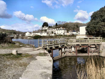 |
Because much of this walk is on a cycle trail, it’s a relatively easy one. It’s also surprisingly quiet as cyclists don’t seem to have found the trail to Mevagissey yet and my route, for the first mile, along the Pentewan Valley Trail, mostly avoids the cycle track. Pentewan itself is well worth exploring so I recommend starting and finishing at the redundant sea lock, fascinating in itself. There are just three short stretches of road – a couple of hundred yards in Pentewan, 100 yards on the footway along the St. Austell road, and less than a quarter mile in Mevagissey. The cycleway that you use from the St. Austell road to Mevagissey is well made and good to walk on. It starts with an easy 250 foot climb through the delightful broadleaf woodland - including holm oak and sweet chestnut - of New Road Plantation. At the very top, at around 300 feet, look out for the fascinating barns of Peruppa Farm on your left. Half-a-mile after Peruppa, a track goes right to Heligan Garden. If you feel like making a visit there, it may only be a quarter mile each way but you will need half a day to do the garden justice. Before the track descends more steeply to Mevagissey, there are delightful views over the wooded Heligan Valley below. The Coast Path back to Pentewan is of no more than moderate difficulty. |
|
|
Oliver's Diary - Route Directions - Statistics, Info, Interest |
Round Walk 28 – Pentewan, Heligan
Garden, Mevagissey, Coast to Pentewan - Oliver's Diary
| I know both Pentewan and Mevagissey quite well, favouring the former by far over the latter. I have also walked all the Clay Trails several times, including Pentewan to Wheal Martyn before its northern section had been completed. It was my map-making friend Ernie Biddle who told me about the new cycle trail from the Pentewan Valley Trail to Heligan and Mevagissey. So when, in August 2010, I spotted it while walking on the Clay Trail from Pentewan to Wheal Martyn, I decided to return to it for my next walk. As it is a round walk, starting and finishing on the coast, it is included here as one of my Coastal Round Walks. For the time being, as it includes a short stretch of Clay Trail, and is waymarked as a ‘Coast and Clay Trail’, I am happy also to include it on my Clay Trails page. I enjoyed the Clay Trail stretch to Mevagissey more than I expected. Although it is part of both the Cornish Way and National Cycle Network Route 3, it seems as yet to be little used by cyclists. All I encountered were dog walkers and one couple on bikes. Reaching Mevagissey, I discovered that I had left my sandwiches on a wall by the St. Austell road. A poor pasty had to suffice for lunch. To my amazement, and pleasure, the sandwiches were still there when I drove by on my way home - so I stopped and ate them. |  |
| Description - Route Directions - Statistics, Info, Interest |
|
Round Walk 28 – Pentewan, Heligan
Garden, Mevagissey, Coast to Pentewan - Route Directions
| Route with detailed GPS Data, grid refs, heights & distances --- Click here for easily printable PDF page |
| Route without GPS Data but occasional distance information --- Click here for easily printable PDF page |
Round Walk 28 – Pentewan, Heligan
Garden, Mevagissey, Coast Path to Pentewan - GPS Data
| Distance: 6.44 miles. Ascent: 880 feet, of which 570 feet on Coast Path. Highest Point: 300 feet inland on the Clay Trail. 275 feet on Coast Path at Penare Point before Portgiskey. Biggest climb: Easy 300 feet on Clay Trail, up from St. Austell road. Easy 210 feet up from Mevagissey. Steep 135 feet up from Polstreath, moderate 150 feet up from Portgiskey, both on Coast Path. Steps: Up 183, includes 78 up from Mevagissy, 92 up from Polstreath. Down 69, includes 44 down to Polstreath. Stiles: 4 wooden stiles. Gates: 6, of which 4 kissing gates, all on coastal leg. Footing: Well made trail and lane and road to Mevagissey. Mostly good on Coast Path, much on grass. Difficulty: Overall moderate. Map: OS Explorer 105 Falmouth and Mevagissey. |
| Parking: Free CP in Pentewan village. Free at Heligan Garden (off trail). Expensive in Mevagissey. Intermediate Parking: CP on trail and in lay-by, just N of Nansladron (just off trail). Getting there: From A390 St. Austell by-pass, take B3273 Mevagissey road for 3 miles then L into Pentewan. Refreshments: Ship Inn and café in Pentewan. Café at Heligan Garden (off trail). Multiple possibilities in Mevagissey. Toilets: Pentewan, by harbour. Mevagissey, on road in. |
| Pentewan: See feature below. Heligan Garden: Rescued from almost a century’s dereliction by Tim Smit of Eden fame, Heligan is now one of the great gardens. Comprising Northern Garden, Ravine Garden, a tropical Jungle, a Lost Valley and a Home Farm, its 90 acres need at least a half-day to do it reasonable justice. Mevagissey: Were it just the busy fishing harbour and its immediate surrounds, Mevagissey would be a delightful place. Unfortunately, it has become the worst sort of trippery resort, filled in season with people wandering aimlessly, eating pasties and ice cream from unattractive cafés and take-aways. Try it in Spring or Autumn. |
Pentewan, its harbour and history
 |
Imagine my surprise, when first walking through Pentewan on the Coast Path, to discover a historic port and more. From early times the stone quarries supplied such homes as Antony with superb silvery grey stone. A small fishing port, at the mouth of the St. Austell River - also known, on acount of china clay spoil, as the White River - it came to handle cargoes of tin, stone, sand and grain. A proper harbour was constructed in 1744 and it was the first port to handle the local china clay. However, when the Rashleighs built their new port at nearby Charlestown in 1801, Pentewan's Hawkins family owners struggled to keep it open, eventually closing. The harbour remains intact and still has its sea-lock but access to the sea is blocked. Remains of industrial buildings moulder to the south of the harbour. Substantial houses and cottages line the main street. Walk up Pentewan Hill and follow the coast path sign to find the colonial looking Terrace and the Georgian church. Behind the beach is a large and orderly looking holiday park. The beach, owned by the holiday park, is private but public access is granted. The Ship Inn is a pleasant place, with simple good value food, but gets busy from the holiday park in summer. The Pentewan Trail follows the White River to St. Austell; an extension continues to Wheal Martyn China Clay Museum on the road from Bugle to St. Austell. |
|
|
Description - Diary - Directions - Statistics, Info, Interest |
Round Walk 29 -Polkerris,
Gribbin Head, Readymoney, Saints Way 6½ mls
Coast path with woodland, lovely
views and a giant daymark.
Inland up a wooded valley and over farmland
 |
With 1100 feet of ascent on the Coast Path, and a climb to 225 feet leaving Readymoney Cove, you might expect this to be a fairly strenuous walk. However, it turns out to be only moderate. The only really steep climb is the first 150 feet out of Polkerris. Even that up to the daymark on Gribbin Head is fairly easy, while that up from Coombe Haven starts steep but becomes easy. The climb out of Readymoney Cove on the inland leg is steepish only for its first 120 feet. The walk starts at Polkerris harbour with a climb through woodland carpeted with wild garlic – the smell makes you hungry. It then undulates up to the National Trust’s Gribbin Head, with its unusual red and white striped daymark tower. You descend to Polridmouth (Pridm’th) Cove then climb up to Lankelly and Southground cliffs. Now down to Coombe Haven and another climb before heading down, passing St. Catherine’s Castle, to Readymoney Cove. The inland leg is on the western alternative of the Saints Way, mostly easy going, first up through woodland, then undulating across farmland. You leave the Saints Way soon after Tregaminion to drop down through the garlic woodland back to Polkerris. Views on the way to Gribbin Head are at first simply back west across St. Austell Bay, but subsequently to the Dodman. Looking east from Gribbbin Head, you see to Rame Head and on into Devon. |
|
|
Oliver's Diary - Route Directions - Statistics, Infor, Interest |
Round Walk 29 - Polkerris, Gribbin
Head, Readymoney, Saints Way - Oliver'sDiary
| I walked this back in May 2010 but am only coming to write these notes in February 2011. There are two results of this delay. The first is that memory may be a little hazy, the second that GPS users, if following my full Route Directions, will find that I have used only 6 figure grid references, as I tended to at that time, fine on the OS Explorer map but less help on the ground. This is a walk that, one way or another, I have done many times. As a full walk, I have done it twice before but in the other direction starting from Readymoney Cove, once with Jane, once with my sister Mary. In April 2010 I was this way as part of my Cornish Coast Path project. In June 2006 I walked the Saints Way part of this route, but in the other direction. I remember finding the Saints Way a little uninspiring. I like plenty of interest in my walks and about all, apart from pleasant countryside, that I found was the start and end towns, Padstow and Fowey; standing stones, and a close-up of those pointless wind turbines on St. Breock Downs; the views from Holman Tor; the charming village of Lanlivery; and a couple of worthwhile churches and a few Cornish crosses. Not enough really along a 30 mile trail to my way of thinking. I really rather felt that its creastors had made a trail for the sake of a trail. |  |
| Description - Route Directions - Statistics, Info, Interest |
|
Round Walk 29 - Polkerris, Gribbin
Head, Readymoney, Saints Way - Route Directions
| Route with detailed GPS Data, grid refs, heights & distances --- Click here for easily printable PDF page |
| Route without GPS Data but occasional distance information --- Click here for easily printable PDF page |
Round Walk 29 - Polkerris, Gribbin
Head, Readymoney, Saints Way - GPS Data
| Distance: 6.59 miles. Ascent: 1600 feet, of which 1100 feet on Coast Path. Highest Point: 260 feet on Gribbin Head on Coast Path. 250 feet approaching Trenant on inland leg. Biggest Climb: On Coast Path, stiff 200 feet up from Polkerris, 4 other climbs of over 100 feet. Easy 225 feet out of Readymoney Cove on the inland leg. Steps: Up 116, no flights of over 30. Down 154, includes 76 before Tregaminion. Stiles: 5 only. Gates: 17, includes 5 kissing gates. Footing: Good footing, mostly on grass, on Coast Path to Readymoney, but can sometimes get muddy and rocky in just a few places. Mostly field paths with some lane, some road, on the inland leg. Difficulty: Overall moderate but 6 climbs between 100 and 225 feet. Map: OS 106 Falmouth and Mevagissey. |
| Parking: Polkeris, large car park ¼ mile up hill from harbour. No parking down by beach. Intermediate Parking: Readymoney Cove, expensive car park up hill from cove. Getting there: From A3082, Par to Fowey, turn R at top of hill after Polmear and R again for Polkeris. Refreshments: Polkerris, Rashleigh Arms pub (all day), Sams on the Beach café and Polkadot café both seasonal. Toilets: Polkerris, just up start of coast path. Readymoney Cove, by beach. |
| Gribbin Head: Its old Cornish name was Pennarthe, the prominent headland. Much more easily climbed than its 260 feet might suggest, the headland, often just known as The Gribbin was acquired by the National Trust A daymark, the 80 foot red and white striped tower, was erected in 1832 to differentiate the Gribbin from the nearby Dodman. Polridmouth: This is the southern end of the Rashleighs sadly inaccessible Menabilly estate. One imagines it would have been well known to Daphne du Maurier who rented Menabilly, her inspiration for Manderley, for many years. It is a delightful cove with two sandy beaches, quiet because not easily accessible. Above the beach is closely cropped grassland, an ornamental lake and a summerhouse. Stepping stones cross the stream that leaves the lake. St. Catherine’s Castle: The small artillery fort was constructed on the orders of Henry VIII as an outer defence for the important harbour of Fowey. Of two storeys, there are gun ports at the lower level. Below the fort is a two gun battery constructed in 1855. Across the Fowey River at Polruan is a blockhouse, though this relates to a similar one in Fowey. Readymoney Cove: At the very beginning of Fowey, the cove, looking across to Polruan, is dominated by a mansion above its northern side. The house behind the cove was once home to Daphne Du Maurier. Its lovely garden has been open on occasions but the house was sold in 2011. Saints Way: In Cornish 'Forth an Syns', it is also sometimes known as the 'Mariners Way'. The 30 mile trail links two important harbour towns, Padstow on the north coast and Fowey on the south. While there may be no evidence that this really was a route used by traders and holy travellers between Ireland, Wales and Britanny in prehistoric and early Christian times, it's a nice conceit and makes an enjoyable and different coast-to-coast route. It was created in 1986 by a group of Cornish hikers and students of history. Heading south, at Helman Tor you have to make a choice, as there are then two routes to Fowey, one by Luxulyan, the other by Lanlivery. |
 |
What a contrast to Par, just a mile away across St. Austell Bay. Par is heavily industrial, its waterfront dominated by the vast former china clay works and its associated harbour, and by a holiday park set immediately above the beach. Polkerris might be another world entirely. Both are in the old parish of Tywardreath - it means 'House on the Strand'' and was the inspiration for Daphne du Maurier's novel. Polkerris is reached down a narrow steep lane off the road from Par to Fowey. Parking in the village is non-existent, unless you are a resident or are lunching in the Rashleigh Arms and are lucky enough to get a space in their small car park. Happily there is a large car park a few hundred yards up the hill, a clear sign that Polkerris gets very busy in season. When I visited in March 2005, even then the car park was fairly well used. The village has a long fishing history, though it no longer has a fleet. As far back as Elizabethan times, however, it could boast the largest pilchard cellars in Cornwall; they are still there. There is also the harbour wall and quay built by the Rashleigh family in the 18th century, on whose estate, Menabilly, it stood. Fishing prosperity didn't last and now Polkerris relies on its pub, its cafés and its summer visitors. Rashleigh Inn is open all year, Sams on the Beach and Polkadot cafés are seasonal. |
|
|
Description - Diary - Route Directions - Statistics, Info, Interest |
Round Walk
30 - Fowey, Pont, Lantic Bay, Polruan - 5¼
miles
 |
This is a very well known walk and features, in one form or another, in most of the Cornwall walk guides. I say "in one form or another" as, unlike the full walk described here, some cut out Lantic Bay (shame!) taking the Polruan path from Pont, while some just have a Pont and Lantic Bay circuit from Polruan. Of the several possibilities this full route offers the most variety and interest. Starting from Caffa Mill in Fowey, you cross to Bodinnick on the car ferry and walk steeply uphill a short way to find the National Trust’s Hall Walk. This a more-or-less level walk through light woodland with a couple of viewpoints and many intermittent delightful views over Fowey town, the River Fowey and its estuary. After a memorial to Q - Fowey author Sir Arthur Quiller-Couch - a path, mostly through woodland, brings you to the NT’s small harbour settlement of Pont at the head of Pont Pill creek. A short stretch of road, then more woodland to St. Wyllow’s church and more quiet road leading to fields and Lantic Bay with its lovely views. The coast path section includes a substantial, but not difficult, climb up to 390 foot Blackbottle, then it’s mostly downhill to Polruan village and the passenger ferry back to Fowey. Happily, the half mile on the road through Fowey back to the car parks at Caffa Mill is both interesting and relatively traffic free. |
|
|
Oliver's Diary - Route Directions - Statistics, Info, Interest |
Round Walk 30 - Fowey, Pont, Lantic
Bay, Polruan - Oliver's Diary
| I have done this walk many times since first walking it in 2003 with Jane. I have also done the coastal section of it on many other occasions. This time I walked it solo in December 2010, Bob and Pam having done a similar walk themselves only a few days earlier. It is a walk that I never tire of. I love the views from Hall Walk, looking across the river down to Fowey. I always enjoy the surprising little harbour settlement of Pont, the fascinating little church of St. Wyllow at Lanteglos-by-Fowey (not to be confused with another Lanteglos near Camelford). But my favourite part of this walk comes as I approach the coast for the glorious views over quiet Lantic Bay to Pencarrow Head. I also like, when heading down into Polruan, to continue out to St. Saviour’s Point. From here the immediate view takes in St. Catherine’s Castle and Readymoney Cove, on a clear day the longer view reaches east to Rame Head, west past Gribbin Head to the Lizard. It is also worth making a small detour, continuing along St. Saviours Hill for the views down over Polruan itself. By some odd coincidence, I almost always seem to do this walk in winter, when the Polruan ferry comes into Town Quay at Fowey. On the one summer occasion when it came into Whitehouse Slip, I was glad to have the chance to see Q’s home and walk along Esplanade. |  |
| Description - Route Directions - Statistics, Info, Interest |
|
Round Walk 30 - Fowey, Pont, Lantic
Bay, Polruan - Route Directions
| Route with detailed GPS Data, grid refs, heights & distances --- Click here for easily printable PDF page |
| Route without GPS Data but occasional distance information --- Click here for easily printable PDF page |
Round Walk 30 - Fowey, Pont, Lantic
Bay, Polruan - GPS Data
| Distance: 5.16 miles; 5.76 miles if you include ferry crossings. Ascent: 1200 feet, of which 825 feet inland, 375 feet on coast path. Highest Point: 390 feet, above Lantic Bay, inland. 390 feet at Blackbottle on Coast Path. Biggest Climb: 200 feet up to St. Wyllow Church, inland. 245 feet up to Blackbottle on Coast Path. Steps: Up 45. Down 60. Both include steps at Polruan ferry landings. Stiles: None, amazingly. Gates: 17, mostly hunting gates on Coast Path. Footing: Mostly well made paths inland. Good on grass on Coast Path. Approx. 1.50 miles on tarmac, on quiet lanes and streets in Polruan and Fowey. Difficulty: Moderate, as long climbs not difficult. Map: OS Explorer 107 St. Austell and Liskeard. |
Round Walk 30 - Useful Information
| Parking: Old Station Yard CP, Fowey, just before Bodinnick Ferry at 12486/52240. Also Caffa Mill CP by ferry. Intermediate Parking: NT Lantic Bay CP, between Churchtown and Lantic Bay at 14948/51354. Getting There: From A390, 1½ miles W of Lostwithiel, go L on B3268 Fowey. At roundabout, go L signed Bodinnick Ferry. Ferries: Bodinnick Ferry runs about every 15 minutes from Caffa Mill. Polruan Ferry also runs about every 15 minutes; it goes to Fowey’s Town Quay summer evenings and winter, to Whitehouse Slip (extra 5 minutes walk) summer daytime. Web site http://www.ctomsandson.ltd.uk/ Refreshments: Ample in Fowey. Old Ferry Inn, Bodinnick (all day). Lugger Inn, Russell Arms and café, Polruan. Toilets: Caffa Mill CP, Bodinnick Ferry CP. Just after ferry at Bodinnick. Quay at Polruan. |
Round Walk 30 - Interest Feature on Fowey
| Bodinnick: There is not much to this little settlement but what there is is interesting. As the ferry comes in to land the white painted house to your right is Ferryside, once home to Daphne Du Maurier. As you set off up the hill you first pass on your left the attractive 400 year old Old Ferry Inn which is open all day. Up the hill on your right is tiny St. John’s Church. And, if you care to make a small detour off Hall Walk, shortly after passing the War Memorial cross a stile on your left and follow the left-hand hedge. Then go through a metal gate, and follow the track past Hall Farm to your left and you will come to 14th century Hall Chapel, now used as a cow shed. You could, if you wish, continue on the track and follow waymarks for a slightly shorter route to Pont. Pont: To judge by the quay, the lime kilns and the handsome buildings this must once have a been a prosperous little trading settlement. Now it is owned by the National Trust (who else) who have converted the farmhouse and the former Ship Inn behind it as self catering accommodation under the collective name of Mohun, former lords of the manor of Lanteglos-by-Fowey. St. Wyllow, Lanteglos-by-Fowey: St. Wyllow's church is a delight. Daphne du Maurier thought so, too, and married Boy Browning there in 1932. If you are looking on the OS map the tiny settlement is un-named. The only nearby habitation is Churchtown Farm. Inside, a brass commemorates Thomas Mohun, 15th century lord of the manor. The former Mohun pew is now a panel in the south aisle. Bench ends are superb, among Cornwall's finest (and that is saying something); one portrays an eel and two fish. Outside the south porch is an unusual 'lantern' cross; nearby is the stump of another. Lantic Bay: This delightful bay is closed by Pencarrow Head to the east and the heights of 390 foot Blackbottle to the west. There are two small beaches, Great and Little Lantic. Great beach is accessed with some difficulty down a steep path and steps, Little beach is accessible only at low tide. Polruan: Largely ignored in favour of Fowey across the water, Polruan, whilst tiny in comparison, has its own charms. Streets are even steeper than Fowey’s and the interest is mostly close to the harbour where there is a successful working boatyard. As you follow the coast path down Battery Lane, look out for a path on your left leading to the Blockhouse on the waterside. Chains were stretched from here, across to its counterpart on the Fowey side, to prevent incursion by French ships. There are two pubs, the Lugger and the Russell Arms, and a tea rooms. |
 |
An attractive small town with narrow streets and a one-way system, so its attractions are less easy to enjoy than those of St. Ives and St. Mawes, comparably pretty waterside towns. While they cluster around a harbour and have walkable waterfronts, Fowey has no harbour as such but depends on its deep tidal river. And while they are alongside the water, Fowey's buildings back on to the river and almost nowhere can you walk by the water. There are attractive shops in Fore, North and Lostwithiel Streets and pretty alleyways climb the steep hill. Of the several pubs, the King of Prussia is best known and there are some boutique hotels. There is a long maritime history. In medieval times it provided ships for the Crusades and the wars with the French. Henry VIII considered it of sufficient importance to fortify it with a pair of castles and a chain across the River Fowey. Now there are yachts, fishing boats and a china clay terminal up-river and, thanks to deep water, cruise ships visit occasionally. A major regatta takes place in August. Don't expect to park in the centre, instead follow signs on the periphery and be prepared to walk. There are also many literary associations. Kenneth Graham is said to have gained inspiration for 'Wind in the Willows' here whilst guest of Sir Arthur Quiller-Couch. Daphne du Maurier stayed at Ferryside House in Bodinnick and rented three homes (one was Menabilly, her 'Manderley'). |
|
|
Description - Diary - Route Directions - Statistics, Info, Interest |
Round Walk 31 - Kingsand,
Rame Head, Forder, Cawsand - 5¼ miles
Mostly wooded coast path to Polhawn
Cove, with great views from Rame Head. Inland on tracks and field
paths.
Combine with Round Walk 32 for a 11½ mile round or figure-of-eight
walk
 |
This walk, though quite short, has something of everything, and for everyone. From the statistics - over 1000 feet of ascent, four individual climbs of 125 feet plus, the biggest 215 feet, and more than 400 steps, you might expect it to merit a severe grading. However, it proves to be only moderate and could easily be done in a couple of hours or so. Not that you would want to complete it that quickly: scenery and views are superb on the coast and inland and interest is considerable, especially if you enjoy charming coastal villages. Although you could equally well start at Rame Head, a Kingsand start is preferred for the easterly light on the coastal leg. The walk begins in Kingsand, and passes through its twin village, Cawsand, on its way to the Coast Path proper, climbing steadily to Rame Head. It continues on the Coast Path down to Polhawn Cove and then turns inland, up, down and up again through the hamlet of Forder before dropping to Cawsand and Kingsand. Views are magnificent, first over mighty Plymouth Sound then, from Rame Head, west to the Lizard, east to Bolt Head and finally, once up Forder Hill, more Plymouth Sound views. Interest includes fascinating Kingsand and Cawsand villages, Rame Church (a ½ mile detour), Rame Head with its cliff castle and chapel, and Cawsand Fort. |
|
|
Oliver's Diary - Route Directions - Statistics, Info, Interest |
Round Walk 31 - Kingsand, Rame
Head, Forder, Cawsand - Oliver's Diary
| Although I had previously done Walk 32 with Jane, the first time I did this one was with my sister Mary in November 2004. Then we did a walk that included much of Walk 32 as well, for a total of about 11 miles. On this occasion, walking with Bob and Pam in February 2011, we settled for this short walk from Kingsand to Rame Head and Polhawn Cove on the Coast Path, returning inland. Walk 32 will also start at Kingsand, heading inland to Maker Church, then down to Millbrook Pool and along the estuary to Cremyll and, finally, through the Mount Edgcumbe estate back to Kingsand. I anticipate it with pleasure, partly because it will complete my Coastal Round Walks, partly for its memories as one of my earliest Cornish walks with Jane, partly because we love the Mount Edgcumbe estate and the wonderful views over Plymouth Sound. On this occasion, I was content with the short walk because I love to linger over the views that the morning light offers of Plymouth Sound, and because I always enjoy spending time in Kingsand and Cawsand. We ate our sandwiches by the chapel on Rame Head; the wind was blowing strongly but we found a sheltered spot to enjoy the view east along the Devon coast. Ageing legs found the climb up Forder Hill pretty steep but worth it for views as you drop back down to finish at Kingsand. |  |
| Description - Route Directions - Statistics, Info, Interest |
|
Round Walk 31 - Kingsand, Rame
Head, Forder, Cawsand - Route Directions
This walk
can be combined with Round Walk 32 for a 11½ mile round or figure-of-eight
walk
| Route with detailed GPS Data, grid refs, heights & distances --- Click here for easily printable PDF page |
| Route without GPS Data but occasional distance information --- Click here for easily printable PDF page |
Round Walk 31 - Kingsand, Rame
Head, Forder, Cawsand - GPS Data
| Distance: 5.13 miles. Ascent: 1060 feet, of which 700 feet on Coast Path. Highest Point: 330 feet at Rame Head on the coastal leg. 275 feet at top of hill after Polhawn Cove. Biggest climb: Easy 600 feet total to Rame Head, on coastal leg, includes 2 individual climbs of 125 feet. Steep 215 feet up from Polhawn Cove, steep 145 feet up from Forder, both on inland leg. Steps: Up 60, includes 57 up to Rame Head. Down 349, includes 57 down from Rame Head, 59 down from Queener Point, 74 down to Polhawn Cove, flight of 97 down to Cawsand. Stiles: 1 only. Gates: 10, all kissing gates, mostly on inland leg. Footing: Coast path, mostly good on lanes, paths and tracks, rocky up to Rame Head. Inland, good on tracks and lanes, good on field paths, steep steps approaching Cawsand on final stretch. Difficulty: Overall moderate. Map: OS Explorer 108 Lower Tamar Valley and Plymouth. |
| Parking: Kingsand, bottom of Fore St., behind Halfway House. Intermediate Parking: Cawsand. End of Military Road, beyond Rame. Rame Head, near Coastwatch Station. Getting there: From A38 at Trerulefoot, A374 (Torpoint) past Polbathic. R Crafthole. L B3247 through Millbrook. R down hill to Kingsand. Refreshments: Kingsand, Halfway House Inn and seasonal café on The Cleave. Cawsand, Cross Keys Inn and seasonal café by Cawsand beach. Toilets: Kingsand, signed from Halfway House. Cawsand, by beach. Rame Head, in car park. |
| Penlee Point: It is from here that you get the first comprehensive views over Plymouth Sound. On the point is what is described as a grotto. Originally just a cave used as a watch house in the 18th century, the stone building, with romanesque and gothic arches and vaulted roof, was constructed for Queen Adelaide's visit to Mount Edgcumbe in 1827. Rame Church: Easily recognised by its slender unbutressed tower and tall, dormer windowed, broach spire, perhaps added as a daymark, St. Germanus church is largely of the mid 13th century though a tympanum is Norman. Inside, there is an original wagon roof, bench ends in the Devon tracery style and a good memorial to Roger Ashton. There is no electricity in the church, all lighting is by candles, and the organ is pumped by hand bellows. Outside, the lych gate still has its stone coffin rest. Rame Head: An isthmus links the headland with the mainland. Across it were cut deep ramparts for an iron age cliff castle. There is also some evidence of neolithic occupation. On top of Rame Head stands a small chapel, dedicated to St. Michael. There may have been one here since before the Norman Conquest but the present building probably dates from the 12th or 13th century. Views from here are superb, in good weather as far west as the Lizard and as far east as Bolt Head. Below the headland, to the west, is Western Gear Cove, popular with small boats in summer. Polhawn Cove: A peaceful spot, sheltered from most of the worst weather by Rame Head and Queener Point. The former fort has been converted to a home and what were probably coastguard cottages have also been converted. Cawsand Fort: Built in the 1860s as one of a string of ‘Palmerstonian’ forts guarding Plymouth Sound, it housed 10 big guns. It went out of use in 1926 and was later converted to apartments, some with spectacular views |
 |
This is a charming, tucked away part of Cornwall, more easily accessed by car ferry to Torpoint or foot ferry to Cremyll than from most of Cornwall. Here the twin villages of Kingsand and Cawsand tumble down their hillsides to meet at small harbours facing broad Plymouth Sound with long views of Drake’s Island and the Devon coast. Where they meet at the bottom is the Halfway House Inn, a comfortable pub with a good welcome, a good atmosphere and excellent food. Surprisingly, until 1830 the Halfway House stood at a county boundary, with Kingsand in Devon, Cawsand in Cornwall. This is a great place to explore on foot with steep streets filled with colour washed stone cottages, jostling for space. Climb high above the Cawsand side to find a gun garden with good views over Kingsand and a Victorian fort, converted to housing with breathtaking views. Climb above the Kingsand side, past a tiny village green, to find a gate near the cliff that leads into glorious Mount Edgcumbe Park with its house, formal garden and Earl's Garden. By Cawsand beach a shelter has an attractive tile mural. Above Kingsand beach is the charming Institute with a slender clock tower. The villages are popular with Plymouth people, thanks to a small ferry operating from Sutton Harbour. |
|
|
Plymouth Sound |
| The vast natural harbour, one of Britain's finest, covers some 10 square miles. Into it flow the Rivers Plym and Tamar, the latter also fed by the Lynher and Tavy. Military forts and artillery batteries surround it. Central in the Sound is the mile long Breakwater that enables waiting ships to anchor in protected waters. Alongside it, to its north, the small island is an artillery battery. The larger island, nearer the northern end, is 6½ acre Drake’s Island. Originally St. Michael’s Island, later St. Nicholas Island, a medieval chapel was demolished in 1549 when construction of a fort began. It became known as Drake’s Island after local hero Sir Francis Drake was made governor of the island. After the Civil War of the 1640s it became a prison. In 1691, when the Royal Naval Dockyard moved from Cattewater at the mouth of the Plym, the island became important to the defence of its new location at Devonport. Best views of the Sound are from Penlee Point, from where you see the Breakwater and the defences on the eastern shore, and from Mount Edgcumbe and Cremyll, from where you see Plymouth Hoe, the entrance to historic Sutton Harbour, from which most explorations of the Americas started and from which the Pilgrim Fathers sailed in 1620, Drake’s Island, Millbay Docks and Royal William Yard, now converted to housing, marina, shops and restaurants. A ferry crosses from Cawsand to Sutton Harbour. |  |
| Kingsand/Cawsand 2020: Drake's Island to beome hotel |
|
Round Walk 32 -
Kingsand, Maker, Empacombe, Cremyll, Mount
Edgecumbe Park- 6½ miles
Good paths up over Maker Heights.
Mostly woods to Empacombe. Coast path through Mount Edgcumbe Park.
Combine with Round Walk 31 for a 11½ mile round or figure-of-eight
walk
 |
Like Walk 31, this too has something of everything and something for everyone. Walked on its own, you could visit Mount Edgcumbe House and enjoy its Formal and Earl’s gardens. Combined with Walk 31 for a round – or figure-of-eight – walk of a little over 11½ miles it offers a wonderful variety of scenery. As it is, the scenery on this Walk 32 is outstanding and its variety immense. It starts, as did Walk 31, by the Kingsand car park and Halfway House inn. The initial climb, for the first ¼ mile out of Kingsand, is steep but soon eases off so the 340 foot ascent to Maker Heights is no problem. After Maker Church, the descent through Pigshill Wood is steepish and awkward in wet weather. Once at Palmer’s Point on Millbrook Lake, going is easy, mostly along the water to Cremyll by way of the charming waterside settlement of Empacombe. Even if you choose not to pay to visit Mount Edgcumbe House and the Earl’s Garden, it is well worth the small detour to enjoy the Formal Gardens, and you will pass ample interest on the way to the wooded part of the estate – Tudor Blockhouse, Amphitheatre, Lake and Temple. From there on, the woodland is best seen in leaf. For most of this walk, views are superb: first over Plymouth Sound, later over Millbrook Lake and the Hamoaze to Plymouth and on to Dartmoor, finally over the Sound again to Plymouth Hoe, Drake’s Island and the Breakwater. |
|
|
Oliver's Diary - Route Directions - Statistics, Info, Interest |
Round Walk 32 - Kingsand, Maker,
Empacombe, Cremyll, Mount Edgecumbe - Oliver's Diary
| Soon after Jane and I moved to Cornwall we did a shorter 5 mile version of this walk, in the same direction but starting in Cremyll and omitting Empacombe by heading down to Mount Edgcumbe and Cremyll from Maker Church. Then we thought it a wonderful walk. Now that I have done the longer version, solo in February 2011, I think it an even better than before. The second time I did the walk was in 2004 with my sister Mary. That time we did the full figure-of-eight to include Walk 31, but again omitting Empacombe. Jane and I have been back to Mount Edgcumbe many times since, often just for the gardens, on one occasion with her sister Mary and Mary’s husband John, who both loved the place. We usually park in the free car park by Maker Church and just wander around the estate. So this walk was the first occasion I have ever seen Empacombe. What a lovely spot; I shall always include it in future walks around here. Of all my 32 Coastal Round Walks, I think this pair of walks must come pretty well top of my list. There is ample interest on each, the variety is immense, the views are superb and there are a couple of good pubs along the way. This was to be the end of this project but now I have added 14 more walks, 46 in all. Next project is a circuit from St. Ives to Cape Cornwall and back on the Zennor Churchway and the Tinners Way. It promises to be very different walking. |  |
| Description - Route Directions - Statistics, Info, Interest |
|
Round Walk 32 - Kingsand, Maker,
Empacombe, Cremyll, Mount Edgecumbe - RouteDirections
This walk
can be combined with Round Walk 31 for a 11½ mile round or figure-of-eight
walk
| Route with detailed GPS Data, grid refs, heights & distances --- Click here for easily printable PDF page |
| Route without GPS Data but occasional distance information --- Click here for easily printable PDF page |
Round Walk 32 - Kingsand, Maker,
Empacombe, Cremyll, Mount Edgecumbe - GPS Data
| Distance: 6.50 miles. Ascent: 1100 feet, of which 610 feet inland. Highest Point: 360 feet on Maker Heights inland. 220 feet in the Mount Edgcumbe estate on the coastal leg. Biggest climb: Moderate 340 feet from Kingsand to Maker Heights, on inland leg. Steepish 210 feet in Mount Edgcumbe estate, on the inland leg. Steps: Up 96, includes steep 88 in Mount Edgcumbe estate. Down 33 only. Stiles: 5 only, mostly hybrid type. Gates: 19, mostly kissing gates. Footing: Inland, mostly good on paths and tracks, but muddy and stony down through Pigshill Wood. Tarmac for ¾ mile from Cremyll. Good paths and tracks through Mount Edgcumbe estate. Difficulty: Overall moderate with 2 big climbs but a lot of easy. Map: OS Explorer 108 Lower Tamar Valley and Plymouth. |
| Parking: Kingsand, bottom of Fore St., behind Halfway House. Intermediate Parking: Maker Church. Cremyll. Getting there: From A38 at Trerulefoot, A374 (Torpoint) past Polbathic. R Crafthole. L B3247 through Millbrook. R down hill to Kingsand. Refreshments: Kingsand, Halfway House Inn and Café on The Cleave. Friary Manor, shortly before Maker church. Cremyll, Edgcumbe Arms and Mount Edgcumbe Orangery. Toilets: Kingsand, signed from Halfway House. Cremyll, behind Mount Edgcumbe Arms and by Mount Edgcumbe Orangery. |
| Grenville Battery: When built in 1782 this fort was known as Maker Heights Redoubt No.4. It was added to in 1887 to house two 12.5" RML guns, as part of Lord Palmerston’s fortifications against French invasion. It then became known as Grenville Battery. The guns were then removed in 1890 and remounted at Maker Heights Battery. More works were carried out between 1899 and 1901, when three 4.7" Quick Firing guns were put in place, remaining there until 1927. It is now in private hands. Maker and its Church: Oddly, the Cornish name was Magor, meaning ruin. It was also known as Egloshayle, the church on the estuary, though high above that estuary and no connection wsith Egoshayle, Wadebridge. The present church of St. Julian (patron saint of ferrymen) is certainly no ruin now. It stands on the site of a much older church but was rebuilt in the 15th century and is typically Cornish of that period. The massive tower is visible for miles. Inside are several Edgcumbe monuments and a Norman font, originally in St. Merryn church near Padstow. The village, little more than a farm, is half-a-mile away. There are some handsome barns there. Empacombe: A delightful little harbourside enclave, the rump of what were once the vast Edgcumbe estates. Most of the family now live in New Zealand, after their house and park were given to the City of Plymouth, but the present Earl lives in Empacombe. Attractive Harbourside House, standing above the quay, is now a holiday let. The massive granite gatehouse was one of the approaches to Mount Edgcumbe House. Cremyll: All most see of Cremyll is the quay where passenger ferries from Plymouth land, the attractive Edgcumbe Arms pub, and the entrance to Mount Edgcumbe Park. It is worth wandering around the rest of the village and walking along the waterside to Mashford’s boat yard. |
Mount Edgcumbe,
House, Garden and Park
 |
Mount Edgcumbe is a paradox. On one hand the House and Earl's Garden are little visited. On the other hand there is the Country Park and 'formal gardens' which act as a lung for the City of Plymouth. Severely damaged by wartime bombing the house was rebuilt by the 7th Earl and the estate gifted to Plymouth and Cornwall jointly. The exterior is striking, contents good but it is a museum rather than a home. The Earl's Garden includes parterre, shrub borders, fine rhodos, shell house and sweeping lawns. The 100 acres of park, much overlooking the water, includes formal gardens in the English, French and Italian styles, informal Rose, American and New Zealand gardens, a National Collection of Camellias, woodland with fine mature trees, classical and gothic eye-catchers - Milton's Temple, Lady Emma's Cottage, several follies, and many viewpoints. It also includes almost nine miles of Cornish Coast Path, from its beginning, where the Cremyll ferry disgorges Plymouth foot passengers, way past Rame Head - topped by a medieval chapel - and on into Whitsand Bay. There are three car parks, one in Cremyll, two on the estate, one free. There is a good pub in Cremyll, the Edgcumbe Arms. There are restaurants in the Orangery in the formal gardens and in the estate yard by the house. Park and formal gardens free; fee for House and Earl's Garden. |
|
|
And
some more Coastal Round Walks
| Since completing the above series of 32 Coastal Round Walks, in February 2012 I have started on some more Round Walks from locations on the Cornish Coast Path. I shall be walking them and uploading the results in random fashion. However, as with the original 32, they will appear in order counter-clockwise round the coast. Generally, they will be shorter in length, a likely maximum of five or six miles. |
| START POINT | ROUTE | MLS |
| Morwenstow | Vicarage Cliff, Stanbury Mouth, Eastaway, Stanbury, Tonacombe, Morwenstow Crosstown | 3.68 |
| Bude | Coast Path over Efford Down to Widemouth, farmland to Helebridge, return along the Bude Canal | 5.77 |
| Widemouth Bay | Penhalt Cliff, Millook, Millook Woods, Trebarfoote, Poundstock, Trevisick and Higher Penhalt | 4.10 |
| Boscastle | Coast Path by Grower Gut to Trevalga, through the village, fields to Forrabury, lanes back to Boscastle | 3.52 |
| Tintagel | From St. Materiana's church, into the village, then by Trevillick, Trebarwith Strand, Treknow and coast back | 4.43 |
| Trebarwith Strand | From Jeffries Pit, by Backways Cove, coast, Trebarwith Strand, Treknow and Old Mill Floor | 3.89 |
| Port Quin | Some of the toughest coast path to Port Isaac, an easier return inland | 4.87 |
| Constantine Bay | Trevose golf course, St. Constantine's Church and Well, Mother Ivey's Bay, Trevose Head | 4.76 |
| Mawgan Porth | A round walk from St. Mawgan. Farmland to the coast; Coast Path; return up a valley to St. Mawgan | 4.98 |
| Mylor Churchtown | Mylor Creek to Trelew, cross country to Flushing, back along Carrick Roads to Mylor Churchtown | 4.08 |
| Maenporth | Coast path to Porth Saxon on the Helford River, inland return by Carwinion and Mawnan Smith | 4.82 |
| St. Mawes | By the Percuil River, to St. Just-in-Roseland, back along Carrick Roads and St. Mawes Waterfront | 5.77 |
| Portmellon | Coast path to Chapel Point, inland by Bodrugan Barton and Gorran Churchtown | 4.75 |
| Lerryn | Along the Lerryn and Fowey Rivers through woodland, returning over farmland and through woods | 4.49 |
Morwenstow
-
Vicarage Cliff, Stanbury Mouth, Eastaway, Stanbury, Tonacombe - 3.68
miles
 |
This may only be a very short walk but it provides not only ample interest along the way but also a surprisingly high degree of difficulty along the short section of Coast Path that it uses, particularly after wet weather when the steeper climbs and descents can be extremely slippery. The walk starts at the car park opposite Morwenstow church – church and graveyard are both well worth exploring – and heads through the churchyard to find a stile out onto fields leading to the Coast Path. Soon after joining the Coast Path famous Hawker’s Hut is just below you on the cliff – not to be missed – with its view of notorious Higher Sharpnose Point. At first the Coast Path seems easy but steep descents and ascents follow to the foot of the Tidna and Stanbury valleys. You need to be something of a mountain goat to get a view of Tidna Shute waterfall. From Stanbury Mouth the ascent to Eastaway is a long but easy 300 feet or so and from there it is easy farmland all the way back, broken by a steep down-and-up through Tidna. You might choose to think of this final section as the ‘manorial trail’, with manor houses at Eastaway, Stanbury and Tonacombe. All are mentioned under Interest; Tonacombe is the most interesting. Views from the Coast Path are of only moderate length, as far as Cambeak, but much of the time the strange radomes and dishes of GCHQ Steeple Point are in view. |
|
|
Oliver's Diary - Statistics, Info & Interest - Route Directions |
Morwenstow
-
Vicarage Cliff, Stanbury Mouth, Eastaway, Stanbury - Oliver's Diary
| I have visited Morwenstow on many occasions since a first visit in 2005 and have walked along this part of the Coast Path several times, the first in 2003. But this short round walk was new. Recovering from illness, and working hard at getting fit again, I felt in March 2012 that I was ready for something more challenging than level walks around Wadebridge or on the Camel Trail. Wanting to see again the daffodils in Morwenstow churchyard – disappointing this year – I settled on this short but in places strenuous walk from Morwenstow. I see that on my Coast Path page I describe the few miles south from Welcombe Mouth as some of the most strenuous. On this round walk there are only two ascents and three descents but I definitely found that 1½ miles as strenuous as anything I have done for some while. Oddly, I found the descents tougher than the ascents; the loose stone was mud covered and very slippery. The long but gentle climb up to to Eastaway was a welcome relief and the subsequent cross country return was almost all gentle, despite the many stiles. At Eastaway I went a little out of my way to see what I could see of the manor – very little but I did enjoy a hilariously capped cob wall. My route took me through the garden of the Bush Inn in Crosstown; if any smokers read this, they will enjoy the elegantly rustic shelters in the garden. |  |
| Description - Statistics, Info, Interest - Route Directions |
|
Morwenstow
-
Vicarage Cliff, Stanbury Mouth, Eastaway, Stanbury - GPS Data
| Distance: 3.68 miles. Ascent: 900 feet. Highest Point: 480 feet soon after Eastaway. Biggest Climb: Fairly steep 290 feet up from Tidna Shute. Long easy 335 feet up from Stanbury Mouth. Steps: Up 71, including 51 up from Tidna Shute. Down 69, including flight of 59 down to Tidna Shute. Stiles: 14, mix of wooden and cattle stiles. Gates: 25, including many kissing gates. Footing: Slippery loose stone in places on Coast Path. Track up from Stanbury Mouth can be wet. Good over pasture from Eastaway. Difficulty: Quite difficult for a short walk. Map: OS Explorer 126 Clovelly and Hartland. |
| Parking: Morwenstow (Churchtown) large CP by Rectory Farm and Church. Intermediate Parking: None. Getting There: From A39 north of Kilkhampton, follow signs for Morwenstow. Refreshments: Bush Inn, Morwenstow Crosstown, open all day. Rectory Farm Tea Rooms, opp. Morwenstow church (seasonal). Toilets: Only at refreshment places above. |
| Morwenstow: Attractive but little more than a couple of hamlets, Crosstown and Churchtown. Famous for its church and its Victorian incumbent, Parson Hawker. See features on Morwenstow and Parson Hawker. Hawker's Hut: In the care of the National Trust and clearly signed along the Coast Path, the driftwood shack is where he wrote much of his poetry. Higher Sharpnose Point: Looking south from Hawker's Hut, this evil looking point is the first thing you see, jagged rocks at its foot. Worth the detour out to the point for the view. Three Manors: The inland part of the walk is deliberately designed to take you past three manor houses. Eastaway Manor: The first of the three is just off the route and, while it needs a small detour and you don't get a view of the house itself, it is worth taking the path along the north side of the property just to see a cob wall, rather on its last legs and coped with slates, corrugated asbestos and corrugated iron. Stanbury: A somewhat dour looking Tudor building, once grand perhaps but now a farmhouse. It was the birth place of John Stanberry, Bishop of Hereford and appointed first Provost of Eton College by King Henry VI. Tonacombe: You see little of this once important manor house, glimpsing it only through its substantial western gates, from where you can also see its equally substantial eastern gates. Listed Grade I, it too dates from Tudor times. It gives the impression of being quite extensive and apparently parts have been demolished. Like Stanbury, it is now a farm. |
 |
The 'holy place of St. Morwenna' is Cornwall's most northerly parish. There are two tiny hamlets, Crosstown and Churchtown. Crosstown is a collection of farms around a large village green, one incorporating a small pub, the Bush. A little further on towards the coast is Churchtown. Here are just a church, the former rectory, Rectory Farm, offering teas in summer, a couple of holy wells and the famous Hawker's Hut on the cliffs. In the churchyard are a Cornish cross, a copy of the figurehead of the 'Caledonia', wrecked off Higher Sharpnose Point (original in the church), masses of daffodils in spring and, at the top, St. John's Well, accessed separately. The church, dedicated to St. John the Baptist and St. Morwenna, possibly a daughter of Welsh King Brychan, is unusual. It must be just about Cornwall's least accessible church, a full five miles from the nearest road of significance. Of Norman origin (though there must have been an earlier church here), although restored in Victorian times, it retains a fair amount of Norman work, notably in the porch and the north arcade. And for 40 years from 1834, it had as its vicar the remarkable Robert Stephen Hawker, poet and free spirit. Worth noting inside are the unusual early Norman font, the screen and rood which Hawker restored, and a degraded wall painting believed to represent St. Morwenna. Outside, look at the lych gate and lych house, at the Caledonia figurehead copy, and in early spring, an amazing display of daffodils. |
|
|
Description - Diary - Statistics, Info, Interest - Directions |
| Robert Stephen Hawker was a graduate of Oxford and won the Newdigate Poetry Prize. As the Vicar of Morwenstow for 40 years from 1834, he was a colourful, independent, charitable man. His relaxations were enjoying the cliff-top on Vicarage Cliff and writing poetry. He was able to combine the two in the driftwood shack he built into Vicarage Cliff not far from his church and rectory. Known to all as Parson Hawker, his poetry brought him fame. Best known is 'Song of the Western Men', and its oft-quoted lines including "And shall Trelawney die?" became a Cornish anthem. His other works include an Arthurian saga 'Quest of the Sangraal'. He is also credited with introducing Harvest Festival to Britain as an equivalent to the much older Thanksgiving festival in the USA. From the west side of the churchyard, climb a stone stile and cross a couple of fields. Turn left to a National Trust plaque directing you down steps. Built into the cliff, its roof covered with turf, the shack commands views of Vicarage Cliff to the north and of vicious looking Higher Sharpnose Point to the south. Walk out to Higher Sharpnose and you can easily understand how the 'Caledonia' and other ships were wrecked here; this part of the North Cornwall coast is a treacherous as any you will find. Hawker is credited with rescuing bodies of shipwrecked sailors from the beaches below and giving them Christian burial in his churchyard. It is not only the sea and coastline around here that are tough; also true to say that the Cornish Coast Path around here is as tough as anywhere in its 312 miles. |  |
| Description Oliver's Diary Statistics, Info, Interest Directions |
|
Bude
- Coast Path to Widemouth, farmland to Helebridge,
Return along Bude Canal
- 5.77 miles
Interest:
includes the Sea Lock, Pepper Pot, Coastal Views and Bude Canal
 |
Although a mere 5¾ miles of easy going, this walk, starting and finishing by the canal in Bude, offers a nice selection of contrasting countryside, a fair amount of interest along the way and ample interest in Bude itself, in recent years a much improved town. The walk starts at the Bude Tourist Information Centre and Canal Visitor Centre in the main car park on the north side of the Bude Canal. It follows the canal to its sea lock, crosses the canal there and follows the Coast Path up onto the springy turf of Efford Down. The route along the coast, as far as the start of Widemouth, is obvious, taking you past the famed Pepper Pot and past a trig point on Efford Beacon. Views along the coast are pleasant but only of moderate length, to Cambeak to the south and to Steeple Point, with its stramge GCHQ dishes and radomes, to the north, though on a clear day Lundy Island should be visible to the north. From Salthouse at the start of Widemouth a well waymarked, but sometimes wet and muddy, path heads inland to Helebridge, where, if in need of refreshment, you should try The Weir café/bistro, set above its own fishing lake. Finally, an obvious route, needing no directions, follows the Bude Canal back to the start point, very easy walking on a well made wheelchair-friendly tarmac path right beside the canal. A pleasant easy walk, with no climbs of more than very moderate degree and, for a pleasant change, not a single stile. Click here for another round walk including the Bude Canal |
|
|
Oliver's Diary - Statistics, Info, Interest. Route Directions |
Bude
- Widemouth and Helebridge, returning along the Bude Canal - Oliver's Diary
| This was one of the earliest Cornish walks that I ever did. In 2002 we had bought several Cornish walk books. While these days I much prefer to devise my own walks then we mostly used Mark Norton’s Classic Walks Cornwall. This walk appeared in that volume and also in the Jarrold Pathfinder walk guide. My directions vary very slightly from both of these guides. At the beginning I prefer to walk along the north side of the canal and cross it on the sea lock. Of course, should the sea lock be open, you will have to walk along the south side. I guess Classic Walks and Patrhfinder were both researched before the advent of GPS devices and that probably accounts for both of them making it ¾ mile shorter than it actually is. And since those guides were written several things have changed: Bude has been improved enormously, the canal has been cleared and the two locks restored and there is a new refreshment spot at Helebridge, The Weir. Although some way from home, this is one of my favourite round walks, though Jane likes it less than I. I like it for its variety – coast, farmland and canal – for its choice of refreshments – Weir café at Helebridge, Falcon Inn, Olive Tree bistro and Castle restaurant in Bude – and for the fact that it’s one of those walks that is long enough for a decent amount of exercise but easy enough to do anytime. |  |
| Description - Statistics, Info, Interest - Route Directions |
|
| Update August 2012: Now we have discovered another excellent café near the canal. If you are walking the cycle route on the east side of the canal and the River Neet, only about half-a-mile out of Bude you will find River Life Café next to Bude Cycle Hire at Pethericks Mull. We came upon it at a time when The Weir was just too busy, and enjoyed it greatly. Open every day, also as a bistro in the evenings Tuesday to Saturday. |
Bude - Widemouth and Helebridge, returning along Bude Canal - GPS Data
| Distance: 5.77 miles. Ascent: 500 feet. Highest Point: 210 feet halfway along the Coast Path. Biggest Climb: Easy cumulative 190 feet up to Efford Beacon trig point. Steps: Up 13. Down none. Stiles: None. Gates: 11, mostly kissing gates. Footing: Good on grass on Coast Path. Can be wet and muddy on farmland section. Very good on tarmac along canal. Difficulty: Easy with no ascents of any note. Map: OS Explorer 111 Bude, Boscastle & Tintagel. |
| Parking: Main CP in Bude, by the bridge over the canal. Bude TIC and canal information here. Intermediate Parking: Free CP by Coast Path level with Lower Longbeak. Pay CP in Widemouth. Several places at Helebridge end of Bude Canal, including Helebridge village, at The Weir (for customers), and just off A39 near canal. Getting There: From A39 from Camelford, follow signs for Widemouth Bay and Coastal route to Bude, cross canal in Bude, CP on your R. Refreshments: Bude, Falcon Inn and Olive Tree, both by canal. Coast Path, Elements, about half way. Widemouth, several in season. Helebridge, the excellent Weir café/bistro, owned by the up-market Whalesborough holiday complex. Toilets: Next to TIC in Bude main CP. |
| Features on Bude and the
Bude
Canal
Efford Cottage: After you leave the sea-lock below you to the right is Efford Cottage. Part of the Ebbingford (Efford) estate, originally owned by the Arundells then by the Aclands, the cottage was built by Sir Thomas Acland in the 1820s and was used as a summer home. Pepper Pot: Another Thomas Acland structure, this one erected in 1835, it is said to be based on the Temple of the Winds in Athens. Intended as a coastguard shelter as well as a decorative feature, its eight sides are carved with the points of the compass. Around 1900 it had to be moved due to eroding cliffs. Unfortunately it was re-erected 7° out of true, so don’t use it for a compass bearing. Widemouth Bay: Very much down-market holiday territory, the area is full of holiday parks and cheap catering. It is, however, a great surfing venue. The house at which you turn away from the coast for the inland leg is called Salthouse; used as a salt store in the 18th century, it is now a holiday home. Whalesborough: The 500 acre farm, just off the route, has luxury self-catering accommodation and operates The Weir, an excellent all day café/bistro, incorporating a wildlife centre. Helebridge: An attractive hamlet on the River Neet. If you take the alternative cycle route back to Bude you will go through Hele, where there is a small car park. The Inclined Plane: If, instead of joining the Bude Canal for the return leg, you follow the canal route through Helebridge towards Marhamchurch, you will first encounter some former canal buildings – barge workshops, stables and iron foundry – then what remains of the former inclined plane. The climb up to Marhamchurch was too steep for a flight of locks, so goods were transferred to tub boats and winched up by a waterwheel powered mechanism at the head of the inclined plane. A couple of miles further on from Marhamchurch is another inclined plane, Thurlibeer at Hobbacott Down. Marhamchurch: An attractive village, worth the detour to visit for its generally Victorian aspect, and a couple of cob-walled thatched cottages. St. Marwenna’s church has a sanctuary knocker on the oak door from the porch, Norman stonework in the south transept, a 17th century pulpit with tester, and an unusual window in a niche in the west wall, thought to be from an anchorite’s cell. Public car park, toilets and shop. Bullers Arms Hotel does home made food lunchtime and evenings. |
 |
When the railway arrived in 1898 Bude developed as as resort, with hotels and villas with sea views. After World War II it went badly downhill and until 2011 had no quality hotel but catered rather only to the lower end of the bus tour trade. However, Bude still had many saving graces, not the least its superb Summerleaze Beach, where the tide recedes a full quarter mile. A sea lock there is the start of the Bude Canal (2 miles restored) that once carried sand inland. Behind the beach look out for the Castle; in front of it the Bude Light sculpture remembers Sir Goldsworthy Gurney who lived in the castle, built a steam road vehicle in 1829, and devised a complex system of arc lights and mirrors which lighted Parliament for 60 years before electricity. Now Bude makes a far better impression. The Quay is smarter, the Castle is now combination Heritage Centre, gallery, museum and restaurant. A hotel with some pretensions, The Strand, sadly closed New paving along the Quay makes it feel more spacious and there is a row of craft and similar shops. Olive Tree bistro there is good value. The town has now taken advantage of the possibilities of the Castle with exhibitions on Bude as port, resort and surf centre; a Sir Goldsworthy Gurney exhibition; a research centre; an art gallery; a shop and helpful staff; good wheelchair access. TIC has a Canal Visitor Centre. |
|
|
Description - Diary - Statistics, Info, Interest - Route Directions |
| We have walked the
Bude Canal on many occasions, often as part of a round walk from Bude,
on one occasion walking a different section starting from Tamar Lakes.
Conceived in 1774, the original plan was for a 95 mile canal from Bude
to Calstock on the River Tamar. What was finally completed
in 1825 was a three armed canal, to Tamar Lakes, Launceston and Holsworthy.
It essential purpose was to carry sea-sand inland to enrich poor acidic
farming soil. Never much of a commercial success, the coming of the
railway to Bude in 1898 (that has long gone) reduced canal trade drastically
and it closed in 1901. Ironically, the railway may be gone but some
of the canal is again open. In the 21st century a major regeneration
project, at a cost of £3.8 million, has cleared the canal for its
2 miles to Helebridge, restoring the two locks. Beyond Helebridge
an inclined plane carried goods to Marhamchurch in tub boats. While
there is no question of the Marhamchurch inclined plane being restored,
the towpath has been improved to the lower inclined plane and the 'Planekeepers
Path' has been re-opened to Marhamchurch and beyond. One criticism
is that, in the name of 'access' the towpath has been tarmacked.
There were fears that cyclists might use it as a race track but happily
there is now a dedicted cycleway on the other side of the canal and river.
More on Bude Canal |
 |
| Description - Diary - Statistics, Info, Interest - Directions |
|
Widemouth
Bay - Coast, Woodland, Manor, Church, Holy Well - 4.10 miles
Penhalt
Cliff, Coast to Millook, Woods to Trebarfoote, Poundstock, Trevisick
Interest: Millook Cliffs, a Nature Reserve, Trebarfoote, Poundstock Church &
Gildhouse
 |
This walk combines a brief difficult section of the Cornish Coast Path with easy inland walking up a wooded valley and even easier walking on well made tracks through farmland. It starts on the coast, a few miles south of Bude at a cliff-top car park with shortish but terrific views to both north and south. First it follows the coast path down a very steep, stone-strewn descent to the odd little bay of Millook Haven. It then turns inland to follow a small tumbling stream, Millook Water, into the Millook Valley Nature Reserve, then winds uphill, climbing 300 feet to the immaculate former manor of Trebarfoote. From here it gets genuinely easy on a track and then a lane to the tiny village of Poundstock, well worth lingering in for church, churchyard and unusual restored Gildhouse. From Poundstock a lane leads down to Wanson Water and a track carries on up to Trevisick Farm. Finally a short field path and more tracks take you back to the start point on Penhalt Cliff. Plenty of interest along the way: rock formations and sea-washed stones at Millook, wildflowers in nearby woods, the 17th century and earlier buildings of attractive Trebarfoote, and the hamlet of Poundstock with its superb church, two wells, medieval Gildhouse, a thatched cottage and an interesting converted barn. A pleasant easy walk with ample interest and one of where going steadily gets easier. |
|
|
Oliver's Diary - Statistics, Info, Interest - Route Directions |
Widemouth Bay - Round Walk, Coast, Woodland, Manor, Church - Oliver's Diary
| My real purpose in planning this research walk, and undertaking it in April 2012, was to visit Poundstock for the restored Gildhouse in the churchyard. I didn’t even know that it existed, let alone that it is unique in Cornwall, until our Western Morning News carried an item about it receiving a conservation award. Because it looked as if the weather might deteriorate by afternoon, I headed for Poundstock before parking to start my walk. I got there in full morning sun and got some good photos. When I got there later on the walk, sun again and more photos from a different angle. I loved not only the gildhouse but also the church, almost a museum of ancient artefacts that were once part of the church fabric. And to think that I have driven within a mile of Poundstock many times on the way to Bude and had never previously visited it. I have now made another visit in July 2012, having learned that there is St. Neot’s Holy Well less than half-a-mile from the village, off a track to Great Wanson. It wasn’t just Poundstock where I enjoyed the architecture. When I got to Trebarfoote, I sat on the edge of their pond, eating my sandwiches and drinking in the atmosphere of the early manor house. Nearing Trebarfoote, I found a path I had missed in Millbrook Woods which would have shortened the walk by half-a-mile but I decided I preferred the route I took by mistake. |  |
| Description - Statistics, Info, Interest - Route Directions |
|
Widemouth Bay - Round Walk, Coast, Woodland, Manor, Church - GPS Data
| Distance: 4.10 miles. Ascent: 720 feet. Highest Point: 370 feet after Trebarfoote. Biggest Climb: 295 feet from Millook Water up to Trebarfoote. Steps: Up 12. Down 24. Stiles: 2 only. Gates: 10, several of which may be open. Footing: Generally good everywhere but it is stony and steep, could be slippery, from Penhalt Cliff down to Millook. Road: A little over ½ mile of quiet lane approaching Poundstock. Difficulty: Awkward to Millook. Long moderate climb up to Trebarfoote. Easy on lane and track from there. Map: OS Explorer 111, Bude, Boscastle and Tintagel. |
| Parking: Penhalt Cliff, CP (free) marked on OS111, at about 18862/00472, S of Widemouth Bay. Intermediate Parking: Large free CP in Poundstock, on road from Bangors. Getting There: From A39, 1st turning L after Bangors, signed Bude Coastal Route. After Widemouth Manor Hotel on L, go L on lane for a little under 1 mile. CP on cliff on R. Refreshments: None on walk. Nearest Widemouth Manor Hotel, presumably all day. Toilets: None. |
| Millook: A tiny haven from which sea bass is still occasionally fished. One of the few cottages was once a mill and still has its wheel in place. You must go down on the beach in order to get a good view of the cliffs. These are of Crackington Shale and are much subject to landslip. The strata are often folded, a strange effect best seen here and at nearby Cambeak. The beach itself is covered with unusual pebbles, shades of grey, blue and white, many of them the size of small boulders. Millook Valley Woods: An extensive 150 acre woodland, now in the ownership of the Woodland Trust, follows the little Millook River upstream roughly south from Millook to close by Wainhouse Corner on the A39. The trees are mostly oak with some ash, sycamore and beech and a fair amount of neglected coppice. Much of this is a relatively level nature reserve but it also extends uphill towards Trebarfoote in the course of this walk. Trebarfoote: A fascinating collection of buildings are to be found at this Grade II* listed former manor, more recently an expensive looking farmhouse. First you see a converted barn, then a range of small buildings, formerly outbuildings but now incorporated in the main house, with early dormer windows and a slate hung chimney. The main house, of medieval origin but looking largely Georgian, is impressive in a restrained way. The view of the house from a pool by the entrance gates is delightful. The Trebarfoote family, the original owners of the estate, died out in the 17th century and the Burgoyne family acquired the manor. It is said that the coat of arms of the Trebarfoote family included three (tre) bears (bar) feet (foote); believe what you will! Poundstock: Delightful hamlet with good church, unusual gildhouse and nearby holy well. See feature below. |
 |
Less than half-a-mile from the busy A39, the so-called Atlantic Highway, Poundstock is a remarkable little hamlet. A lane loops through it from the A39 but otherwise goes nowhere. Yet this was once an important place, mentioned in Domesday Book but in existence as a manor for long before that. Even if you include nearby Trekinnard and Bangors the population is tiny yet the impressive church, set in a lovely sloping churchyard, might seem to belong to a much larger village than this. The church as it is today dates largely from the fifteenth century, though there are scant Norman remains. It is dedicated to St. Winwaloe; can this really be the same Winwaloe as on the Lizard, at Towednack and at St. Germans? Confusingly, a nearby well is dedicated to St. Neot, as in Bodmin Moor. There are some treasures inside: a late Norman font, an octagonal Jacobean pulpit, a panel from the original rood screen, a 16th century chest, parts of a wall painting, saved and exhibited against the north wall, and some early inscribed slate tomb slabs. Sadly there are almost no bench ends but there is an interesting bench in the chancel. Perhaps the greatest treasure of all is at the south end of the graveyard, a restored late medieval gildhouse (church hall), the only one in Cornwall. In the churchyard are early inscribed slate tomb slabs. St Neot’s Well is off a track that heads NNW to Great Wanson. Just up the lane to Bangors is a large free car park. |
|
|
Description - Diary - Statistics, Info, Interest - Route Directions |
Feature
- St. Neot's Holy Well
| There are two wells in Poundstock. One is in a small well-house opposite the church lych-gate. This one, St. Neot’s Well, is half a mile from the church but can be difficult to find if you use the grid ref. in Megalithic Portal. I believe my grid ref. is accurate and my route the most practicable. Start from the car park entrance. Go L on the road downhill to where it bears left after 125 yards. Continue forward on a tarmac lane, roughly W. After a short distance go R (FP sign). After 15 yards, go through a galvanised gate and through a farmyard to a difficult wooden gate to a grassy track. Follow the track to the first wooden gate to a field on your R at 400 yards at 20164/99760. (Really, you should continue on the grassy track to the next wooden gate on your R at 20145/99919, entering the second field. However parts of the track can be impassable when wet and the gate to the second field is almost impossible to open) Cross the field, uphill roughly NNE to a galvanised gate at 20192/99947 to a second field. Cross this field obliquely downhill, heading roughly NNW towards the wood in the valley. When you come to an opening in the barbed wire fence on your R, go through a small wooden gate and R downhill for 20 yards to reach the well in a small gated enclosure at 20180/00193 after about half a mile. The date on the pediment is 1914 but that must be a restoration. |  |
| Description - Diary - Statistics, Infor, Interest - Route Directions |
|
Boscastle
- Fairly tough short walk. Willapark, Trevalga and Forrabury - 3.52
miles
Coast Path to Trevalga,
through village, fields to Welltown Farm, lanes by Forrabury
 |
A short walk of considerable variety, a certain degree of toughness and quite a lot of interest. You should allow the time, either before or after your walk, to explore Boscastle, a fascinating village, if more than a little overcrowded in the holiday season. And do be sure to spend enough time in Trevalga to do that village justice, too. The walk is straightforward enough. From the car park in Boscastle the route follows the River Valency to pass the little harbour and take the more difficult route up to Willapark. I say more difficult because it involves some rough slatey steps, whereas the official coast path route avoids these. At the gate to Willapark you may like to make a small detour, adding about ¼ mile, for the views from the Coastwatch tower. There are two more climbs on the way to Trevalga and a couple of steep descents. Along the way, do make a point of enjoying the views, not only forward but also back to GCHQ and Cambeak. Trevalga is an unusual linear estate village with some attractive cottages and a pleasant church with a Cornish cross in its churchyard. From there to Welltown Farm and Manor House there are five unusual slate cattle stiles. Forrabury church, also worth visiting, has a Cornish cross on the path up to it. On reaching Boscastle, don 't make the mistake of following New Road but cross it and drop down for the much more attactive Old Road. |
|
|
Oliver's Diary - Statistics, Info, Interest - Route Directions |
Boscastle - A fairly tough short walk. Coast, Trevalga, Forrabury - Oliver's Diary
| When I set off on this walk in August 2015, I was assuming that its mere 3½ miles would prove to be easy. And my memories of rewalking the whole of the Cornish Coast Path in 2009 and 2010 envisaged the secton between Boscastle and Tintagel as being not only short but also fairly easy. I was younger and fitter then! Six years and some illnesses later I now find many parts of the Coast Path fairly hard work. This short walk was no exception and I found the 1½ miles to Trevalga quite hard going with about 600 feet of ascent and a couple of awkward short descents, which really stretched the thigh muscles and where I was really grateful for a pole. In retrospect it was also a mistake to do a walk that involved Boscastle in the height of the holiday season. The town was full of bus tours, all of which - or so it seemed - were doing guided walks up to Willapark Coastwatch lookout and back. It really was the Piccadilly Circus of coastal villages! All that didn't prevent me from enjoying my walk, particularly seeing Trevalga again and visiting its church and that at Forrabury. I made a small detour before entering the Trevalga Estate to check that Ladies Window, a little to the Tintagel side of Trevalga, is still standing - I had heard that it may have disappeared in a storm a few winters back. Not only is Ladies Window still there but, for the first time, I spotted another smaller window 100 yards or so nearer Tintagel. |
 |
| Description - Statistics, Information & Interest - Route Directions |
|
Boscastle, Trevalga and Forrabury - GPS Data
| Distance: 3.52 miles. Total ascent: 600 feet. Biggest climb: 285 feet Boscastle harbour to above Western Blackapit. Max height: 330 feet at Trevalga. Steps: Up 61, includes flight of 38 up to Willapark gate. Down 101 includes 54 down to Grower Gut. Stiles: 9 mixed, includes 5 new slate cattle stiles. Gates: 5 including 2 kissing gates. Road: 1.06 miles of generally quiet road and lanes. |
| Parking: In the main Boscastle car park (rather expensive), entrance at 10004/91264, opposite the Cobweb Inn. Getting there: From A39 Wadebridge to Camelford. At Valley Truckle, just before Camelford, shortly after a filling station on the R, go L and follow Boscastle signs by B3266. Refreshments: Wide choice in Boscastle. Toilets: Boscastle car park. |
| Boscastle: Full description on my Towns and Villages page. Trevalga: A charming hamlet, its last Lord of the Manor, Gerald Curgenven, left it in 1959 to a Trust managed by his old school, Marlborough College. It's six farms are now just two and its important buildings are away from the hamlet - the Manor House on the cliffs, the Rectory half-a-mile inland. Since 2010 the Trust has been trying, but failing, to sell the village, much against the wishes of most residents. Full Trevalga description & photos. Forrabury: The village is notable for two features. Most historic is the ancient field system, probably medieval but believed by some to have Celtic origins, known as the "Stitches". The church is believed to have Norman origins but is mostly late medieval with a tower added in 1750. There is some good wood carving in the pulpit and reredos. The font looks Norman, as is the case with so many Cornish churches. Dedication, as at Veryan, is to St. Symphorian, a Christian martyr of the second or third century. |
Tintagel
- A figure of eight walk from St. Materiana's church - 4.43 miles
Inland to Hole
Beach, Coast Path to Trebarwith Strand,
back by Treknow and coast
 |
This walk is about equally inland and coast. It starts from St. Materiana's church, away from the village, close to Glebe Cliff and not far from Tintagel Castle. Parking could not be more convenient; as long as you are in reasonably good time, you can use the free car park close by the church. The first part of the route is inland. A path from Glebe Cliff leads to the village. A short stretch of road in the village, then Vicarage Hill takes you past the Vicarage, with a dovecot in its garden, and Fontevreux Chapel, to a cross country path through a smallholding and fields to the coast by Lanterdan Quarry. Coast path leads you steeply down to disappointing Trebarwith Strand. You then follow the road out but leave it for a path up the valley to Treknow. Then it's back to the coast at Hole Beach and back to St. Materiana's along the coast by way of Penhallick and Lambshouse Quarries with their remnants of Tintagel's slate quarrying days. Except for the almost precipitous descent to Trebarwith Strand, this is generally easy walking with, although restricted by the shape of the coastline here, plenty of glorious views along the coast. As it is a relatively short walk, you should have ample time to explore much improved Tintagel and perhaps visit its remarkable castle. There are plenty of watering holes in both Tintagel and Trebarwith Strand. |
|
|
Oliver's Diary - Statistics, Info, Interest - Route Directions |
Tintagel - Figure of eight walk from St. Materiana's church - Oliver's Diary
| When I set off from home on this late May day my intention was to do a walk from Jeffrey's Pit car park, described by John Alden on his iwalkcornwall web site. When I got there, thick fog had rolled in off the sea and I decided that discretion was the better part of valour when it came to new walks involving quarries. So instead I headed for Tintagel and parked in the very handy free car park by St. Materiana's church. I had previously, first with Jane and later with my sister Mary, done a walk from Tintagel a little similar to this one but done in the opposite direction. When I set off from the church I had planned, on reaching Trebarwith Strand, to immediately climb back up on the coast path. However, I found it hard enough work descending the steep 350 feet to sea level and decided I didn't fancy that as a 350 foot climb! So I headed up the road to the second car park and followed an unwaymarked route up the valley to Treknow. From there I made my way back to the clifftop for the remainder of my return to the church. I had started my walk in fairly thick sea-mist. This had all but dissipated by the time I got to Trebarwith Strand so the coastal part of my return leg was done in glorious clear sun with crystal clear views. Age tells: this was an easy walk in May 2005, much less so in May 2015. |  |
| Description - Statistics, Info, Interest - Route Directions |
|
Tintagel and Trebarwith Strand - GPS Data
| Distance: 4.33 miles. Total ascent: 900 feet. Biggest climb: 335 feet Trebarwith Strand to Treknow, relatively easy. Max height: 355 feet on coast path above Trebarwith Strand. Steps: Up 14. Down 49. Stiles: 17 of varying types. Gates: 1 plus 2 kissing gates. Road: 0.72 miles of generally quiet lanes. |
| Parking: Smallish car park by St. Materiana's church, which is at 05052/88426. Getting There: Follow B3267 towards Tintagel. Where road does sharp R bend at Tregatta, at about 05479/89506, go forward on a byway that leads directly to the church. Refreshments: Wide choice in Tintagel. Several, including Port William pub, in Trebarwith Strand. Toilets: Tintagel and Trebarwith Strand. |
| Tintagel: See full description below. Tintagel Castle: See full description below St. Materiana's Church: See full description below Trebarwith Strand: It's reputation as a beauty spot is hardly merited. At medium to high tide there is no beach. At low tide there are yards of potentially slippery rock to scramble over to get to the sand. All that is really outstanding is the view to Gull Rock. The Port William (the place's original name) pub is nicely located above the cove, with tables outside. Continue past the pub to find the small harbour. Port William's trade was in slate export from the quarries along the cliffs while sand from the beach was carried inland for soil enrichment. Slate Quarries: These line the cliffs from Backways Cove, south of Trebarwith Strand, most of the way to Tintagel. Men hung from the cliff on ropes, hacking out the slate which was hoisted up the clifff, later to be lowered to boats below. You can see remnants of platforms from which donkey-powered machinery operated. In Lanterdan Quarry is a tall stack of poor quality slate, left from quarrying. Lambshouse Quarry, nearer Tintagel, has a vast waste tip. |
 |
At first we hated Tintagel as an awful tourist trap. Now we know it better we find we can ignore the tat and concentrate on the interest. Most people come to seek King Arthur and his Tintagel Castle. For that, park in the designated car park, walk to the Island, climb it, enjoy the views and drink your fill of history, real or mythical. Dedicated Arthurians will also look almost opposite the National Trust's Old Post Office for King Arthur's Halls, an odd mix of Pre-Raphaelite mythology and modern audio-visual. The Old Post Office is really a small 14th century manor house, used in Victorian times as the local mail receiving office. Away from the village, high on cliffs to the west, the church of St. Materiana is worth seeing in its own right; close by are ravishing coastal views. On the way there, look out for the Vicarage; enter its ancient gatehouse to find a simple chapel, once a 13th century cottage; look over its garden wall for a medieval dovecote. We enjoy Tintagel for all these things and now think it a shame that most people are unable to see beyond the tourist traps. The village has improved greatly (it cost £2.4 million) but shops, cafés and restaurants are still mostly aimed at the worst end of the tourist trade and almost all rely on the Arthurian connection. Our preferred eating place is the Olde Malthouse Inn. |
|
|
From A39 at Camelford, take B3266 and B3263 |
| Legend names Tintagel Castle as home of Igerne, Duchess of Cornwall and mother of King Arthur. Certainly the site was occupied in the 5th and 6th centuries. The 1998 discovery of a 6th century slate engraved with the word ‘Artognov’ might be thought to give some credence to Arthurian claims; and early graves by Tintagel Church are thought to be of the 6th century. Once the whole site would have been on an intact headland but the action of wind and waves over the centuries has almost detached part of the site. Major remains, on the ‘Island’ and mainland, are of a late Norman castle built by Richard Earl of Cornwall. Above are the 6th century remains, uncovered by nature following fire and storms in the 1980s. The ‘Island’ rises to 250 feet; one climbs to that height three times, so bring strong shoes and stamina - but it is worth it for the history, for the atmosphere and for the views. During the summer there is transport from the nearest car park, otherwise it is a long walk down - and a steep one back. We prefer to approach from St. Materiana's church, walking along Glebe Cliff and enjoying the impressive views along the coast. We used to think the village Cornwall's worst tourist trap; our views have changed more than a little and we are more pro-Tintagel now. For our updated view go to Tintagel on my Towns and Villages page. |
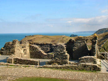 |
| Ample parking in the village - but a long walk |
|
| NOV
2015: Recent news reports that it is proposed to build a new
bridge from the mainland to The Island to improve access. 2020: The new bridge is now in place, making access very much easier. |
 |
The two best things about Tintagel are the climb to the top of the 'Island' in search of King Arthur and the parish church of St. Materiana, both well away from the tawdry bustle of the tourist-trap village. Its siting is odd, stranded on a clifftop to the west of the town; a whole early settlement must have gone missing here. Inside, a simple Norman granite font stands on a most unusual plinth of small upright slates set in a checker pattern, almost as if architect Sir Edwin Lutyens had designed it as part of one of his unusual garden paths. Wood work in the church is unusual; the reredos appears to be made of old bench ends which carry carvings of the Passion and of local coats of arms. From the clifftop beyond the church you get a view of The Island on which Tintagel Castle stands. As you walk or drive along Church Hill on the way to St. Materiana's church, you pass Tintagel Vicarage, the tiny Fontevrault Chapel, converted from a barn, in its gatehouse, a dovecot in its garden. If you do drive, there are parking spaces close to the church. You can approach Tintagel Castle along the cliff from the church. |
|
|
Trebarwith
Farm, Backways Cove, Trebarwith Strand, Treknow - 3.89 mls
Starts from Jeffries
Pit, includes short stretch of coast but almost all inland
Really
an Inland Round Walk but included as includes a short stretch of coast
| I have also posted this on my Inland Round Walks page, since it includes a short section of coast, but I choose to classify it as an Inland Walk since it starts inland, at Jeffries Pit car park, as does the previous Delabole walk. .And indeed this walk is mostly inland. From Jeffries Pit you use a short stretch of the road towards Trebarwith Strand but turn off it at up the driveway towards Fentafriddle. Field paths then lead to the interesting buildings of Trebarwith Farm and on to precipitous Backways Cove, on the coast path. There is then a steep climb of around 300 feet up to Dennis Point and an even steeper descent, with a flight of over 200 steps down to disappointing Trebarwith Cove. If you are looking for refreshments, the Port William Inn has a good lunchtime pub menu. From there the walk continues up the road for a short way before heading off up a valley to the village of Treknow and back by pasture and a woodland nature reserve. Apart from ascending and descending Dennis Point, this is quite an easy walk with a number of ravishing cosatal views. The older and less able (like me) may like to note that there are 22 stiles, some a bit awkward. In addition to the Port William at Trebarwith Cove, there are a couple of cafés and toilets with seasonal opening. |  |
| Oliver's Diary - Interest - Statistics and Info, Directions |
|
Trebarwith Farm, Backways Cove, Trebarwith Strand, Treknow - Diary
 |
Recently, for reasons not unconnected with age and health, I have tended to avoid Cornwall's Coast Path whern researching new walks. However, I had already researched a couple of walks in the area, one of them using the Coast Path between Trebarwith Strand and Tintagel, and I had already done a Slate Walk using Jeffries Pit as my start and finish point. So I thought that to do this walk from the same start point would offer more serious walkers the opportunity to add two short walks together to make a more challenging 8.35 mile walk. I was pleased that I had less difficulty than expected with the steep climb up to Dennis Point and the long, steep flight of steps down. What did give me trouble was the stiles, not so much the number as the nature. In several locations, where there are perfectly good cattle or sheep stiles over fairly high hedges, farmers have added an additional wooden barrier on top (acceptable) and high wooden stiles before and after the hedge, sometimes with barbed wire to trap the unwary. What on earth is the matter with them? Do they think their cows are olympic athletes? Or do they resent public rights of way across their land and are deliberately making things difficult for walkers? It's so unnecessary: a proper Cornish stile in the right place is all that should be needed. |
|
|
Description - Interest - Statistics and Info - Directions |
Trebarwith Farm, Backways , Trebarwith Strand, Treknow - Interest
| Jeffries Pit: A former slate quarry which closed in 1928. Cutting sheds were on the other side of the road. A stream runs down through the woodland where the walks starts. It is then covered by slate tips and re-emerges later to flow down the valley to Trebarwith Strand. Fentafriddle: As you walk up Fentafridle's driveway, you get the impression of a well-tended expensive estate. Verges are carefully mown, a wooden fence well maintaned. On a bank on the left is a topiary tea party. Barns have been converted to luxury holiday accommodation and it is also a wedding venue. Trebarwith Farm: The big farmhouse is rather dour looking. The adjacent attractive listed cottage is a holiday let - what else! The farmyard boasts an attractive cart shed. Trebarwith Strand: It's reputation as a beauty spot is hardly merited. At medium to high tide there is no beach. At low tide there are yards of potentially slippery rock to scramble over to get to the sand. All that is really outstanding is the view to Gull Rock. The Port William (the place's original name) pub is nicely located above the cove, with tables outside. Continue past the pub to find the small harbour. Port William's trade was in slate export from the quarries along the cliffs while sand from the beach was carried inland for soil enrichment. Treknow: (From Wikipedia) Treknow is mentioned as a manor (under the name of 'Tretdeno') in Domesday Book. The acidic local soil was manured with beach sand from nearby Trebarwith Strand: the trade in sand led to road improvements in the early 19th century (the Trebarwith Strand to Condolden "Sanding Road"). Some buildings in the village display a marked Arts and Crafts influence, probably as a result of the work of architect Detmar Blow who is known to have worked on the Old Post Office in Tintagel for four years from 1896. Trebarwith Nature Reserve: Steeply sloping 3 acre site, at its best from late spring to autumn. Wildflowers, particularly speedwell, proliferate. You may be lucky enough to see brown trout in the stream near the clapper bridge. Old Millfloor: Presumably once a mill, now apparently a B&B and restaurant. Looks pretty difficult to get to! Prince of Wales Quarry: Not directly on the walk but near Jeffries Pit. Entrance to POW car park at 07091/86095. You could walk the ¼ mile between the two but it is a busy road and there is a perfectly good car park at POW Quarry. The engine house in Prince of Wales Slate Quarry is the only one to have survived in North Cornwall. It once housed a Woolf Compound Beam Engine. The engine house was built in 1870 and the beam engine was installed in 1871. It was used to drive a wire ropeway to haul slate, and to pump water from the quarry pit. The engine house was restored in 1973. In 2015 the whole site was put up for auction by its then owner the Duchy of Cornwall with a guide price of £40,000 to £50,000. It achieved £81,000 from an anonymous telephone bid. See fuller posting |
Trebarwith Farm, Backways , Trebarwith Strand, Treknow - Stats & Info
| Statistics
Distance: 3.89 miles. Ascent: About 500 feet in all. Highest Point: 485 feet after Fentafriddle. Biggest Climb: Easy 400 feet from Trebarwith Strand up through Treknow to the Camelford to Tintagel road. Tougher 280 feet from Backways Cove up to Dennis Point. Steps: Up 120. Down 208, includes 203 down to Trebarwith Strand. Stiles: 22, mostly wood but with a few proper Cornish granite or slate stiles. Gates: 10 plus 3 kissing gates. Footing: Generally good on pasture land. A little vertiginous on narrow path from Backways Cove up to Dennis Point. Long steep flight of steps down to Trebarwith Strand. Some uneven footing in Trebarwith Nature Reserve. Difficulty: Generally easy enough, though climb up to, and steps down from, Dennis Point may be hard going. Road: 0.92 miles of quiet enough lanes, though the road down to Trebarwith Strand can get rather busy at holiday times. Map: OS Explorer 109 Bodmin Moor and OS 111 Bude, Boscastle and Tintagel |
| Information
Parking: Park in large free car park in Jeffries Pit at 06767/86181. Getting there: From Wadebridge, follow B3314 to far end of Delabole. Go L towards Trebarwith. First R down Bowithick Hill to bottom. L on Tintagel road. Soon L on Trebarwith Strand road and shortly L into Jeffries Pit. Intermediate Parking: Trerbarwith Strand, 2 car parks. Refreshments: Trebarwith Strand, Port William and cafés. Toilets: Trebarwith Strand (seasonal). |
Port Quin
and Port Isaac - 4.87 miles
Some of the toughest
coast path to Port Isaac, an easier inland return route
 |
If you are in the mood for a short but tough walk, this is the one for you. The stretch of coast path from Port Quin to Port Isaac may be only just over 3 miles but it's 3 miles of serious ups and downs, many of them negotiated by long flights of steps, some of them high risers. Along the way you climb to over 200 feet on five occasions for a total ascent of over 900 feet; the highest point along the way is 255 feet. You climb 437 steps and descend 457. The longest flight down involves 167 steps down to Pinehaven. Up you encounter flights of 84, 145 and 176 steps, the last the flight up from Pinehaven. Is it worth it? The answer has to be yes for the glorious views along Port Isaac Bay in both directions, west to The Rumps, north-east to Tintagel Island. The inland return is a great deal easier but even this has its moments. The initial 300 foot climb out of Port Isaac includes a nasty 6-step cattle stile in a narrow, muddy, tree overhung defile. I do offer an alternative start out of Port Isaac that avoids this obstacle. Views on the return are less spectacular but still pleasant. And, after climbing up from the Pinehaven Valley on the way back to Port Quin, a short detour would take you to fascinating Roscarrock, recognisable from the first Poldark TV series. Do allow yourself the time to enjoy Port Quin and explore Port Isaac. |
|
|
Oliver's Diary - Statistics, Info, Interest - Route Directions |
Port Quin and Port
Isaac - Oliver's Diary
| I must confess to cheating a bit with this one. All my other walks have been researched in one go. On this occasion, in March 2015, I felt that my age - plus a few minor disablities aquired in my 70s - would make the coast path section from Port Quin to Port Isaac, with all those climbs, descents and steps, too much for me. So the outward part of the walk relies on my 2009 research when walking the whole of the Cornish Coast Path. What I did on this occasion was an inland out and back, starting in Port Quin where NT membership gives me the benefit of free parking. As it was, I still had some substantial climbs - from sea level to 280 and 300 feet - but far easier than those on the coast path and on the inland route very few steps. What I missed inland was the views. All I had was a brief view to Tintagel Island on the way to Port Isaac and a restricted view over Port Quin to Doyden Castle on the way back. The one bit with which I had real difficulty was the last field on the way down to Roscarrock Hill. Above I call it a "nasty 6-step cattle stile in a narrow, muddy, tree overhung defile". It's probably a lot easier in dry weather but the deep mud made it difficult this time. What I really like about this walk is the photo opportunities in both tiny quiet Port Quin and larger busier Port Isaac. And, since I was last in Port Isaac, more cafés have opened. |  |
| Description - Statistics, Info, Interest, Directions |
|
Port Quin and Port
Isaac - GPS Data
| Port Quin to Port
Isaac on the Coast Path
Distance: 3.08 miles. Total ascent: 910 feet. Climb 5 times to 200 feet or more. Biggest climb: 140 feet. Max height: 255 feet. Steps: Up 437. Down: 457. Stiles: None. Gates: 4 kissing gates Port Isaac to Port Quin inland route Distance: 1.79 miles. Total ascent: 450 feet. Biggest climb: 300 feet out of Port Isaac. Max height: 300 feet. Steps: None. Stiles: 2, 1 of them a difficult 6-step cattle stile. Several others are bypassed by open gates. Gates: None |
Useful Information
| Parking: NT Car park at Port Quin. Car park in Port Isaac is way up the hill towards Port Gaverne. Getting There: From B3314, 3 miles N of Wadebridge, follow Polzeath then Port Quin signs. Refreshments: Pubs, cafês and restaurants in Port Isaac. Toilets: Port Isaac (seasonal). |
Interest
| Port Quin: The National Trust owns this charming sheltered former fishing hamlet. Legend has it that Port Quin's fishing fleet was lost in a storm, all the men were drowned and the village was abandoned. In calm weather this is a delightful place; in stormy weather it can feel threatening. Click for a fuller description. Pinehaven: The descent and ascent of the valley on the inland route is substantial. On the coastal route this is a severe but delightfully scenic spot. Roscarrock: It is worth making the short detour to see the farming hamlet. Its house was used as Nampara, Ross's home in the original TV Poldark; its outbuildings were used for some Truro location scenes. Port Isaac: Best known as the location of Port Wenn in the Doc Martin TV series. Click for a fuller description |
Constantine Bay
- A Round Walk from beach - Constantine Bay - 4.76 mls
Route: Trevose
golf course, Mother Ivey's Bay, Trevose Head, Booby's Bay
Interest:
St. Constantine's Church and Holy Well
 |
This is a simple counter-clockwise walk of two very different parts. First comes the inland leg from Constantine Bay to Mother Ivey’s Bay, then the coastal leg back to Constantine Bay. At the start of the walk, if in a hurry, you could ignore the path across the dunes and alongside the golf course. The lane which you drove down would save both time and distance. Once at Trevose Golf Club, do be careful to stick to the route described; there are no other rights of way than those used on this walk. Again, if in a hurry, you could omit the Holy Well and ruined church of St. Constantine, a saving of about half-a-mile. The real scenery begins when you reach the coast path at Mother Ivey’s Bay; the delightful view is described in the Route Directions. You then have to wait until after Trevose Head for more sweeping views, this time south to St. Agnes Head and, on a clear day, as far as St. Ives. Looking at the map, you might think it worthwhile, once at Trevose Head, to continue out to Dinas Head. That is not particularly to be recommended as it adds little to the impressive scenery. The grassy route back is generally easy going. You may like to detour for a good view of Round Hole, an impressive blow hole. Although OS107 shows a route across the Constantine Bay dunes, ideally the path goes down wooden steps to the beach and crosses its length. |
|
|
Oliver's Diary - Statistics, Info, Interest - Route Directions |
Constantine Bay - Round Walk from Constantine Bay - Oliver's Diary
| A familiar route, taken many a time since I first did it as a round walk in 2004. Yet surprisingly it was not until 2007 that I first sought out St. Constantine’s Church and Holy Well. In 2004 both well and church remains were fairly well cared for. In September 2012 the well is still in good order under its modern housing. But sadly the church has been overcome by ivy, scrub and other growth and there is no way now that I could have got the photos I took in 2007. I chose this as a round walk for this Coastal Round Walks page as it seemed a fairly easy one to do at a time when I was still recovering from an earlier operation. It was a good choice as there are no serious climbs on it. The climb up to 245 feet Trevose Head is never steep – although I had quite forgotten that there is a series of wooden stiles, some high, on the way up. As usual, I made the short detour on the way down to Booby’s Bay to look at Round Hole but the tide was wrong for the blowhole to be operating. Perhaps some day I shall catch it right. Parking can be an issue on this walk and you may need to be fairly early to beat the surfers to the free beach car park on Constantine Bay. I was OK this time but have occasionally had to pay to park back up the lane. |  |
| Description - Statistics, Info, Interest - Directions |
|
| Distance: 4.76 miles. Ascent: 550 feet. Highest Point: 245 feet near Trevose light. Biggest Climb: Easy 205 feet, in 2 stages, up to Trevose Head. Steps: Up 20. Down 90, includes 33 down to Dinas Head quarry, 44 down to Constantine Bay beach. Stiles: 5 wooden stiles, 1 granite step stile, and you pass 2 redundant stiles. Gates: 2 open gates, 2 kissing gates and 3 gaps that were once kissing gates. Footing: Generally good everywhere except for some loose stone approaching Trevose Head and down towards Dinas Head quarry. Sand on Constantine beach fairly firm. Road: 0.40 miles. Quiet lane after Trevose Golf Club and lane after leaving golf course. Difficulty: Fairly easy. Map: OS Explorer 106 Newquay and Padstow. |
| Parking: Constantine Bay beach CP (free) at 85952/74521. On R about 200 yards before beach (pay). Opposite Constantine Stores (free). Intermediate Parking: Trevose Head (pay). Getting there: From B3276 Padstow to Newquay, follow Constantine Bay sign from just W of St. Merryn. Transport: First Kernow 56 Padstow to Newquay, alternate buses go to Constantine Bay Stores. Toilets: In Constantine beach car park. Refreshments: Seasonal coffee wagon, above beach near Constantine beach CP. Treglos Hotel, back up lane. Trevose Golf Club. |
| Constantine Bay: The bay, with its half-mile long sandy beach is popular with surfers and a couple of surf schools operate. There is a small free car park and toilets. In summer there is a mobile coffee wagon. A delightful spot. Trevose Golf Club: The Championship Course is claimed to be one of Britain’s top links courses. There is also a challenging 9 hole course and a short par 3 course. The course exists thanks to amateur archaeologist Dr. Penrose Williams buying a holiday cottage in the early 1900s, then buying the land in order to excavate St. Constantine’s holy well. Wondering what to do with the land he had bought, he hired course architect Harry Colt to build him a golf course. St. Constantine: It is only a short detour to see his church and holy well. See feature below. Padstow Lifeboat Station: It seems hard to believe that Padstow’s lifeboat once operated from Hawker’s Cove, where two lifeboat houses, one from before 1825 and the other from 1899, have been converted to private homes. Silting up of the cove meant that a new station was built on the north side of Mother Ivey’s Bay in 1967. This was replaced by the present impressive modern station which opened in 2006. Polventon: The striking white moderne house was built in 1936 for Rick Stein’s father and is listed Grade II. Trevose Head: The prominent headland, with its white lighthouse, is visible for many miles from both up and down the coast. It’s westernmost extremity is bulbous Dinas Head, its shape much changed by quarrying and its cliff castle (Dinas) no longer identifiable although you can see an outline of buildings on its north side. There is no great benefit in going off the coast path out to Dinas Head, although there is a fine view of Trevose Light from the extremity. The Bull and the Quies: The Bull rock lies just a couple of hundred yards off Dinas Head. The Quies (Sows) appear to be almost as close but are actually a mile offshore. Round Hole: A cave collapse created the massive conical blowhole below Trevose Head. To get a good photograph of it, best to be there earlyish on a sunny summer morning at highish tide with a high sea running. |
St. Constantine
- his Church and Holy Well
 |
I found St. Constantine's Well in 2004, on Trevose Golf Course, but had to wait till 2007 to find his church. When I came to research Constantine I came up with conflicting stories, placing the saint variously in Ireland, Scotland, Wales and Cornwall, though all sources agreed on the 6th century. I prefer the 'Britannia Early British Kingdoms' version, supported by references in the annals of scholar monk Gildas. Constantine, cousin of King Arthur, survived the battle of Camlaan and succeeded his father Cado as King of Dumnonia (Devon and Cornwall). Out hunting, his quarry took refuge in St. Petroc's monastery at Padstow. Impressed by the power of sanctuary Constantine became Christian. He helped found Petroc's monastery at Bodmin, founded others at Cornwall's two Constantines then joined St. David in Wales. He was killed by Irish pirates in Kintyre south west Scotland in AD 576 (or 598). His feast day is 9th March in Cornwall. The well remains are nicely housed under a roof but the church is a sad affair. The well site is obvious. The church is to the north of it and a path is signed up a dune. What little remains of the church can only be seen by climbing the thorn and bramble covered dune. This must be a candidate for the care of Cornwall Heritage Trust, which has done such a good job elsewhere. In the meantime, perhaps the golf club could do their bit. |
|
|
Description - Diary - Statistics, Info, Interest - Directions |
Mawgan
Porth - A Round Walk from St. Mawgan - 4.98 miles
St.
Mawgan, Trevarrian, Beacon Cove, Mawgan Porth, Vale of Lanherne
Interest:
St. Mawgan village, church and Japanese garden; Mawgan Porth
| This walk is an exception. It starts inland and, I feel, works better that way, though there is no reason why you should not start at Mawgan Porth. There is a nice mix of landscapes. From St. Mawgan a short steep climb takes you to field paths over grazing land to Trevarrian. From there, a track and an NT field lead to the coast, where you turn right on the Coast Path. Going across country is generally easy, though in winter it can be a bit wet in places. Views along the coast are not especially extensive but are none the less delightful, south across Watergate Bay to Towan Head and Pentire Point East, north past Bedruthan Steps to Park Head. The only steep up and down bits are along the coast but there is no difficulty, except perhaps for the 92 steps down to Mawgan Porth. The final inland leg is very easy going though views are restricted as you are in light woodland above the little River Menalhyl much of the way. Major interest is St. Mawgan village, well worth taking time over for its handsome church, attractive cottages and Japanese garden. Mawgan Porth is also worth lingering in for its superb sandy beach and the good value, generous food and coffee served at the Merrymoor Inn. (Merrymoor Inn has changed but still good) If you are interested in prehistory, don’t miss the cliff castle on Griffin’s Point, off the route but clearly visible from where you join the coast path. | |
|
|
Oliver's Diary - Statistics, Info, Interest - Route Directions |
Mawgan Porth - A Round Walk from St. Mawgan - Oliver's Diary
| Jane and I have walked
many times from St. Mawgan to Mawgan Porth and back on the valley route
used for the last leg of this walk. I have also been in Mawgan Porth
on many occasions when walking the coast path; it makes a good break
on the way to or from Newquay, particularly if it is around lunch time
and you want to enjoy the great value, well filled hot baguettes and the
very good value fresh coffee at the Merrymouth Inn, a great favourite of
mine ever since the late Tony, former Wadebridge barber, told me about
it. Doing the research for this walk in February 2010, I had debated
whether to start in Mawgan Porth or in St. Mawgan. Still not at full
fitness after illness, I opted for what seemed the easiest option.
So I started in St. Mawgan for a relatively easy, fairly level walk to
the coast; did more downhill than uphill on the way from Beacon
Cove to Mawgan Porth, including the 92 steps down to Mawgan Porth;
and had the known quantity of an easy valley walk back to St. Mawgan with
only a few very minor gradients. It was this, and the fact that such
an arrangement would leave ample time for interest in St. Mawgan, that
persuaded me to start and finish the walk in St. Mawgan. Slightly
to my surprise, considering that the inland paths are good and that it
was a warm sunny day, the only walkers I encountered were on the coast
path. Merrymouth Inn info may be out of date! |
 |
| Description - Statistics, Info, Interest - Route Directions |
|
Mawgan Porth - A Round Walk from St. Mawgan - GPS Data
| Distance: 4.98 miles. Ascent: 750 feet. Highest Point: 275 feet near Trevarrian. Biggest Climb: 235 feet out of St. Mawgan. Steps: Up 8. Down 96 in one flight approaching Mawgan Porth. Stiles: 14, mostly wooden. Gates: 7, includes 4 kissing gates, 1 very narrow. Footing: Generally good on farmland, coast and up Vale of Lanherne. Some parts could be wet or muddy in winter. Difficulty: Fairly easy with no particularly steep ascents. Map: OS Explorer 106 Newquay and Padstow. |
| Parking: St.Mawgan, behind Falcon Inn and village shop. Intermediate Parking: Mawgan Porth, signed. Getting There: From A39 from Wadebridge, ½ mile before Trekenning roundabout at St. Columb, go R, signed Talskiddy and continue overall W, following St. Mawgan signs. Transport: First Kernow bus 56, between Padstow and Newquay, links St. Mawgan and Mawgan Porth. Refreshments: St. Mawgan, Village Shop tearoom and tea garden, Falcon Inn. Trevarrian, Travellers Rest Inn. Mawgan Porth, Merrymoor Inn and several seasonal cafés, fish and chipperies etc. Toilets: St. Mawgan (seasonal). Mawgan Porth (seasonal), by CP entrance. |
| St. Mawgan: A delightful small village, correct name Mawgan in Pydar to distinguish it from Mawgan in Meneague near Helston. See feature below. Bre Pen Farm: You pass fairly close by the farm, which is on theTrevarian to Mawgan Porth road, and you walk through part of the estate on this walk. It’s an impressive sounding place, on National Trust property but run by the Brakes as B&B, bistro, tea rooms and farm shop and raising their own lamb. Griffin’s Point: Remains of an iron age promontory fort or cliff castle, more striking from a distance than close-up. The coastline must have receded here because it is difficult to see how fortifications can have enclosed much of a settlement. Mawgan Porth: Popular resort with several holiday parks, lovely sands and acceptable surfing. The village is a bit tatty looking but there are shops, cafés and an excellent pub, the Merrymoor Inn, where fresh coffee is still (2010) only £1 and hot baguettes vast. (It has changed a lot since these comments). Despite the tat of the village down by the beach, there are two expensive hotels overlooking the sea, the family-friendly Bedruthan Steps (oddly, the rocks are completely impossibly to see from the hotel) and the very expensive boutique type hotel, The Scarlet. Despite their quality, both look awful from the beach, modern and stark. Menalhyl River: The little river, not much more than a stream, rises on semi-moorland to the east of St. Columb, flows west to that town then north-west through the Carnanton estate, down the Vale of Lanherne and on through St. Mawgan to reach the sea at Mawgan Porth. If you particularly enjoy river walks, you might consider parking in St. Columb and following its course to the coast and back. |
Feature - St. Mawgan or Mawgan in Pydar
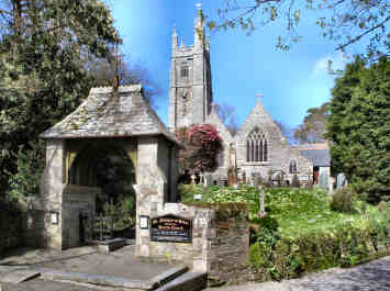 |
First encountered in February 2006 when Jane and I parked down at Mawgan Porth and walked up the valley to the village - officially Mawgan in Pydar and sometimes signed just as Mawgan - primarily to visit the Japanese Garden there and have lunch in the Falcon Inn. The garden was disappointing, colourful enough but too small to justify the entry charge. The walk up from the coast is an easy and pleasant one, first along the open valley, than gently up through light woodland. The village is charming, the garden pleasant and the Falcon Inn good. Cottages in the village are immaculate and expensive looking. The church, mostly of the 13th to 15th centuries, has an impressively pinnacled tower, a 20th century lych gate and a much admired lantern cross near the porch. Inside are 15th century bench ends, some brasses and, surprisingly, a rood screen and loft. Behind the church, the big house is Lanherne, once seat of the Arundell family. The male line died out in 1701 and in 1794 the house was given to Carmelite nuns; it is still a religious house. Opposite Lanherne's entrance a farm has a charming range of small buildings, best seen from up the hill. We had a light lunch in the attractive Falcon Inn, excellent soup and rich garlic bread, with a large fire blazing nearby and a wedding party lunching in the dining room. Excellent tea room and tea garden at the village shop. |
|
|
Description- Diary - Statistics, Info, Interest, Directions |
Mylor Churchtown
- A Circular Walk by Flushing - 4.08 miles
Route: Mylor
Creek, Trelew, Tregew, Flushing and back by Carrick Roads
Interest:
Mylor Yacht Harbour, St. Mylor's Church, Flushing, Kiln Quay
 |
While it is not strictly a ‘Walk from the Cornish Coast Path’, that is close enough. It is certainly coastal and the Coast Path is just a short ferry ride away in Falmouth. For a short walk – little over four miles – it has a surprising amount of interest and variety. It starts in Mylor Churchtown, a village with a charming church and unusual churchyard. At the beginning or end of your walk you should find it well worth while exploring these. It also boasts what is probably Cornwall’s major yacht harbour. The route continues with a creekside walk along Mylor Creek to the little settlement of Trelew. This is followed by a woodland walk taking you up to the high point of the walk at Tregew. You then descend to Flushing, the unusually named and interesting village across the Penryn River from Falmouth. Finally, a full half of the walk, mostly on the Trefusis Estate, follows the shores of Carrick Roads, easy grassy walking with fine views across the water to St. Anthony Head, St. Mawes Castle and St. Just Creek. It is a very pleasant and really quite easy short walk with ample opportunity for refreshment at the beginning, at the end and on the way. Café Mylor is open all day, a wine bar and seafood restaurant may have shorter hours. Flushing has two pubs and a restaurant on the Quay, the latter open all day for much of the year and with a fairly extensive seafood menu. |
|
|
Oliver's Diary - Statistics, Info, Interest - Route Directions |
Mylor Churchtown - A Circular Walk by Flushing - Oliver's Diary
| When I planned this research walk I was sure I had done it with Jane many years ago. When I actually came to do the walk, I was surprised to find just how much of it seemed unfamiliar. It turned out that we had actually parked in Flushing and walked only as far as Kiln Quay, where Flushing’s beach is, at the southern end of the Trefusis Estate. On another occasion I had visited Mylor Harbour on the way to walk from Flushing to Penryn and back. So it was a pleasure to discover that, as a walk, this was almost all new ground to me. I made one mistake and had to retrace my steps. I mistook the path in Trelew Woods and found myself outside the eastern edge of the woods; the correct path looks as if it goes nowhere – but it does continue. But I was pleased that I routed my walk through Mylor churchyard, a fascinating place. Researched in late March 2012, it seemed I had chosen a slightly strange day weatherwise. It was one of those days when you are in strong full sunshine – bare arms in March! – but the distance is shrouded in haze, on this occasion so much so that I could scarcely make out the ships at Falmouth Docks, a mere quarter-of-a-mile away from Trefusis Point. However, that didn’t spoil the day for photography. I may have missed distant land and seascapes but the near light was crystal clear for shots of Mylor Harbour and of St. Mylor’s church. |  |
| Description
- Statistics, Info, Interest |
|
Mylor Churchtown
- A Circular Walk by Flushing - GPS Data
| Distance: 4.08 miles. Ascent: 600 feet. Highest Point: Trefusis Barton lane at 235 feet. Biggest Climb: Easy 225 feet from Trelew up to Tregew. Steps: Up 26. Down 16. Stiles: 8, of mixed type. Gates: 6, some probably open. Footing: Generally good but path in woods between Trelew and Tregew can be wet and muddy in places. Road: 1¼ quiet miles in all. Difficulty: Easy. Map: OS Explorer 105, Falmouth and Mevagissey. |
| Parking: Mylor Harbour, pay CP. Free on road Oct – Mar. Intermediate Parking: Flushing Quay and Trefusis Road approaching dead end at Kiln Quay. Getting There: From A39 S of Truro, 2nd L after Perranarworthal and follow Mylor Harbour signs. Refreshments: Mylor Harbour: Café Mylor, Castaways Wine Bar, Seafood Restaurant. Flushing: Seven Stars Inn, food lunch and evening; Royal Standard Inn; Waterside Restaurant on Quay, seasonal. Toilets: Mylor Harbour, by E gate to churchyard. Flushing, on the Quay. |
| Mylor Churchtown and Yacht Harbour: See Mylor feature. Mylor Creek: The route follows peaceful Mylor Creek as far as Trelew. As with Mylor Churchtown itself, this is again expensive residential territory. Flushing: See Flushing feature. Carrick Roads: An odd seeming name but Carrick refers to a rock, Black Rock, at the mouth of the Roads and Roads is a corruption of Rode meaning a haven. This is, in fact, the estuary of the River Fal, itself really a ria or drowned valley, and one of the largest natural harbours in the world. There is much dispute about the order of the largest; other contenders include Sydney, Rio, Halifax, Hong Kong, Poole, New York, Pearl and San Francisco. In difficult times for the shipping industry there are many ships laid up in Carrick Roads and further up the Fal beyond Turnaware Point, the northern limit of the Roads. |
Feature - Mylor Churchtown and Yacht Harbour
 |
To many this is just Mylor Yacht Harbour, a major yachting and watersports centre where Mylor Creek joins Carrick Roads. With yacht club, large marina, extensive moorings, renowned boatyard and bars and restaurants, that’s quite understandable. As a result of the Harbour’s success property prices are among Cornwall’s highest and large houses spread right along Mylor Creek. However, for others, this is Mylor Churchtown – to distinguish it from Mylor Bridge – and the main interest is the church of St. Mylor, largely unnoticed by the boating fraternity. One of Cornwall’s oldest holy sites, the first church is said to have been founded before AD411 when St. Mylor was martyred here. A charming church, set in a steeply sloping churchyard, there are two Norman doorways but the body of the church is essentially of 13th and 15th centuries. There are remains of a 15th century painted rood screen, an Elizabethan pulpit and a puzzling priest’s chair, reputed to have come from nearby Glasney College, closed when Henry VIII dissolved the monasteries, of 1000 year old Irish bog oak with Norse carving and Tudor panelling. The churchyard, lych gate at the top, small iron gate on the quay, is most enjoyable. Steeply sloping, it contains a free standing bell tower, St. Mylor’s holy well, a Cornish Cross that, if the whole shaft were visible, would stand 17’ 6” high, a fine display of wild flowers, and ancient tombstones, one commemorating the 200 who died when Queen was wrecked on Trefusis Point. |
|
|
Description - Diary - Statistics, Info, Interest - Directions |
| Originally Nankersey, the present name was given by Dutch engineers who built the village’s quays. They were from Vlissingen, known to the British as Flushing. Oddly there is another Flushing on Gillan Creek south of Falmouth; no connection is known. This Flushing is an attractive village with some big houses on St. Peter’s Hill and Trefusis Street, many once homes of Falmouth ships captains, now probably home to commuters to Falmouth or Truro. One such, Rockside on Trefusis Street, looks like a handsome Georgian house but, according to Pevsner, is a converted warehouse. Flushing is very much a small boat sailing village and an important regatta is held in summer, complete with swimming and bath-tub racing as well as sailing. According to Wikipedia Henry VIII had planned to build a castle on Trefusis Point to complement those at St. Mawes and Pendennis guarding Falmouth but never did. Flushing is no longer the fishing village it once was but there are still a few commercial boats. And, sadly, many of the houses are now, like so many in Cornwall’s more attractive villages, used as second homes. Happily there are still two pubs, the Royal Standard and the Seven Stars, and there is a nicely located restaurant on The Quay, the Waterside with tables outside. The Trefusis Estate, walked on much of the way to Mylor Churchtown, is part of Devon based Clinton Estates, the Trefusis family holding the title Baron Clinton. |  |
| Description - Diary - Statistics, Info, Interest - Directions |
|
Maenporth
- Coast Path to the Helford River,
inland by Carwinion & Mawnan Smith
- 4.82 miles
 |
As walks involving the Cornish Coast Path go, this must be one of the easiest and, at less than 5 miles, one of the shortest. That is not to say that it is not enjoyable, nor is it without its minor challenges. It starts from Maenporth beach which happily still has abundant free car parking out of season and boasts one of the better beach cafés - "Life's a Beach". Unsurprisingly you are immediately on the coast path and climbing to follow the line of the cliffs south to Rosemullion Head then west round to Porth Saxon on the Helford River. Along the coast path you encounter no difficult conditions but there are a number of steps, including almost 100 down with a few high risers, and a few stiles. When I researched this walk I missed out Rosemullion Head; you really should include it for a detour of only a few hundred yards. Shortly before you drop down to the Helford River you pass through a grove of evergreen Holm Oaks, quite a surprise. On the Helford River there are two small coves with boathouses and slate pebbled beaches, Porthallack and Porth Saxon. The easy walk up the Carwinion Valley is a delight; you could detour at the top of the valley, just before Mawnan Smith, to visit Carwinion Garden but it is not everyone's idea of a Cornish valley garden. Back down to Maenporth is straightforward and problem free. |
|
|
Oliver's Diary - Statistics, Info, Interest - Route Directions |
Maenporth, Helford River, Carwinion and Mawnan Smith - Oliver's Diary
| This is one of three pieces of Coastal Round Walk research done during March 2015; the others are on this page, too, under Port Quin and Portmellon. Of the three this one is probably the easiest. It is also my least favourite. The coastal section of the walk I was already familiar with, having walked it several times when originally researching the Cornish Coast Path. I have to confess that, whenever I do one of these Coastal Round Walks, I am strongly reminded of my advancing years and minor disabilities; either that or they have made the coast path harder since I first walked it! As always I enjoyed the quiet coves, with their boathouses, on the Helford River. The inland parts were new to me though I know well all the valley gardens along the Helford River. I was delighted to find that the ascent from Porth Saxon to Mawnan Smith was something of a valley garden in itself. Its upper part is full of exotic growth which has spread from adjacent Carwinion Garden. And I was surprised to find an unusual clapper bridge on the way up the valley - two large slate slabs which could almost once have been grave slabs. Do note that, on the return leg from Mawnan Smith to Maenporth, you could go wrong as, at least when I walked it, an important waymark was missing at the point where you turn right to head down the valley. |
 |
| Description - Statistics, Info & Interest - Route Directions |
|
Maenporth, Helford River, Carwinion and Mawnan Smith - GPS Data
| Distance: 4.82 miles. Ascent: 850 feet, of which 650 feet on coast path. Highest Point: 225 feet at Mawnan Smith.. Biggest Climb: Easy 225 feet from Porth Saxon up to Mawnan Smith. Steps: Up 34. Down 92. Stiles: 8, of mixed type. Gates: 22, mostly kissing gates. Footing: Generally good but a little rocky in places on the coast path. Road: About 200 yards only. Difficulty: Generally easy. Map: OS Explorer 103 The Lizard. |
| Parking: Maenporth, above the beach, free out of season. Intermediate Parking: Can probably park on the lane between Carwinion and Mawnan Smith. Getting There: Follow A39 Penryn By-pass towards Falmouth; at the last roundabout before the end go R signed Maenporth. Refreshments: Life's a Beach Café, Maenporth. Red Lion Inn, Mawnan Smith. Toilets: Maenporth (seasonal). |
| Maenporth: Good sandy beach, well sheltered. Excellent Life's a Beach Café, all year. Behind the beach is The Cove, seafood restaurant and bar, all day, all year. Above the beach is the Maenporth holiday estate. Meudon Hotel: Accessed from the coast path through its valley garden. Holm Oaks: A small grove of evergreen Holm Oaks is on the coast path, shortly before dropping down to the Helford River. Helford River: More a ria (drowned valley) than a river, this is a popular place with sailors of small boats. Excellent Ferryboat Inn at Helford Passage on the north shore. Foodie Shiprights Arms in Helford on south shore. Helford River Valley Gardens: In just a mile or so along the Helford River there are several valley gardens, most essentially spring gardens. Finest is Trebah with the National Trust's Glendurgan not far behind. Also here are Carwinion and Penjerrick, both interesting but much less colourful. Meudon Hotel's garden runs down to the sea at Bream Cove. Coves: Along the Helford River you walk across the back of two small coves, Porthallack and Porth Saxon. Both have wooden boathouses. Both have unusual beaches, covered in large sea-rounded slate pebbles. Carwinion Garden: You walk right past it. Click for a detailed review. |
St.Mawes
- by Percuil River to St. Just-in-Roseland, back by Carrick Roads
- 5.77 mls
 |
Most people who stay in St. Mawes will be familiar with the pleasing walk from the castle along the shore of Carrick Roads to delightful St. Just-in-Roseland with its churchyard more like a sub-tropical garden. What few realise is that this 5 mile out-and-back walk can be made into an even more interesting 5¾ mile round walk taking in the banks of the Percuil River. Starting at The Quay on the harbour, you follow the road round the harbour and continue for half-a-mile or so before heading down to the Percuil River. You stay along or close to the river before starting a long climb up to Bosloggas and on to the St. Mawes-Tregony road by a water tower. From there a path crosses National Trust land almost all the way to St. Just. After exploring St. Just – its church, churchyard, creek and boatyard – you again cross mostly National Trust land back along Carrick Roads to St. Mawes. On the NT land, many of the paths are not shown on OS105 but do appear on NT leaflet 18/19, covering the Roseland Peninsula. Because the NT land is grazed there are quite a few stiles, 17 in the whole walk, and 15 gates altogether. It is a pleasant and easy walk, despite the long 275 foot climb up from the Percuil River. Photographers will prefer a sunny day as views, while never long, are always delightful, particularly when there is activity on the water. |
|
|
Oliver's Diary - Statistics, Info, Interest - Route Directions |
St. Mawes
- Percuil River, St. Just-in-Roseland, back along Carrick Roads -
Diary
| I have known the Roseland since the 1950s when my father’s cousin Bertie was Rector of St. Just and we used to stay in the Rectory (now the Old Rectory and a private house) in St. Just for summer holidays. I think it a lovely spot and also have a long standing affection for St. Mawes, a delightful harbour village which seems that little bit more Mediterranean each time I see it. I have walked between St. Mawes and St. Just many times but, until my friends Bob and Pam told me they had done it as a round walk, had never thought to try one myself. At the time of writing I don’t know whether this is Bob and Pam’s route but I expect it is with perhaps some variations. I enjoyed researching this one in October 2011, having walked on the east bank of the Percuil River before but never on the west. Jane was taking her friends Anne and Lynette from Portscatho out to lunch so she left me in St. Mawes. It was a very dull day so disappointingly not one for photos. But I wasn’t disappointed in my lunch, a superb steak pasty from the bakery on The Quay at St. Mawes, still warm when I got to St. Just. Jane’s timing was superb; I was just finishing a coffee outside the St. Mawes Hotel when she arrived to collect me. A successful day and good to do a coastal round walk that was mostly along rivers rather than sea. |  |
| Description- Statistics, Info, Interest - Route Directions |
|
St. Mawes - Percuil
River, St. Just-in-Roseland, Carrick Roads - GPS Data
| Distance: 5.77 miles Ascent: 800 feet. Highest Point: 275 feet at the water tower on the Tregony to St. Mawes road. Biggest climb: 275 feet up from leaving the Percuil River, fairly steep in places. Steps: Up 28. Down 37. Stiles: 17, almost all wooden stiles. Gates: 15, including 2 kissing gates. Road: 1 mile in St. Mawes. Footing: Mostly good along the Percuil River but with one steep slippery section with handrail. Muddy in places on way up to Tregony to St. Mawes road. Good on field paths from there to St. Just and on to St. Mawes. Difficulty: Overall easy but with one long climb. Map: OS Explorer 105 Falmouth and Mevagissey. |
| Parking: St. Mawes, on The Quay. Also main car park, behind Rising Sun. Also field below the Castle. Intermediate Parking: St. Just, car park above the church. Getting there: From A390, 6 miles E of Truro, take A3078 to St. Mawes. Refreshments: St. Mawes is full of hotels, pubs, restaurants, cafés and take-aways. Toilets: St. Mawes, in main car park. St. Just churchyard, opposite where path comes out on lane. |
| St. Mawes: See feature below. Percuil River: Not really a river, just a tidal creek. Beyond Percuil on the east bank it’s mud for much of the day but, below Percuil, views across to Quay Cottage at the head of Porth Creek are enjoyable. Nanshuttal: Shortly before the end of the long climb up to the water tower, Nanshuttal has a delightful collection of converted barns. The 17th century farmhouse is listed Grade II and still has most of its original features. National Trust: Once you get to the water tower, much of the rest of the walk is on the National Trust property - Tregear Vean, Churchtown Farm and Newton Farm. This is all grazing land so expect plenty of stiles and gates. St. Just in Roseland: See feature below. St. Mawes Castle: One of Henry VIII’s coastal defences. At Fowey he linked two forts with a protective chain across the estuary. At Falmouth, where the estuary is more than a mile wide and chains would have been impossible, he built forts on Pendennis Head and on high ground at St. Mawes; their combined artillery fire-power provided full protection. At first glance St. Mawes Castle appears tiny, just a round tower and encircling wall. It is only when you get close that you spot the size and the clover leaf of artillery bastions. It speaks volumes for the expertise of Henry's engineers that St. Mawes and Pendennis were able to be garrisoned in both world wars. Lamorran House Garden: Entered from Upper Castle Road in St. Mawes, Lamorran House garden was created since 1982 by the Dudley-Cookes. Like St. Mawes itself, it has a very Mediterranean feeling with terraces, statuary, mock temple ruins and exotic planting. It also has a very secret feeling as narrow paths wind down through luxuriant growth: Chusan palms, Himalyan fan palms, brilliant azaleas, rich succulents, bright acers, agaves, mesembryanthemums and aloes - and water features. At its best early in its season; later it gets over luxuriant but less colourful. |
 |
Rock, on the Camel Estuary on Cornwall's north coast, is the sailing village that gets all the attention from the media, perhaps partly thanks the well-connected youngsters who holiday and party there. St. Mawes has always been a great deal more discreet but has always been a home for serious wealth. It is a bright and colourful sailing village with white-washed cottages under slate roofs - and a little thatch - with flowers everywhere enhancing its charms. Above the village one of Henry VIII's coastal castles looks across Carrick Roads to its twin atop Pendennis Point high above Falmouth. On Upper Castle Road, above St. Mawes Castle a sign points to Lamorran House Garden, a delight open three afternoons a week in summer. Hotels abound; Tresanton is undoubtedly the best, the Idle Rocks next best, while the Rising Sun is an attractive inn. Pub afficionados will enjoy the Victory Inn, tucked away up a steep side street. Walkers who enjoy an unusual and unexpected garden should park by the castle and follow the water north to find the tiny village of St. Just with its delightful churchyard garden. Ferries run from St. Mawes, one crosses Carrick Roads to Falmouth, the other crosses the Percuil River to Place on the St. Anthony peninsula; both provide links to the Cornish Coast Path links. |
|
|
Description - Diary - Statistics, Info, Interest - Route Directions |
Feature - St. Just-in-Roseland
| I must confess a special interest in the church at St. Just-in-Roseland. For twenty years my father's cousin Bertie was rector. As children we enjoyed family summer holidays staying with Bertie and Marjorie at the rectory, just across the road from the church (it's now the Old Rectory and a private home). Jane knows it too, having lived a few miles away at Gerrans. The church has a long history, reputed to have been founded by St. Anthony in the 6th century on a spot said to have been visited by tin merchant Joseph of Arimathea and his nephew Jesus! Remarkably, although the English Church submitted to the rule of Rome in 664 AD, St. Just remained Celtic until the middle of the 10th century. The church is attractive from the outside but is disappointing inside, having been over-restored in the 19th century. The real attraction is the location, deep in a wooded valley with the waters of a little creek lapping the churchyard walls below the lower lych gate - unusually there are two lych gates - and the sub-tropical garden planted in the sloping churchyard by an enterprising Victorian rector. The churchyard is sufficiently steep that from the upper lych gate you are looking over the church tower. The church is easy to find; a sign on the road to St. Mawes points intriguingly to "St. Just Church and Bar" - perhaps this is an illustration of thirsting after righteousness? |  |
| Description - Diary - Statistics, Info, Interest - Directions |
|
Portmellon
by Mevagissey - Coast Path with an Inland Return - 4.75 miles
Coast Path to Chapel
Point, Inland by Bodrugan Barton and Gorran Church
 |
This walk, starting from Portmellon just to the south of Mevagissey, begins with just a short stretch along the coast before heading inland to complete a walk shaped a bit like a sagging sausage. The short coastal section - good views across Mevagissey Bay - takes you only as far as attractive Chapel Point. There you leave the coast path to head west inland up a shallow valley to Old Walls then turn north-north-east up to ancient and fascinating Bodrugan Barton. From there you take field paths, interspersed with short sections of quiet road, to get to Gorran Church on the eastern edge of Gorran Churchtown. A well made track leads north from there to Cotna House. Then field paths take you over a hill and eventually down into the woodland of West Bodrugan Nature Reserve and on back to Portmellon. Going is generally easy, though it can be muddy in the nature reserve woodland and when you leave that there is a short section where bracken and mud make going a little difficult. There is a reasonable amount of interest along the way: Mediterranean looking Chapel Point, ancient barns at Bodrugan Barton, and an interesting church and a good pub in Gorran Churchtown. All this makes for a reasonably varied, relatively easy walk with the opportunity for refreshment both at the start and in Gorran Churchtown. |
|
|
Oliver's Diary - Statistics, Info, Interest - Route Directions |
Portmellon by Mevagissey - Coast Path with Inland Return - Oliver's Diary
| I have walked between Portmellon and Gorran Haven many times so the first part of this walk, as far as Chapel Point, done in March 2015, was very familiar to me. Portmellon to Gorran Haven was one of the earliest coast walks that Jane and I did. Later we did it with my sister Mary on a day with so strong an offshore wind that we had to climb a gate and walk in parallel fields for some of the way. I remember that we were very much taken with Chapel Point and entertained by the tales of Bodrugan's Leap: in 1483 Sir Henry Trenowth of Bodrugan, chased by his mortal enemy Sir Richard Edgcumbe, is said to have escaped by leaping from the cliffs into a boat and escaping to France. The location is variously given as Chapel Point, Turbot Point and elsewhere along this short stretch of coastline. Oddly enough a complementary tale has Edgcumbe escaping from Bodrugan by leaping from a cliff into the Tamar at Cotehele. Even more oddly, it seems that Bodrugan Barton, through which this walk passes, is now part of the Edgcumbe Estate! I enjoyed seeing Chapel Point again, still looking like an immaculate Mediterranean monastery. I was particularly pleased to see Bodrugan Barton with its impressive barns, some in ruin, and its derelict watermill. In Portmellon I was at first puzzled now to find the pub called "An Gof" but apparently this was just for filming. |
 |
| Description - Statistics, Info, Interest - Route Directions |
|
Portmellon by Mevagissey - Coast Path with an Inland Return - GPS Data
| Distance: 4.75 miles. Ascent: Around 700 feet. Highest Point: 300 feet on the Portmellon to Gorran road. Biggest Climb: Easy 260 feet from start to before Chapel Point. Easy 260 feet from Colona Beach to the road after Bodrugan Barton. Steps: None. Stiles: 19, a mix of granite types and wood. Gates: 6 plus several usually open. Footing: Generally good but a little muddy in West Bodrugan wood and in a field after that. Road: About ¾ mile. Difficulty: Generally easy. Map: OS Explorer 105 Falmouth & Mevagissey. |
| Parking: Portmellon, at the seaward end of Portmellon Parc. You might be able to park in the large car park by the Rising Sun but ask. Getting There: From A390 St. Austell Bypass follow B3273 south through Mevagissey. Refreshments: Rising Sun Inn, Portmellon. Toilets: None. |
| Portmellon: Really just a residential cove at the southern end of Mevagissey wth a boat builder, boatyard and a popular pub, the Rising Sun. Safe sandy beach and public slipway for launching boats. An idyllic spot in summer but can be storm-blasted in winter. Chapel Point: The cluster of white painted buildings on Chapel Point, built in the 1930s as a private house looks for all the world like a small Mediterranean monastery. It is now a luxury self-catering holiday location. Bodrugan's Leap: In 1487, after Lambert Simnel's abortive uprising, Sir Henry Trenoweth of Bodrugan, chased by his mortal enemy Sir Richard Edgcumbe, is said to have escaped by leaping from the cliffs into a boat and escaping to France. Bodrugan and Edgcumbe had been on opposite sides in the Wars of the Roses, Bodrugan supporting Richard III, Edgcumbe the Earl of Richmond who became Henry VII. Oddly a complementary tale has Edgcumbe escaping from Bodrugan by pretending to leap from a cliff into the Tamar at Cotehele. Even more oddly, it seems that Bodrugan Barton, through which this walk passes, is now part of the Edgcumbe Estate! The exact location of Bodrugan's Leap is in some doubt but it is probably between Chapel Point and Turbot Point. Bodrugan Barton: It stands where Bodrugan Castle once stood. Sadly, all that remains of the castle is an impressive barn or two. In the Edgcumbe family since the late 15th century, the Kendalls have occupied Bodrugan Barton for several generations. Now, while still a family home and working farm, barns have been converted to self-catering holiday lets and to a residential art course location. Gorran Churchtown: St. Goran (or Goranus) is probably the Guron of Bodmin, who moved here when St. Petroc arrived there. His handsome 13th to 15th century church is typically Cornish with its crenellated and pinnacled porch, a fine collection of original bench ends and some good modern wood carvings. Outside there is an unexpected vault dated WSG 1813 and a lovely display of daffodils in season. |
Lerryn
- River & Woodland to St. Winnow, fields return -
4.49 miles
Route
- Lerryn and Fowey Rivers to St. Winnow, farm and woodland back
Interest
- Lerryn Village, Ethy Woods, St. Winnow Church and Mill
 |
You may wonder that a walk four and a half miles inland can be described as a Coastal Round Walk. While it goes nowhere near the Coast Path, I justify it because just over half the walk is along tidal waters, first by the little River Lerryn, then by the Fowey River. It’s a walk probably best done in late spring when bluebells are out in the woodland and leaf growth not yet vigorous enough to obscure river views. The walk starts in the charming village of Lerryn, a few miles south of Lostwithiel. It first crosses the little River Lerryn – by stepping stones, tide permitting, otherwise by bridge – then, after nice views across to the main part of Lerryn village, soon enters Ethy Wood. Woodland continues all the way to St. Winnow on the Fowey River, at first National Trust broadleaf, then Forestry Commission mixed. Parts can be muddy and those who don’t like mud could take a forest track from where it is first encountered to shortly before St. Winnow. The last short stretch to St. Winnow is along the foreshore but a detour may be needed at high tide. In St. Winnow you should take time to enjoy the charming church and the view across the Fowey River. The return leg heads inland up a steep grassy track then across five fields, climbing to 275 feet, to attractive St. Winnow Mill. From there it’s up and down mostly through woodland but with open views to Ethy House. |
|
|
Oliver's Diary - Statistics, Info, Interest - Route Directions |
Lerryn - Walk along the River and through Woodland to St. Winnow, returning mostly by fields - Oliver's Diary
| Jane and I first visited Lerryn in November 2003, enjoying lunch at the excellent Ship Inn. We returned in May 2004, with my sister Mary, for a walk along the Lerryn and Fowey rivers to the hamlet of St. Winnow and back. Bluebells were flourishing much of the way and leaves on the broadleaf trees were still young enough to allow views of the rivers. This research walk was done in July 2012 with trees in full leaf and views only intermittent. It was done as a round walk, returning from St. Winnow over the hill by way of St. Winnow Mill and the grounds of Ethy House, a route we had not taken before. After St. Winnow Mill we found the many and unwaymarked paths confusing and took a wrong turn which brought us back to the river in the wrong place. So we returned a few days later to try again, this time successfully. On both occasions we were able to park in the little car park near the Ship Inn. On the first walk, when we set off the tide was out and we were able to cross the river on stepping stones. On the way back the tide was in and we had to detour to cross the 16th century bridge. Perhaps the best time to do this pleasant and varied walk is in May for the bluebells, choosing the one time when Ethy House garden is open for the Du Maurier Festival. It is a shame that the 18th & 19th century house should not be open to the public. |  |
| Description - Statistics, Info, Interest- Route Directions |
|
Lerryn and St. Winnow Round Walk - GPS Data
| Distance: 4.49 miles. Ascent: Estimated 750 feet (includes estimated total of 250 feet in woodland in first leg). Highest Point: 275 feet in second field after St. Winnow on return leg. Biggest Climb: 275 feet out of St. Winnow. Steps: Up 12. Down 22. Stiles: 10, all but 1 are wooden stiles, some quite high. Gates: 4, all galvanised, one or two may be open. Footing: Generally good in woodland to St. Winnow but may be muddy in places. Bit rocky and often wet on track up from St. Winnow. Good in fields to St. Winnow Mill. Good through woods up to Ethy fields, which can be wet or rutted, depending on season. Road: Approx. ¼ mile on quiet lane at end of walk. Difficulty: Fairly easy. Map: OS Explorer 107 St. Austell and Liskeard; also NT Leaflet 18, Fowey area. |
| Parking: Lerryn Waterfront car park (free). Intermediate Parking: St. Winnow, by church (free). Getting there: In Lostwithiel, cross medieval bridge over Fowey river, then halfway up hill go R signed Lerryn. Transport: Travel Cornwall bus 482, Polruan to Lostwithiel and Bodmin, Wednesday only, one bus only, probably not much use. Toilets: Between car park and Village Hall. Refreshments: Lerryn, Ship Inn, Village Stores, teas on lawn by river; St. Winnow, snack shack by farm, probably summer weekend only but worth checking because good. |
| Lerryn: see
Feature below. St. Winnow:
see Feature below.
Ethy Estate: As boats once traded to Lerryn and St. Winnow, so did Ethy once have its own quay. A ruined boathouse stands there, if you can find it. Ethy Wood, though apparently managed by the Forestry Commission, continues as delightful mature oak woodland. The house, of which the visible fronts are 18th and 19th century, is privately owned and not open to the public. |
 |
Although Lerryn in only 3 miles from Lostwithiel, and that seems the obvious way to approach it, I think that the best way to approach the village is to start from Fowey and and take the Bodinnick Ferry across the Fowey River. This way not only will you have a good view of Daphne du Maurier's parents' Ferryside home, but you will then travel along quiet lanes and through the charming hamlet of Lower Penpoll. Lerryn is clearly a wealthy little village. A number of handsome homes stand along both side of the little River Lerryn, a tributary of the Fowey River. It is effectively a tidal creek, crossed by a medieval bridge and, at low tide by stepping stones. Oddly, despite being the largest village of three, Lerryn is not a parish; to the north of the river it is in St. Winnow, to the south in St. Veep. Small boats line the river but don't go anywhere very often - the river is very tidal. Signs of former industry include lime kilns built into homes and a former barn or warehouse by the river. The walk along the north side of the river to the tiny hamlet of St. Winnow is a delight. Try this walk in spring when the woodland is filled with bluebells and wild garlic. You can make this round walk of it by returning across fields to Winnow Mill, then through the National Trust's Ethy estate. We have enjoyed several good meals in the Ship Inn at Lerryn. |
|
|
Description - Diary - Statistics, Info & Interest - Directions |
| Best approached, as on this walk, by following the Rivers Lerryn and Fowey, through broadleaf Ethy Wood and more coniferous Middle Wood. And best of all, approached in late spring when the bluebells and wild garlic proliferate, shown off at their best by the delicate new greenery of Ethy wood. St. Winnow is a tiny hamlet: just a church, a small boatyard, a couple of farms (one selling organic meats and cream teas) and a boathouse converted to a holiday home. The setting on the River Fowey is idyllic. The church stands where St. Winnoc (some think him the same as Winwaloe) is said to have founded an oratory in around 670AD. Inside are the usual Cornish wagon roofs, a 16th century screen and some charming and unusual medieval bench ends, including a ship in full sail and a Cornishman in a kilt! There is some stained glass and the 16th century rood screen has been restored. Outside, elaborate Cornish crosses remember several Barons Vivian, local landowners. We have enjoyed cream tea from a snack shack by the farm before the return leg through the NT's Ethy estate. On the way you pass interesting St. Winnow Mill, which worked right up until 1940. The miller's house, listed Grade II is nearby but not very visible. Notts Mill, halfway down the valley, on an alternative return route, is now a private house. |  |
| Description - Diary - Statistics, Info, Interest - Directions |
|
|
|
|
|
|
|
|
|
|
|
|
|
|
|
|
|
|
|
|